How to get to Us National Archives Archival Recovery Program by bus?
Click on the bus route to see step by step directions with maps, line arrival times and updated time schedules.
From Basilica of the National Shrine of the Immaculate Conception, Washington
72 minFrom Allstate Insurance Agent: Azqa Goraya, Prince George's County
39 minFrom Albert Einstein High School, Montgomery County
76 minFrom Children's National Columbia heights shuttle, Washington
91 minFrom Rock Creek Park Tennis Center (William Hg Fitzgerald), Washington
86 minFrom Hillwood Estate, Museum & Gardens, Washington
115 minFrom White Oak MVA, Montgomery County
44 minFrom Howard University, Washington
97 minFrom Washington DC Temple, Montgomery County
78 minFrom Target, Washington
91 min
Bus stops near Us National Archives Archival Recovery Program in Prince George's County
Metro station near Us National Archives Archival Recovery Program in Prince George's County
- Hyattsville Crossing Metro Station, 42 min walk,VIEW
Train station near Us National Archives Archival Recovery Program in Prince George's County
- College Park Marc Sb, 57 min walk,VIEW
Bus lines to Us National Archives Archival Recovery Program in Prince George's County
What are the closest stations to Us National Archives Archival Recovery Program?
The closest stations to Us National Archives Archival Recovery Program are:
- Archives II Bldg Rdwy + Main Entrance is 162 yards away, 3 min walk.
- Metzerott Rd (National Archives at College Park) Eb is 458 yards away, 6 min walk.
- Riggs Rd+Hughes Rd is 616 yards away, 8 min walk.
- Hyattsville Crossing Metro Station is 3525 yards away, 42 min walk.
- College Park Marc Sb is 4876 yards away, 57 min walk.
Which bus lines stop near Us National Archives Archival Recovery Program?
These bus lines stop near Us National Archives Archival Recovery Program: P16, P37.
What’s the nearest bus station to Us National Archives Archival Recovery Program in Prince George's County?
The nearest bus station to Us National Archives Archival Recovery Program in Prince George's County is Archives II Bldg Rdwy + Main Entrance. It’s a 3 min walk away.
What time is the first metro to Us National Archives Archival Recovery Program in Prince George's County?
The GREEN is the first metro that goes to Us National Archives Archival Recovery Program in Prince George's County. It stops nearby at 5:03 AM.
What time is the last metro to Us National Archives Archival Recovery Program in Prince George's County?
The GREEN is the last metro that goes to Us National Archives Archival Recovery Program in Prince George's County. It stops nearby at 12:38 AM.
What time is the first train to Us National Archives Archival Recovery Program in Prince George's County?
The MARC is the first train that goes to Us National Archives Archival Recovery Program in Prince George's County. It stops nearby at 5:43 AM.
What time is the last train to Us National Archives Archival Recovery Program in Prince George's County?
The MARC is the last train that goes to Us National Archives Archival Recovery Program in Prince George's County. It stops nearby at 7:57 PM.
What time is the first bus to Us National Archives Archival Recovery Program in Prince George's County?
The P16 is the first bus that goes to Us National Archives Archival Recovery Program in Prince George's County. It stops nearby at 4:46 AM.
What time is the last bus to Us National Archives Archival Recovery Program in Prince George's County?
The P16 is the last bus that goes to Us National Archives Archival Recovery Program in Prince George's County. It stops nearby at 12:23 AM.
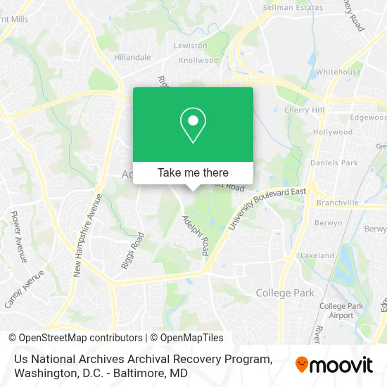
See Us National Archives Archival Recovery Program, Prince George's County, on the map
Public Transit to Us National Archives Archival Recovery Program in Prince George's County
Wondering how to get to Us National Archives Archival Recovery Program in Prince George's County? Moovit helps you find the best way to get to Us National Archives Archival Recovery Program with step-by-step directions from the nearest public transit station.
Moovit provides free maps and live directions to help you navigate through your city. View schedules, routes, timetables, and find out how long does it take to get to Us National Archives Archival Recovery Program in real time.
Looking for the nearest stop or station to Us National Archives Archival Recovery Program? Check out this list of stops closest to your destination: Archives II Bldg Rdwy + Main Entrance; Metzerott Rd (National Archives at College Park) Eb; Riggs Rd+Hughes Rd; Hyattsville Crossing Metro Station; College Park Marc Sb.
Bus: P16, P37, 204.Train: MARC.Metro: GREEN, YELLOW.
Want to see if there’s another route that gets you there at an earlier time? Moovit helps you find alternative routes or times. Get directions from and directions to Us National Archives Archival Recovery Program easily from the Moovit App or Website.
We make riding to Us National Archives Archival Recovery Program easy, which is why over 1.7 million users, including users in Prince George's County, trust Moovit as the best app for public transit. You don’t need to download an individual bus app or train app, Moovit is your all-in-one transit app that helps you find the best bus time or train time available.
For information on prices of bus and metro, costs and ride fares to Us National Archives Archival Recovery Program, please check the Moovit app.
Use the app to navigate to popular places including to the airport, hospital, stadium, grocery store, mall, coffee shop, school, college, and university.
Us National Archives Archival Recovery Program Address: 8601 Adelphi Rd street in Prince George's County
- National Archives at College Park,
- Iglesia Evangelica Apostolica Y Profetica Ciudad De Sion, Inc.,
- Mary Harris Mother Jones Elementary School,
- Cherokee Lane Elementary School,
- Adelphi, Maryland,
- 20783,
- University of Maryland Golf Course,
- Buck Lodge Middle School,
- College Park Woods, Maryland,
- The Clarice Smith Performing Arts Center,
- Eppley Recreation Center,
- Capital One Field at Maryland Stadium,
- University of MD Xfinity Center,
- Terrapin Trail Garage,
- College Park Marriott Hotel & Conference Center,
- XFINITY Center,
- Adelphi Manor Archery Range (Adephi Park Archery Range),
- J. Logan & Louise Schutz Football Practice Complex,
- University of Maryland-College Park,
- College Park Weigh Station
Places Near Us National Archives Archival Recovery Program (Prince George's County)
- Marriott Marquis Washington, DC, Washington,
- Washington National Cathedral, Washington,
- Capital One Arena, Washington,
- Pennsylvania Ave NW (3rd st and pennsylvania), Washington,
- Westfield Montgomery Mall, Montgomery County,
- M&T Bank Stadium, Baltimore,
- The Anthem, Washington,
- Museum Of The Bible, Washington,
- National Museum of African American History and Culture, Washington,
- Georgetown, Washington,
- Amazon Hq2, Arlington County,
- Rock Creek Tennis Center, Washington,
- National Theatre, Washington,
- Basilica of the National Shrine, Washington,
- Camden Yards, Baltimore,
- Sibley Memorial Hospital, Washington,
- National Zoo, Washington,
- Washington DC VA Medical Center, Washington,
- Warner Theatre, Washington,
- PG Mall, Prince George's County
How to get to popular places in Washington, D.C. - Baltimore, MD with public transit
Get around Prince George's County by public transit!
Traveling around Prince George's County has never been so easy. See step by step directions as you travel to any attraction, street or major public transit station. View bus and train schedules, arrival times, service alerts and detailed routes on a map, so you know exactly how to get to anywhere in Prince George's County.
When traveling to any destination around Prince George's County use Moovit's Live Directions with Get Off Notifications to know exactly where and how far to walk, how long to wait for your line, and how many stops are left. Moovit will alert you when it's time to get off — no need to constantly re-check whether yours is the next stop.
Wondering how to use public transit in Prince George's County or how to pay for public transit in Prince George's County? Moovit public transit app can help you navigate your way with public transit easily, and at minimum cost. It includes public transit fees, ticket prices, and costs. Looking for a map of Prince George's County public transit lines? Moovit public transit app shows all public transit maps in Prince George's County with all Bus, Train, Metro, Light Rail and Ferry routes and stops on an interactive map.
Washington, D.C. - Baltimore, MD has 5 transit type(s), including: Bus, Train, Metro, Light Rail and Ferry, operated by several transit agencies, including WMATA, Montgomery County Ride On, Fairfax Connector, TheBus, PRTC, DASH - Alexandria, Arlington Transit (ART), RTA of Central Maryland, MDOT MTA, MDOT MTA Light RailLink, MDOT MTA Commuter Bus, MDOT MTA Local Bus, FXBGO!, Virginia Railway Express (VRE) and MARC