How to get to Utc by bus?
Click on the bus route to see step by step directions with maps, line arrival times and updated time schedules.
From Eden Center, Falls Church
65 minFrom Washington Yu Ying Public Charter School, Washington
50 minFrom Walmart, Arlington County
50 minFrom Sheraton Suites Old Town Alexandria, Alexandria
45 minFrom Hilton Alexandria Mark Center, Alexandria
60 minFrom George H.W. Bush Center For Intelligence (CIA Headquarters), Fairfax County
96 minFrom Hilton Garden Inn Reagan National Airport, Arlington County
50 minFrom Courtyard Alexandria Pentagon South, Alexandria
46 minFrom Congressional Cemetery, Washington
47 minFrom Hyattsville District Court, Prince George's County
60 min
How to get to Utc by train?
Click on the train route to see step by step directions with maps, line arrival times and updated time schedules.
How to get to Utc by metro?
Click on the metro route to see step by step directions with maps, line arrival times and updated time schedules.
From Eden Center, Falls Church
45 minFrom Washington Yu Ying Public Charter School, Washington
42 minFrom Walmart, Arlington County
28 minFrom Sheraton Suites Old Town Alexandria, Alexandria
44 minFrom Hilton Garden Inn Reagan National Airport, Arlington County
33 minFrom Congressional Cemetery, Washington
36 min
Bus stops near Utc in Washington
Metro stations near Utc in Washington
Bus lines to Utc in Washington
- 305, 305/3 Washington Dc,VIEW
- 325, 325/1 Washington Dc / Capitol Hill,VIEW
- 715, 715/9 Golden Beach Park & Ride,VIEW
- 725, 725/4 California,VIEW
- 810, 810/2 Washington Dc,VIEW
- 820, 820/2 Washington Dc,VIEW
- 830, 830/3 Washington Dc,VIEW
- 840, 840/7 Prince Frederick / St Leonard,VIEW
- 335, 335/5 Clarksville,VIEW
- 345, 345/8 Long Gate Park & Ride,VIEW
- A58, East To Farragut Sq,VIEW
- D94, East To Gallery Place,VIEW
- D96, North To Bethesda,VIEW
- 220, 220/8 Kent Island,VIEW
- 240, 240/4 Kent Island,VIEW
- 260, 260/1 Washington Dc,VIEW
- 620, 620/6 Washington Dc,VIEW
- 640, 640/7 Waldorf,VIEW
- 650, 650/2 Washington Dc,VIEW
- D74, East To Rhode Island Av,VIEW
What are the closest stations to Utc?
The closest stations to Utc are:
- 19th St & M St NW Sb is 58 yards away, 1 min walk.
- K St & 19th St NW Eb is 137 yards away, 2 min walk.
- K St NW & 19th St NW (Main) is 151 yards away, 2 min walk.
- Nw 20th St & Nw M St is 179 yards away, 3 min walk.
- K St & 20th St NW Wb is 214 yards away, 3 min walk.
- New Hampshire Av Nw+M St NW is 261 yards away, 4 min walk.
- M St & 21st St NW Wb is 300 yards away, 4 min walk.
- Foggy Bottom Gwu Kennedy Center Metro Station is 926 yards away, 12 min walk.
- Dupont Circle - Connecticut Ave. &Amp; Q St. NW is 1035 yards away, 13 min walk.
Which bus lines stop near Utc?
These bus lines stop near Utc: 971, 981, A58, D74, D94, F19.
Which train line stops near Utc?
NORTHEAST REGIONAL (Boston)
Which metro lines stop near Utc?
These metro lines stop near Utc: BLUE, ORANGE, RED, SILVER.
What’s the nearest metro station to Utc in Washington?
The nearest metro station to Utc in Washington is Foggy Bottom Gwu Kennedy Center Metro Station. It’s a 12 min walk away.
What’s the nearest bus station to Utc in Washington?
The nearest bus station to Utc in Washington is 19th St & M St NW Sb. It’s a 1 min walk away.
What time is the first metro to Utc in Washington?
The BLUE is the first metro that goes to Utc in Washington. It stops nearby at 5:23 AM.
What time is the last metro to Utc in Washington?
The RED is the last metro that goes to Utc in Washington. It stops nearby at 12:10 AM.
What time is the first bus to Utc in Washington?
The D94 is the first bus that goes to Utc in Washington. It stops nearby at 5:10 AM.
What time is the last bus to Utc in Washington?
The A58 is the last bus that goes to Utc in Washington. It stops nearby at 2:26 AM.
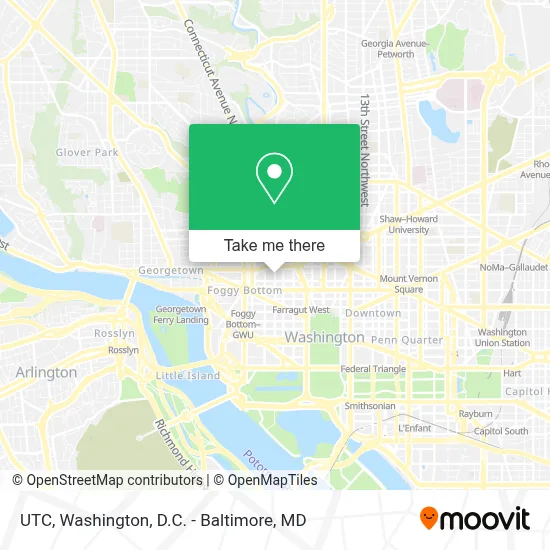
See Utc, Washington, on the map
Public Transit to Utc in Washington
Wondering how to get to Utc in Washington? Moovit helps you find the best way to get to Utc with step-by-step directions from the nearest public transit station.
Moovit provides free maps and live directions to help you navigate through your city. View schedules, routes, timetables, and find out how long does it take to get to Utc in real time.
Looking for the nearest stop or station to Utc? Check out this list of stops closest to your destination: 19th St & M St NW Sb; K St & 19th St NW Eb; K St NW & 19th St NW (Main); Nw 20th St & Nw M St; K St & 20th St NW Wb; New Hampshire Av Nw+M St NW; M St & 21st St NW Wb; Foggy Bottom Gwu Kennedy Center Metro Station; Dupont Circle - Connecticut Ave. &Amp; Q St. NW.
Bus: 971, 981, A58, D74, D94, F19, 305, 325, 715, 725, 810, 820, 830, 335, 345.Train: NORTHEAST REGIONAL.Metro: BLUE, ORANGE, RED, SILVER.
Want to see if there’s another route that gets you there at an earlier time? Moovit helps you find alternative routes or times. Get directions from and directions to Utc easily from the Moovit App or Website.
We make riding to Utc easy, which is why over 1.7 million users, including users in Washington, trust Moovit as the best app for public transit. You don’t need to download an individual bus app or train app, Moovit is your all-in-one transit app that helps you find the best bus time or train time available.
For information on prices of bus, metro and train, costs and ride fares to Utc, please check the Moovit app.
Use the app to navigate to popular places including to the airport, hospital, stadium, grocery store, mall, coffee shop, school, college, and university.
Utc Address: 1129 20th St NW Ste 350 street in Washington
- Lafayette Center,
- Pisco Y Nazca Ceviche Gastrobar,
- Federal Communications Commission,
- 20th St NW (20th and l street),
- AC Hotel by Marriott Washington DC Downtown (AC Hotel Washington DC Downtown),
- Peace Corps,
- Nooshi,
- Medstar Surgery Center at Lafayette Centre,
- Swahili Village - the Consulate DC,
- Sección Consular de la Embajada de Honduras,
- Embassy Of Honduras,
- Alexander Court (PMI Location (Alexander Court (Colonial Parking Station #169)),
- McDonald's,
- Soi 38,
- 600,
- St. Gregory Hotel,
- 21st St NW & L St NW,
- 301,
- Rehabilitation Center,
- Mckinsey & Company
Places Near Utc (Washington)
- Pennsylvania Ave NW (3rd st and pennsylvania), Washington,
- Warner Theatre, Washington,
- Washington DC VA Medical Center, Washington,
- Westfield Montgomery Mall, Montgomery County,
- Capital One Arena, Washington,
- Museum Of The Bible, Washington,
- Camden Yards, Baltimore,
- Georgetown, Washington,
- Amazon Hq2, Arlington County,
- Washington National Cathedral, Washington,
- Basilica of the National Shrine, Washington,
- National Theatre, Washington,
- Sibley Memorial Hospital, Washington,
- M&T Bank Stadium, Baltimore,
- The Anthem, Washington,
- National Museum of African American History and Culture, Washington,
- National Zoo, Washington,
- Marriott Marquis Washington, DC, Washington,
- PG Mall, Prince George's County,
- Rock Creek Tennis Center, Washington
How to get to popular places in Washington, D.C. - Baltimore, MD with public transit
Get around Washington by public transit!
Traveling around Washington has never been so easy. See step by step directions as you travel to any attraction, street or major public transit station. View bus and train schedules, arrival times, service alerts and detailed routes on a map, so you know exactly how to get to anywhere in Washington.
When traveling to any destination around Washington use Moovit's Live Directions with Get Off Notifications to know exactly where and how far to walk, how long to wait for your line, and how many stops are left. Moovit will alert you when it's time to get off — no need to constantly re-check whether yours is the next stop.
Wondering how to use public transit in Washington or how to pay for public transit in Washington? Moovit public transit app can help you navigate your way with public transit easily, and at minimum cost. It includes public transit fees, ticket prices, and costs. Looking for a map of Washington public transit lines? Moovit public transit app shows all public transit maps in Washington with all Bus, Train, Metro, Light Rail and Ferry routes and stops on an interactive map.
Washington, D.C. - Baltimore, MD has 5 transit type(s), including: Bus, Train, Metro, Light Rail and Ferry, operated by several transit agencies, including WMATA, Montgomery County Ride On, Fairfax Connector, TheBus, PRTC, DASH - Alexandria, Arlington Transit (ART), RTA of Central Maryland, MDOT MTA, MDOT MTA Light RailLink, MDOT MTA Commuter Bus, MDOT MTA Local Bus, FXBGO!, Virginia Railway Express (VRE) and MARC