Directions to VA Emergency Management Assoc (Fairfax County) with public transportation
The following transit lines have routes that pass near VA Emergency Management Assoc
 Bus: 306, 610, F50, GOLD 1.
- Train: NORTHEAST REGIONAL, MANASSAS LINE.
How to get to VA Emergency Management Assoc by bus?
Click on the bus route to see step by step directions with maps, line arrival times and updated time schedules.
From Centreville, VA, Fairfax County
106 minFrom Falls Church Marriott Fairview Park, Fairfax County
110 minFrom Arabx Com Inc, Fairfax County
88 minFrom Inova Fair Oaks Hospital, Fairfax County
89 minFrom Inova Fairfax Hospital North Tower Building, Fairfax County
80 minFrom Spa World, Fairfax County
111 minFrom Vienna, Virginia, Fairfax County
93 minFrom [I-495] Exit 54 - Braddock Road, Fairfax County
68 minFrom Defense Health Agency Headquarters, Fairfax County
96 minFrom Mosaic District, Fairfax County
88 min
Train station near VA Emergency Management Assoc in Fairfax County
- Burke Centre, 33 min walk,VIEW
What are the closest stations to VA Emergency Management Assoc?
The closest stations to VA Emergency Management Assoc are:
- Burke Centre is 2815 yards away, 33 min walk.
Which bus lines stop near VA Emergency Management Assoc?
These bus lines stop near VA Emergency Management Assoc: 306, 610, F50, GOLD 1.
What time is the first train to VA Emergency Management Assoc in Fairfax County?
The MANASSAS LINE is the first train that goes to VA Emergency Management Assoc in Fairfax County. It stops nearby at 5:29 AM.
What time is the last train to VA Emergency Management Assoc in Fairfax County?
The MANASSAS LINE is the last train that goes to VA Emergency Management Assoc in Fairfax County. It stops nearby at 7:48 PM.
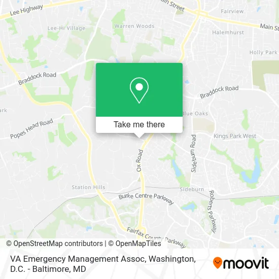
See VA Emergency Management Assoc, Fairfax County, on the map
Public Transit to VA Emergency Management Assoc in Fairfax County
Wondering how to get to VA Emergency Management Assoc in Fairfax County? Moovit helps you find the best way to get to VA Emergency Management Assoc with step-by-step directions from the nearest public transit station.
Moovit provides free maps and live directions to help you navigate through your city. View schedules, routes, timetables, and find out how long does it take to get to VA Emergency Management Assoc in real time.
Looking for the nearest stop or station to VA Emergency Management Assoc? Check out this list of stops closest to your destination: Burke Centre.
Bus: 306, 610, F50, GOLD 1.Train: NORTHEAST REGIONAL, MANASSAS LINE.
Want to see if there’s another route that gets you there at an earlier time? Moovit helps you find alternative routes or times. Get directions from and directions to VA Emergency Management Assoc easily from the Moovit App or Website.
We make riding to VA Emergency Management Assoc easy, which is why over 1.5 million users, including users in Fairfax County, trust Moovit as the best app for public transit. You don’t need to download an individual bus app or train app, Moovit is your all-in-one transit app that helps you find the best bus time or train time available.
For information on prices of bus, costs and ride fares to VA Emergency Management Assoc, please check the Moovit app.
Use the app to navigate to popular places including to the airport, hospital, stadium, grocery store, mall, coffee shop, school, college, and university.
Location: Fairfax County, Washington, D.C. - Baltimore, MD
- Fairfax Park Authority,
- Northern Vrgnia Rgonal Pk Auth,
- Redeeming Grace Church,
- Mothers' Day Out Preschool,
- Burke Centre Library (historical),
- ATM,
- Airc2,
- Twyllie & Associates Inc,
- David B Jackson,
- Safety Focus Group LLC,
- Middleridge Park,
- Face Time Inc,
- Owen's Electric Inc,
- A A A Enterprises,
- Kenneth M Fauteux,
- Fairfax Stat VA-123,
- Country Club View Park,
- Randolph W Church Jr,
- Fairfax Station, Virginia,
- St Mary's Church
Places Near VA Emergency Management Assoc (Fairfax County)
- Camden Yards, Baltimore,
- Amazon Hq2, Arlington County,
- National Museum of African American History and Culture, Washington,
- Washington DC VA Medical Center, Washington,
- Pennsylvania Ave NW (3rd st and pennsylvania), Washington,
- Westfield Montgomery Mall, Montgomery County,
- Sibley Memorial Hospital, Washington,
- The Anthem, Washington,
- Washington National Cathedral, Washington,
- Georgetown, Washington,
- Capital One Arena, Washington,
- Marriott Marquis Washington, DC, Washington,
- Museum Of The Bible, Washington,
- National Theatre, Washington,
- Warner Theatre, Washington,
- Basilica of the National Shrine, Washington,
- Rock Creek Tennis Center, Washington,
- National Zoo, Washington,
- M&T Bank Stadium, Baltimore,
- PG Mall, Prince George's County
How to get to popular places in Washington, D.C. - Baltimore, MD with public transit
Get around Fairfax County by public transit!
Traveling around Fairfax County has never been so easy. See step by step directions as you travel to any attraction, street or major public transit station. View bus and train schedules, arrival times, service alerts and detailed routes on a map, so you know exactly how to get to anywhere in Fairfax County.
When traveling to any destination around Fairfax County use Moovit's Live Directions with Get Off Notifications to know exactly where and how far to walk, how long to wait for your line, and how many stops are left. Moovit will alert you when it's time to get off — no need to constantly re-check whether yours is the next stop.
Wondering how to use public transit in Fairfax County or how to pay for public transit in Fairfax County? Moovit public transit app can help you navigate your way with public transit easily, and at minimum cost. It includes public transit fees, ticket prices, and costs. Looking for a map of Fairfax County public transit lines? Moovit public transit app shows all public transit maps in Fairfax County with all Bus, Train, Metro, Light Rail and Ferry routes and stops on an interactive map.
Washington, D.C. - Baltimore, MD has 5 transit type(s), including: Bus, Train, Metro, Light Rail and Ferry, operated by several transit agencies, including WMATA, Montgomery County Ride On, Fairfax Connector, TheBus, PRTC, DASH - Alexandria, Arlington Transit (ART), RTA of Central Maryland, MDOT MTA, MDOT MTA Light RailLink, MDOT MTA Commuter Bus, MDOT MTA Local Bus, FXBGO!, Virginia Railway Express (VRE) and MARC