How to get to VULCANIZADORA by bus?
Click on the bus route to see step by step directions with maps, line arrival times and updated time schedules.
From Ruiseñores [Fraccionamiento], Aguascalientes
57 minFrom Funeraria La Gloria, Aguascalientes
36 minFrom Fracc. Bulevares 1ra. Sección, Aguascalientes
51 minFrom Calle Aquiles Elorduy, Aguascalientes
39 minFrom Misa Dominical Rancho Santa Monica, Aguascalientes
68 minFrom Imss Jesus Maria Clinica#6, Aguascalientes
36 minFrom Larreategui & 5 de Mayo, Aguascalientes
22 minFrom Rancho Santa Monica, Aguascalientes
63 minFrom Jose Guadalupe Posada, Aguascalientes
28 minFrom Barlovento Residencial, Aguascalientes
65 min
Bus stops near VULCANIZADORA in Aguascalientes
Bus lines to VULCANIZADORA in Aguascalientes
What are the closest stations to VULCANIZADORA?
The closest stations to VULCANIZADORA are:
- Bulevar Guadalupano, 1810 is 74 meters away, 2 min walk.
- Bulevar Guadalupano, 1808 is 124 meters away, 2 min walk.
- Avenida Siglo Xxi, Lb is 305 meters away, 5 min walk.
Which bus lines stop near VULCANIZADORA?
These bus lines stop near VULCANIZADORA: RUTA 09, RUTA 37, RUTA 50.
What’s the nearest bus station to VULCANIZADORA in Aguascalientes?
The nearest bus stations to VULCANIZADORA in Aguascalientes are Bulevar Guadalupano, 1810 and Bulevar Guadalupano, 1808. The closest one is a 2 min walk away.
What time is the first bus to VULCANIZADORA in Aguascalientes?
The RUTA 42 is the first bus that goes to VULCANIZADORA in Aguascalientes. It stops nearby at 5:56 AM.
What time is the last bus to VULCANIZADORA in Aguascalientes?
The RUTA 50 is the last bus that goes to VULCANIZADORA in Aguascalientes. It stops nearby at 10:30 PM.
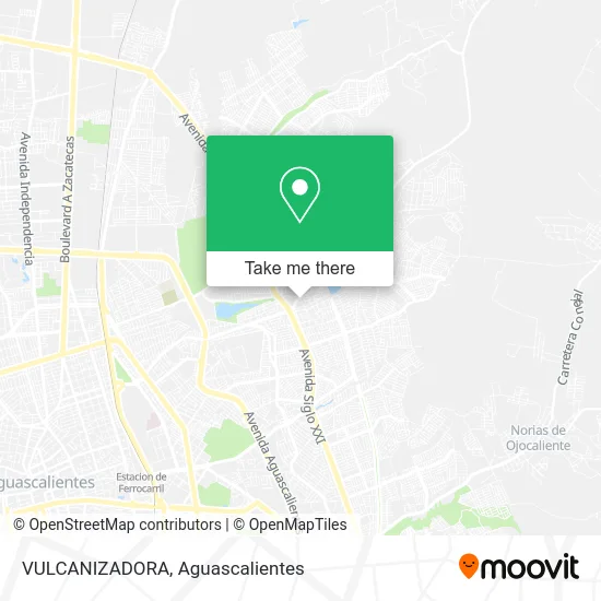
See VULCANIZADORA, Aguascalientes, on the map
Public Transit to VULCANIZADORA in Aguascalientes
Wondering how to get to VULCANIZADORA in Aguascalientes? Moovit helps you find the best way to get to VULCANIZADORA with step-by-step directions from the nearest public transit station.
Moovit provides free maps and live directions to help you navigate through your city. View schedules, routes, timetables, and find out how long does it take to get to VULCANIZADORA in real time.
Looking for the nearest stop or station to VULCANIZADORA? Check out this list of stops closest to your destination: Bulevar Guadalupano; Bulevar Guadalupano; Avenida Siglo Xxi.
Bus: RUTA 09, RUTA 37, RUTA 50, RUTA 42, RUTA 45, RUTA 23.
Want to see if there’s another route that gets you there at an earlier time? Moovit helps you find alternative routes or times. Get directions from and directions to VULCANIZADORA easily from the Moovit App or Website.
We make riding to VULCANIZADORA easy, which is why over 1.5 million users, including users in Aguascalientes, trust Moovit as the best app for public transit. You don’t need to download an individual bus app or train app, Moovit is your all-in-one transit app that helps you find the best bus time or train time available.
For information on prices of bus, costs and ride fares to VULCANIZADORA, please check the Moovit app.
Use the app to navigate to popular places including to the airport, hospital, stadium, grocery store, mall, coffee shop, school, college, and university.
VULCANIZADORA Address: VULCANIZADORA, Calle Miahuatlán, Fraccionamiento Ejido Las Cumbres, 20175 Aguascalientes, Aguascali street in Aguascalientes
- Autopartes Sandy,
- Farmacia San Andres,
- Compra Venta de Partes Usadas para Carro,
- Boulevard Guadalupano,
- Playeras Reno,
- Material para Construcción,
- Rosticería El Pechugon,
- Polarizado,
- Carniceria Lara,
- Mariscos El Arrecife,
- Ferretería Gonzales,
- Bodega de Pañal,
- Helados Lety,
- Moto Mecánica Moy,
- Tenis,
- Pasteleria Lupita,
- Estancia Infantil El Tesoro de Mama,
- Mariscos El Primo,
- Merendero Bar Hollywood,
- Abarrotes Diana
Places Near VULCANIZADORA (Aguascalientes)
- Centro, Aguascalientes,
- Imss Clinica 1, Aguascalientes,
- Terminal De Combis, Aguascalientes,
- La Isla San Marcos, Aguascalientes,
- Centro Comercial Altaria, Aguascalientes,
- Hospital Imss No. 3, Aguascalientes,
- Aeropuerto de Aguascalientes S.A. de C.V., Aguascalientes,
- ESPACIOS, Aguascalientes,
- Villas de Nuestra Señora de la Asunción, Aguascalientes,
- Agropecuario, Aguascalientes,
- Villasuncion, Aguascalientes,
- Blvd. Luis Donaldo Colosio, Aguascalientes,
- Jesús María, Aguascalientes,
- Universidad Autónoma de Aguascalientes, Aguascalientes,
- Isla San Marcos, Aguascalientes,
- Ciudad industrial, Aguascalientes,
- Parque Las Tres Centurias, Aguascalientes,
- Central De Autobuses, Aguascalientes,
- clinica 3 uaa, Aguascalientes,
- Nuevo Hospital Hidalgo, Aguascalientes
How to get to popular places in Aguascalientes with public transit
Get around Aguascalientes by public transit!
Traveling around Aguascalientes has never been so easy. See step by step directions as you travel to any attraction, street or major public transit station. View bus and train schedules, arrival times, service alerts and detailed routes on a map, so you know exactly how to get to anywhere in Aguascalientes.
When traveling to any destination around Aguascalientes use Moovit's Live Directions with Get Off Notifications to know exactly where and how far to walk, how long to wait for your line, and how many stops are left. Moovit will alert you when it's time to get off — no need to constantly re-check whether yours is the next stop.
Wondering how to use public transit in Aguascalientes or how to pay for public transit in Aguascalientes? Moovit public transit app can help you navigate your way with public transit easily, and at minimum cost. It includes public transit fees, ticket prices, and costs. Looking for a map of Aguascalientes public transit lines? Moovit public transit app shows all public transit maps in Aguascalientes with all bus routes and stops on an interactive map.
Aguascalientes has 1 transit type(s), including: bus, operated by several transit agencies, including Coordinación General de Movilidad