How to get to VZX by bus?
Click on the bus route to see step by step directions with maps, line arrival times and updated time schedules.
From Sancaktepe Ağız ve Diş Sağlığı Merkezi, Sancaktepe
82 minFrom Rings AVM, Sancaktepe
109 minFrom 131S Sabiha Gökçen H.L. - Tepeüstü, Sultanbeyli
110 minFrom Yunus Emre Kültür ve Sanat Merkezi, Pendik
40 minFrom Ferhatpaşa, Ataşehir
130 minFrom City's Kozyatağı, Ataşehir
85 minFrom sultanbeyli, Sancaktepe
106 minFrom Maltepe Başıbüyük Devlet Hastanesi, Maltepe
92 minFrom Ataşehir Ağız ve Diş Sağlığı Hastanesi, Ataşehir
66 minFrom samandıra otogar, Sancaktepe
79 min
How to get to VZX by train?
Click on the train route to see step by step directions with maps, line arrival times and updated time schedules.
How to get to VZX by metro?
Click on the metro route to see step by step directions with maps, line arrival times and updated time schedules.
Bus stops near VZX in Kartal
Dolmus & Minibus station near VZX in Kartal
- İnce Sokak, 3 min walk,VIEW
Train station near VZX in Kartal
- Atalar, 6 min walk,VIEW
Bus lines to VZX in Kartal
- 134YK, Kartal-Uğur Mumcu,VIEW
- C50, Kadıköy(Kartaldan Başlar),VIEW
- 16, Pendik-Kadıköy,VIEW
- 16A, Pendik-Harem Peronlar 3,VIEW
- 17, Kadıköy-Pendik,VIEW
- 133G, Kartal-Gülensu Mahallesi,VIEW
- 133N, Marmara Eğitim Köyü-Kartal,VIEW
- 133T, Deniz Harp Okulu-Maltepe Peronlar,VIEW
- 16D, Kadıköy-Kaynarca Sondurak,VIEW
- KM30, Kartal-Gülsuyu Metro 2,VIEW
What are the closest stations to VZX?
The closest stations to VZX are:
- Yemeni Sokak - Kartal 252 Yönü is 30 meters away, 1 min walk.
- İnce Sokak is 200 meters away, 3 min walk.
- İstasyon - Pendik Yönü is 230 meters away, 4 min walk.
- Atalar is 396 meters away, 6 min walk.
- Trabzonspor - Kadıköy Yönü is 584 meters away, 8 min walk.
- Atalar Merkez Camii - Esenkent Metro Yönü is 638 meters away, 9 min walk.
Which bus lines stop near VZX?
These bus lines stop near VZX: 134YK, 16, 16D, 17.
Which metro line stops near VZX?
M4 (Kadıköy→Sabiha Gökçen Havalimanı)
Which train line stops near VZX?
B1 (Halkalı)
Which Dolmus & Minibus line stops near VZX?
C50 (Kadıköy(Kartaldan Başlar))
What’s the nearest train station to VZX in Kartal?
The nearest train station to VZX in Kartal is Atalar. It’s a 6 min walk away.
What’s the nearest bus station to VZX in Kartal?
The nearest bus station to VZX in Kartal is Yemeni Sokak - Kartal 252 Yönü. It’s a 1 min walk away.
What’s the nearest Dolmus & Minibus station to VZX in Kartal?
The nearest Dolmus & Minibus station to VZX in Kartal is İnce Sokak. It’s a 3 min walk away.
What time is the first train to VZX in Kartal?
The B1 is the first train that goes to VZX in Kartal. It stops nearby at 6:03 AM.
What time is the last train to VZX in Kartal?
The B1 is the last train that goes to VZX in Kartal. It stops nearby at 12:38 AM.
What time is the first bus to VZX in Kartal?
The 17 is the first bus that goes to VZX in Kartal. It stops nearby at 5:40 AM.
What time is the last bus to VZX in Kartal?
The 17 is the last bus that goes to VZX in Kartal. It stops nearby at 1:20 AM.
What time is the first Dolmus & Minibus to VZX in Kartal?
The C50 is the first Dolmus & Minibus that goes to VZX in Kartal. It stops nearby at 6:12 AM.
What time is the last Dolmus & Minibus to VZX in Kartal?
The C90 is the last Dolmus & Minibus that goes to VZX in Kartal. It stops nearby at 12:11 AM.
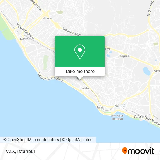
See VZX, Kartal, on the map
Public Transit to VZX in Kartal
Wondering how to get to VZX in Kartal? Moovit helps you find the best way to get to VZX with step-by-step directions from the nearest public transit station.
Moovit provides free maps and live directions to help you navigate through your city. View schedules, routes, timetables, and find out how long does it take to get to VZX in real time.
Looking for the nearest stop or station to VZX? Check out this list of stops closest to your destination: Yemeni Sokak - Kartal 252 Yönü; İnce Sokak; İstasyon - Pendik Yönü; Atalar; Trabzonspor - Kadıköy Yönü; Atalar Merkez Camii - Esenkent Metro Yönü.
Bus: 134YK, 16, 16D, 17, C50, 16A, 133G, KM30.Metro: M4.Train: B1.Dolmus & Minibus: C50, C90.
Want to see if there’s another route that gets you there at an earlier time? Moovit helps you find alternative routes or times. Get directions from and directions to VZX easily from the Moovit App or Website.
We make riding to VZX easy, which is why over 1.5 million users, including users in Kartal, trust Moovit as the best app for public transit. You don’t need to download an individual bus app or train app, Moovit is your all-in-one transit app that helps you find the best bus time or train time available.
For information on prices of bus, Dolmus & Minibus, metro and train, costs and ride fares to VZX, please check the Moovit app.
Use the app to navigate to popular places including to the airport, hospital, stadium, grocery store, mall, coffee shop, school, college, and university.
VZX Address: Yemeni Sokak, 2 34860 Kordonboyu, Kartal street in Kartal
- Home,
- Güven Gıda,
- tekel caddesi no:52 Eagle park,
- Hb Metal Profil İnşaat San. Vetic. Limited Şti.,
- Recebin Yeri,
- Dalyan Şarküteri & Tekel Bayii,
- ING Bank,
- Detay Akvaryum,
- Kadiroğlu Eczanesi,
- Dragosunlumamuller,
- Dragos Gıda,
- Dragos Tuning,
- Ulusal Perakende,
- Hertz Car Hifi,
- Vetqueen Veterıner Mua,
- Giyimmatik,
- Birlik Gayrimenkul,
- Far Dünyası,
- Muzipo Kids Kartal/Dragos,
- Sinem'in Yeri
Places Near VZX (Kartal)
- Karaköy Genelevi, Karaköy, Beyoğlu,
- Başakşehir Çam Ve Sakura Şehir Hastanesi, Basaksehir,
- 212 AVM, Bagcilar,
- Hilltown AVM, Maltepe,
- Mall Of İstanbul, Basaksehir,
- Gebze-Harem Minibüs Hattı, Gebze,
- METROPOL IsTaNBuL, Ataşehir,
- Topkule Kışlası 47.Komando Tugay Komutanlığı, Esenler,
- Şehit Prof. Dr. İlhan Varank Eğitim Ve Araştırma Hastanesi, Sancaktepe,
- Bakırköy Sosyete Pazarı, Bakirköy,
- İstanbul,
- VİALAND AVM, Eyüp,
- Gebze Koop Durağı, Gebze,
- 41 Burda AVM, Kocaeli Merkezi,
- Tersane İstanbul, Beyoğlu,
- Mehmet Emin Tokadî Hz. Türbesi, Fatih,
- Hz. Yuşa Tepesi, Beykoz,
- Beylikdüzü - 4 Nolu Minibüs Hattı, Beylikduzu,
- 2 Nolu Minibüss, Beylikduzu,
- İstinye Park, Sariyer
How to get to popular places in Istanbul with public transit
Get around Kartal by public transit!
Traveling around Kartal has never been so easy. See step by step directions as you travel to any attraction, street or major public transit station. View bus and train schedules, arrival times, service alerts and detailed routes on a map, so you know exactly how to get to anywhere in Kartal.
When traveling to any destination around Kartal use Moovit's Live Directions with Get Off Notifications to know exactly where and how far to walk, how long to wait for your line, and how many stops are left. Moovit will alert you when it's time to get off — no need to constantly re-check whether yours is the next stop.
Wondering how to use public transit in Kartal or how to pay for public transit in Kartal? Moovit public transit app can help you navigate your way with public transit easily, and at minimum cost. It includes public transit fees, ticket prices, and costs. Looking for a map of Kartal public transit lines? Moovit public transit app shows all public transit maps in Kartal with all Bus, Train, Metro, Tram, Ferry, Metrobus and Dolmus & Minibus routes and stops on an interactive map.
Istanbul has 7 transit type(s), including: Bus, Train, Metro, Tram, Ferry, Metrobus and Dolmus & Minibus, operated by several transit agencies, including Marmaray, Metro İstanbul, Metrobüs, UAB, İETT, İETT ÇIFT KATLI HATLAR, İETT BÖLGESEL HATLAR, TCDD, Şehir Hatları, Dentur Avrasya, Beyden, Turyol, Mavi Marmara, Havaist and Prenstur
