How to get to Valhalla by bus?
Click on the bus route to see step by step directions with maps, line arrival times and updated time schedules.
From Ridge Hill Mall, Yonkers
86 minFrom Cross County Mall, Yonkers
62 minFrom St. John's Riverside Hospital, Yonkers
73 minFrom Mamaroneck NY, Mamaroneck
59 minFrom Port Chester, NY, Port Chester
49 minFrom Palisades mall, West Nyack
60 minFrom Regeneron Pharmaceuticals Inc, Tarrytown
84 minFrom Cross County Shopping Center, Yonkers
63 minFrom Rye Playland, Rye
91 minFrom New Rochelle, NY, New Rochelle
90 min
How to get to Valhalla by train?
Click on the train route to see step by step directions with maps, line arrival times and updated time schedules.
Bus stops near Valhalla in Mount Pleasant
Train station near Valhalla in Mount Pleasant
- Vallhalla, 15 min walk,VIEW
Bus lines to Valhalla in Mount Pleasant
What are the closest stations to Valhalla?
The closest stations to Valhalla are:
- Broadway @ Cleveland St is 15 yards away, 1 min walk.
- Grasslands Rd @ Legion Dr is 1136 yards away, 14 min walk.
- Vallhalla is 1234 yards away, 15 min walk.
Which bus lines stop near Valhalla?
These bus lines stop near Valhalla: 40, 6.
Which train line stops near Valhalla?
2 (613#| Southeast)
What’s the nearest train station to Valhalla in Mount Pleasant?
The nearest train station to Valhalla in Mount Pleasant is Vallhalla. It’s a 15 min walk away.
What’s the nearest bus station to Valhalla in Mount Pleasant?
The nearest bus station to Valhalla in Mount Pleasant is Broadway @ Cleveland St. It’s a 1 min walk away.
What time is the first train to Valhalla in Mount Pleasant?
The 2 is the first train that goes to Valhalla in Mount Pleasant. It stops nearby at 3:00 AM.
What time is the last train to Valhalla in Mount Pleasant?
The 2 is the last train that goes to Valhalla in Mount Pleasant. It stops nearby at 3:00 AM.
What time is the first bus to Valhalla in Mount Pleasant?
The 40 is the first bus that goes to Valhalla in Mount Pleasant. It stops nearby at 6:28 AM.
What time is the last bus to Valhalla in Mount Pleasant?
The 6 is the last bus that goes to Valhalla in Mount Pleasant. It stops nearby at 10:25 PM.
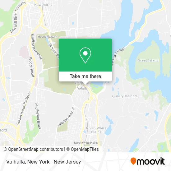
See Valhalla, Mount Pleasant, on the map
Public Transit to Valhalla in Mount Pleasant
Wondering how to get to Valhalla in Mount Pleasant? Moovit helps you find the best way to get to Valhalla with step-by-step directions from the nearest public transit station.
Moovit provides free maps and live directions to help you navigate through your city. View schedules, routes, timetables, and find out how long does it take to get to Valhalla in real time.
Looking for the nearest stop or station to Valhalla? Check out this list of stops closest to your destination: Broadway @ Cleveland St; Grasslands Rd @ Legion Dr; Vallhalla.
Bus: 40, 6, 41.Train: 2.
Want to see if there’s another route that gets you there at an earlier time? Moovit helps you find alternative routes or times. Get directions from and directions to Valhalla easily from the Moovit App or Website.
We make riding to Valhalla easy, which is why over 1.5 million users, including users in Mount Pleasant, trust Moovit as the best app for public transit. You don’t need to download an individual bus app or train app, Moovit is your all-in-one transit app that helps you find the best bus time or train time available.
For information on prices of bus and train, costs and ride fares to Valhalla, please check the Moovit app.
Use the app to navigate to popular places including to the airport, hospital, stadium, grocery store, mall, coffee shop, school, college, and university.
Valhalla Address: Westchester, New York street in Mount Pleasant
- Teresa Alessandro - Making Westchester Home,
- Jacked Fitness,
- Broad and Bailey,
- Albanian American Realtors,
- The Farm Cafe,
- Valhalla Pizza Station,
- Sandy’S Flower Shop Valhalla,
- Valhalla, New York,
- Phillip Capozzi, M.D., Library at New York Medical College,
- Old Glory Locksmith,
- Post Office-Valhalla,
- Thrift To the Max,
- Sit Means Sit Connecticut and Southern Westchester,
- Just Pups,
- Valhalla Beauty Salon,
- Yimny Espinal-Farmers Insurance Agent,
- Sinclair Gas Station,
- John Mckoy With Coldwell Banker,
- Sit Means Sit Dog Training Of Westchester,
- Marc Tedaldi
Places Near Valhalla (Mount Pleasant)
- Mountainside Hospital, Glen Ridge,
- SoHo, Manhattan,
- 111 Centre New York City Supreme Court, Manhattan,
- Queens Center Mall, Queens,
- 26 Federal Plaza, Manhattan,
- 1 Police Plaza, Manhattan,
- Rockefeller Center, Manhattan,
- 3 Stone St, Manhattan,
- Wall Street, Manhattan,
- 376 Hudson Street, Manhattan,
- 66 John Street, Manhattan,
- Pier 83, Manhattan,
- Times Square, Manhattan,
- 911 Memorial, Manhattan,
- Hudson Yards, Manhattan,
- Katz's Deli, Manhattan,
- San Gennaro Feast, Manhattan,
- qqqq, Manhattan,
- Chinatown, Manhattan,
- Bellevue Hospital, Manhattan
How to get to popular places in New York - New Jersey with public transit
Get around Mount Pleasant by public transit!
Traveling around Mount Pleasant has never been so easy. See step by step directions as you travel to any attraction, street or major public transit station. View bus and train schedules, arrival times, service alerts and detailed routes on a map, so you know exactly how to get to anywhere in Mount Pleasant.
When traveling to any destination around Mount Pleasant use Moovit's Live Directions with Get Off Notifications to know exactly where and how far to walk, how long to wait for your line, and how many stops are left. Moovit will alert you when it's time to get off — no need to constantly re-check whether yours is the next stop.
Wondering how to use public transit in Mount Pleasant or how to pay for public transit in Mount Pleasant? Moovit public transit app can help you navigate your way with public transit easily, and at minimum cost. It includes public transit fees, ticket prices, and costs. Looking for a map of Mount Pleasant public transit lines? Moovit public transit app shows all public transit maps in Mount Pleasant with all Bus, Train, Subway, Light Rail, Ferry and Cable Car routes and stops on an interactive map.
New York - New Jersey has 6 transit type(s), including: Bus, Train, Subway, Light Rail, Ferry and Cable Car, operated by several transit agencies, including MTA Subway, Metro-North Railroad, LIRR, PATH, MTA New York City Transit - Express routes, MTA Bus, NJ Transit, NYC Ferry, NICE bus, Bee-Line Bus, NJ Transit Rail, Norwalk Transit District, Hartford Line, River Valley Transit and HART