Valle Aurelia (Ma-Fl3) stop - Sunday schedule
| Line | Direction | Time |
|---|---|---|
| 31 | Laurentina (Metro B) | 5:35 AM |
| 31 | Laurentina (Metro B) | 6:06 AM |
| 31 | Laurentina (Metro B) | 6:37 AM |
| 31 | Laurentina (Metro B) | 7:10 AM |
| 31 | Laurentina (Metro B) | 7:43 AM |
| 180F | Mazzacurati | 8:07 AM |
| 31 | Laurentina (Metro B) | 8:16 AM |
| 180F | Mazzacurati | 8:22 AM |
| 180F | Mazzacurati | 8:37 AM |
| 31 | Laurentina (Metro B) | 8:51 AM |
| 180F | Mazzacurati | 8:52 AM |
| 180F | Mazzacurati | 9:07 AM |
| 180F | Mazzacurati | 9:22 AM |
| 31 | Laurentina (Metro B) | 9:26 AM |
| 180F | Mazzacurati | 9:37 AM |
| 180F | Mazzacurati | 9:52 AM |
| 31 | Laurentina (Metro B) | 9:56 AM |
| 180F | Mazzacurati | 10:07 AM |
| 180F | Mazzacurati | 10:22 AM |
| 31 | Laurentina (Metro B) | 10:25 AM |
| 180F | Mazzacurati | 10:37 AM |
| 180F | Mazzacurati | 10:52 AM |
| 31 | Laurentina (Metro B) | 10:55 AM |
| 180F | Mazzacurati | 11:07 AM |
| 180F | Mazzacurati | 11:22 AM |
Directions to Valle Aurelia (Ma-Fl3) stop (Rome) with public transit
The following transit lines have routes that pass near Valle Aurelia (Ma-Fl3)
 Bus: 180F, 31, 490, 495, 46.
- Train: FL3.
- Metro: A.
How to get to Valle Aurelia (Ma-Fl3) stop by bus?
Click on the bus route to see step by step directions with maps, line arrival times and updated time schedules.
How to get to Valle Aurelia (Ma-Fl3) stop by train?
Click on the train route to see step by step directions with maps, line arrival times and updated time schedules.
How to get to Valle Aurelia (Ma-Fl3) stop by metro?
Click on the metro route to see step by step directions with maps, line arrival times and updated time schedules.
Bus stops near Valle Aurelia (Ma-Fl3) stop in Rome
- Aurelia/Paolo III, 1 min walk,
- Valle Aurelia/Gandino, 2 min walk,
- Anastasio II/De Cristofaro, 4 min walk,
- Rome | Valle Aurelia Railway, 4 min walk,
- Valle Aurelia (Metro), 4 min walk,
Train stations near Valle Aurelia (Ma-Fl3) station in Rome
- Appiano, 11 min walk,
Metro stations near Valle Aurelia (Ma-Fl3) station in Rome
- Valle Aurelia, 14 min walk,
Bus lines to Valle Aurelia (Ma-Fl3) stop in Rome
- 46, Piazza Venezia,
- N46, Monte Mario Station (FS-FL3),
- 49, Cavour Square,
- 495, Tiburtina Station (Metro B),
- 906, Casale Lumbroso/Fontebasso,
- 31, Laurentina (Metro B),
- 33, Clodio,
- 247, Aurelia Station,
- COTRAL, Manziana - Roma Cornelia,
- COTRAL, Allumiere - Roma Cornelia,
- COTRAL, Civita Castellana - Roma Cornelia,
- COTRAL, Viterbo - Roma Cornelia,
- 180F, Dalla Chiesa,
- NMA, Anagnina Metro,
- 490, Tiburtina Station (Metro B),
- COTRAL, Viterbo via Riello,
- COTRAL, Civita via Terni via Palombara,
- COTRAL, Blera | Via Monteromano (Depot),
- 892, Valle Aurelia,
What are the closest stations to Valle Aurelia (Ma-Fl3)?
The closest stations to Valle Aurelia (Ma-Fl3) are:
- Aurelia/Paolo III is 51 meters away, 1 min walk.
- Valle Aurelia/Gandino is 114 meters away, 2 min walk.
- Anastasio II/De Cristofaro is 270 meters away, 4 min walk.
- Rome | Valle Aurelia Railway is 283 meters away, 4 min walk.
- Valle Aurelia (Metro) is 292 meters away, 4 min walk.
- Appiano is 868 meters away, 11 min walk.
- Valle Aurelia is 1057 meters away, 14 min walk.
Which bus lines stop near Valle Aurelia (Ma-Fl3)?
These bus lines stop near Valle Aurelia (Ma-Fl3): 180F, 31, 490, 495.
Which train line stops near Valle Aurelia (Ma-Fl3)?
FL3 (Viterbo)
Which metro line stops near Valle Aurelia (Ma-Fl3)?
A (Battistini)
What’s the nearest metro station to Valle Aurelia (Ma-Fl3) in Rome?
The nearest metro station to Valle Aurelia (Ma-Fl3) in Rome is Valle Aurelia. It’s a 14 min walk away.
What’s the nearest train station to Valle Aurelia (Ma-Fl3) in Rome?
The nearest train station to Valle Aurelia (Ma-Fl3) in Rome is Appiano. It’s a 11 min walk away.
What’s the nearest bus station to Valle Aurelia (Ma-Fl3) in Rome?
The nearest bus station to Valle Aurelia (Ma-Fl3) in Rome is Aurelia/Paolo III. It’s a 1 min walk away.
What time is the first metro to Valle Aurelia (Ma-Fl3) in Rome?
The A is the first metro that goes to Valle Aurelia (Ma-Fl3) in Rome. It stops nearby at 5:34 AM.
What time is the last metro to Valle Aurelia (Ma-Fl3) in Rome?
The A is the last metro that goes to Valle Aurelia (Ma-Fl3) in Rome. It stops nearby at 12:06 AM.
What time is the first train to Valle Aurelia (Ma-Fl3) in Rome?
The FL3 is the first train that goes to Valle Aurelia (Ma-Fl3) in Rome. It stops nearby at 5:48 AM.
What time is the last train to Valle Aurelia (Ma-Fl3) in Rome?
The FL3 is the last train that goes to Valle Aurelia (Ma-Fl3) in Rome. It stops nearby at 11:09 PM.
What time is the first bus to Valle Aurelia (Ma-Fl3) in Rome?
The N46 is the first bus that goes to Valle Aurelia (Ma-Fl3) in Rome. It stops nearby at 3:00 AM.
What time is the last bus to Valle Aurelia (Ma-Fl3) in Rome?
The NMA is the last bus that goes to Valle Aurelia (Ma-Fl3) in Rome. It stops nearby at 3:45 AM.
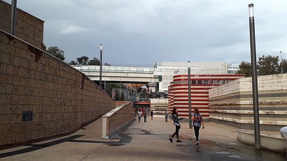
Valle Aurelia (Ma-Fl3) station
 Taken by Alexander S.
See Valle Aurelia (Ma-Fl3) stop, Rome, on the map
Public transit to Valle Aurelia (Ma-Fl3) stop (ID: 71155) in Rome
Looking for directions to Valle Aurelia (Ma-Fl3) in Rome, Italy?
Download the Moovit App to find the current schedule and step-by-step directions for Bus, Metro or Train routes that pass through Valle Aurelia (Ma-Fl3).
Looking for the nearest stops closest to Valle Aurelia (Ma-Fl3) ? Check out this list of closest stops to your destination: Aurelia/Paolo III; Valle Aurelia/Gandino; Anastasio II/De Cristofaro; Rome | Valle Aurelia Railway; Valle Aurelia (Metro); Appiano; Valle Aurelia.
Bus: 180F, 31, 490, 495, 46, N46, 49, 906, 33, 247, COTRAL, COTRAL, COTRAL, COTRAL.Train: FL3.Metro: A.
We make riding on public transit to Valle Aurelia (Ma-Fl3) easy, which is why over 1.5 million users, including users in Rome trust Moovit as the best app for public transit.
Use the app to navigate to popular places including to the airport, hospital, stadium, grocery store, mall, coffee shop, school, college, and university.
Valle Aurelia (Ma-Fl3) stop’s code is 71155
The first line to this stop is 31, at 5:35 AM, and the last line is 31 at 12:05 AM.
This stop serves ATAC’s lines
Popular routes from Valle Aurelia (Ma-Fl3) stop, Rome
- To San Giovanni-Addolorata Hospital (S. Giovanni Facility),
- To Passoscuro,
- To Valle Giulia Clinic,
- To Camillo De Lellis Provincial Hospital,
- To IDI (Dermopatico Dell'Immacolata Institute),
- To San Filippo Neri,
- To Three Fountains,
- To Santo Spirito Hospital in Sassia,
- To Casilino Polyclinic Clinic - Building D,
- To Niccolò Cusano University Foundation
- Aurelia/Paolo III,
- Valle Aurelia/Gandino,
- Anastasio II/De Cristofaro,
- Rome | Valle Aurelia Railway,
- Valle Aurelia (Metro)
Bus stops near Valle Aurelia (Ma-Fl3) stop
- Appiano
Train station near Valle Aurelia (Ma-Fl3) station
- Valle Aurelia
Metro station near Valle Aurelia (Ma-Fl3) station
- Bonelli Villa,
- Monterotondo | Salaria Street (Piedicosta),
- Ottavia,
- Poggio Mirteto,
- Subaugusta (Metro A),
- Muse,
- Baldelli (Metro B),
- Frosinone,
- Portuense/Casetta Mattei,
- Viterbo via Riello,
- Mancini,
- Boselli,
- Tuscolana/Quadraro,
- Vitorchiano,
- Sports Fields (On Request),
- Formia | Port,
- Livorno,
- Torpignattara/Casilina,
- Passo Corese Bus Station FS,
- Pontinia | Via Marittima Via Appia
Popular public transit stations in Rome
Get around Rome by public transit!
Traveling around Rome has never been so easy. See step by step directions as you travel to any attraction, street or major public transit station. View bus and train schedules, arrival times, service alerts and detailed routes on a map, so you know exactly how to get to anywhere in Rome.
When traveling to any destination around Rome use Moovit's Live Directions with Get Off Notifications to know exactly where and how far to walk, how long to wait for your line, and how many stops are left. Moovit will alert you when it's time to get off — no need to constantly re-check whether yours is the next stop.
Wondering how to use public transit in Rome or how to pay for public transit in Rome? Moovit public transit app can help you navigate your way with public transit easily, and at minimum cost. It includes public transit fees, ticket prices, and costs. Looking for a map of Rome public transit lines? Moovit public transit app shows all public transit maps in Rome with all Bus, Train, Metro, Light Rail, Ferry, Funicular and Gondola routes and stops on an interactive map.
Rome and Lazio has 7 transit type(s), including: Bus, Train, Metro, Light Rail, Ferry, Funicular and Gondola, operated by several transit agencies, including ATAC, Cotral, Trenitalia, Troiani Transportation Services, BIS, ATR Mobility, Tuscia, Shuttle, Seatour, Troiani Bus Lines, CSC Mobility, Terravision, ATRAL, Tambus and Sitbus