How to get to Valrose Premier Shade Structures by bus?
Click on the bus route to see step by step directions with maps, line arrival times and updated time schedules.
From Neighbor Transport Services, Miami
72 minFrom Sawgrass Mills Mall, Miami
99 minFrom Davie, FL, Davie
82 minFrom Fort Lauderdale airport terminal 3 Jet Blue, Hollywood
62 minFrom Sunny Isles Beach, Miami Beach
70 minFrom Haulover Beach, Miami Beach
73 minFrom Red Carpet Inn Fort Lauderdale Airport / Cruise Port, Hollywood
75 minFrom Interstate 95 & FL Turnpike/US 441/Palmetto Expy/FL 826, Miami
73 minFrom Griffin Road & Davie Road, Davie
83 minFrom Miami International Autodrome F1 Track, Miami Gardens
72 min
How to get to Valrose Premier Shade Structures by train?
Click on the train route to see step by step directions with maps, line arrival times and updated time schedules.
Bus stops near Valrose Premier Shade Structures in Hallandale Beach
Train station near Valrose Premier Shade Structures in Hallandale Beach
- Hollywood Station, 49 min walk,VIEW
Bus lines to Valrose Premier Shade Structures in Hallandale Beach
What are the closest stations to Valrose Premier Shade Structures?
The closest stations to Valrose Premier Shade Structures are:
- Pembroke Road/Southwest 31st Avenue - (Public Storage) is 306 yards away, 4 min walk.
- Pembroke Road & South 26th Avenue is 1129 yards away, 14 min walk.
- Hollywood Station is 4183 yards away, 49 min walk.
Which bus lines stop near Valrose Premier Shade Structures?
These bus lines stop near Valrose Premier Shade Structures: 05, 06, 15.
Which train line stops near Valrose Premier Shade Structures?
TRIRAIL (Northbound To Mangonia Park)
What’s the nearest bus station to Valrose Premier Shade Structures in Hallandale Beach?
The nearest bus station to Valrose Premier Shade Structures in Hallandale Beach is Pembroke Road/Southwest 31st Avenue - (Public Storage). It’s a 4 min walk away.
What time is the first train to Valrose Premier Shade Structures in Hallandale Beach?
The TRIRAIL is the first train that goes to Valrose Premier Shade Structures in Hallandale Beach. It stops nearby at 4:16 AM.
What time is the last train to Valrose Premier Shade Structures in Hallandale Beach?
The FLORIDIAN is the last train that goes to Valrose Premier Shade Structures in Hallandale Beach. It stops nearby at 5:29 PM.
What time is the first bus to Valrose Premier Shade Structures in Hallandale Beach?
The 06 is the first bus that goes to Valrose Premier Shade Structures in Hallandale Beach. It stops nearby at 5:19 AM.
What time is the last bus to Valrose Premier Shade Structures in Hallandale Beach?
The 06 is the last bus that goes to Valrose Premier Shade Structures in Hallandale Beach. It stops nearby at 11:36 PM.
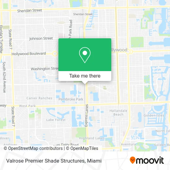
See Valrose Premier Shade Structures, Hallandale Beach, on the map
Public Transit to Valrose Premier Shade Structures in Hallandale Beach
Wondering how to get to Valrose Premier Shade Structures in Hallandale Beach? Moovit helps you find the best way to get to Valrose Premier Shade Structures with step-by-step directions from the nearest public transit station.
Moovit provides free maps and live directions to help you navigate through your city. View schedules, routes, timetables, and find out how long does it take to get to Valrose Premier Shade Structures in real time.
Looking for the nearest stop or station to Valrose Premier Shade Structures? Check out this list of stops closest to your destination: Pembroke Road/Southwest 31st Avenue - (Public Storage); Pembroke Road & South 26th Avenue; Hollywood Station.
Bus: 05, 06, 15.Train: TRIRAIL, FLORIDIAN, SILVER METEOR.
Want to see if there’s another route that gets you there at an earlier time? Moovit helps you find alternative routes or times. Get directions from and directions to Valrose Premier Shade Structures easily from the Moovit App or Website.
We make riding to Valrose Premier Shade Structures easy, which is why over 1.5 million users, including users in Hallandale Beach, trust Moovit as the best app for public transit. You don’t need to download an individual bus app or train app, Moovit is your all-in-one transit app that helps you find the best bus time or train time available.
For information on prices of bus and train, costs and ride fares to Valrose Premier Shade Structures, please check the Moovit app.
Use the app to navigate to popular places including to the airport, hospital, stadium, grocery store, mall, coffee shop, school, college, and university.
Valrose Premier Shade Structures Address: 1730 SW 30th Ave Hallandale Beach, FL 33009 street in Hallandale Beach
- Express Roofing Supply 2,
- Victory Roofing & Associates,
- Taller de Actuación Sebastian Ligarde,
- Unique Coffee Roasters,
- J M Scrap Metals,
- Evergreen Cleaning Service,
- Elan USA,
- Alibaba Events: Theme Parties & Luxury Tents,
- Pleasure emporium,
- The Stem Factory Academy of Excellence,
- Ct Car Golf Carts,
- Vending Just Right,
- Zero Diagnostic,
- Utopia Ice,
- Sebco Books & Mitchell Lane Publishers,
- Daytona Beach Motorcycle Rally,
- Fast Memorial Prints,
- Family Tire Distributors,
- Productive Welding Workshop,
- Stn Glass Works
Places Near Valrose Premier Shade Structures (Hallandale Beach)
- Marlins Park, Miami,
- Miami Freedom Park, Miami,
- Sawgrass Mall, Miami,
- Keiser University Flagship Campus, West Palm Beach,
- Aventura Mall, Miami Beach,
- Hard Rock Stadium, Miami Gardens,
- Brickell City Centre, Miami,
- Little Havana, Miami,
- Zoo Miami, Miami,
- Miami VA Hospital, Miami,
- Miami-Dade County Courthouse, Miami,
- Sawgrass mall ( FL ), Miami Beach,
- Bayside Marketplace, Miami,
- Miami Design District, Miami,
- Port of Miami Cruise Terminal, Miami,
- Dolphin Mall, Miami,
- Wynwood, Miami,
- Aventura Mall, Miami,
- Dolphin Mall Bus, Miami,
- Richard E. Gerstein Justice Building, Miami
How to get to popular places in Miami with public transit
Get around Hallandale Beach by public transit!
Traveling around Hallandale Beach has never been so easy. See step by step directions as you travel to any attraction, street or major public transit station. View bus and train schedules, arrival times, service alerts and detailed routes on a map, so you know exactly how to get to anywhere in Hallandale Beach.
When traveling to any destination around Hallandale Beach use Moovit's Live Directions with Get Off Notifications to know exactly where and how far to walk, how long to wait for your line, and how many stops are left. Moovit will alert you when it's time to get off — no need to constantly re-check whether yours is the next stop.
Wondering how to use public transit in Hallandale Beach or how to pay for public transit in Hallandale Beach? Moovit public transit app can help you navigate your way with public transit easily, and at minimum cost. It includes public transit fees, ticket prices, and costs. Looking for a map of Hallandale Beach public transit lines? Moovit public transit app shows all public transit maps in Hallandale Beach with all Bus, Train, Light Rail and Ferry routes and stops on an interactive map.
Miami has 4 transit type(s), including: Bus, Train, Light Rail and Ferry, operated by several transit agencies, including Broward County Transit, Miami-Dade Transit, Metrorail, Palm Tran, Tri-Rail, Brightline, MARTY, City of Homestead Trolley, Key West Transit, Treasure Coast Connector, GoLine IRT, Amtrak, Greyhound-us, FlixBus-us and Aventura Express Shuttle Bus