How to get to Valsic by bus?
Click on the bus route to see step by step directions with maps, line arrival times and updated time schedules.
From Castillo de Sagunto, Sagunto
36 minFrom Platja de Puçol / Playa de Puzol, Puçol
126 minFrom Hospital de Sagunt, Sagunto
23 minFrom L'epicentre, Sagunto
27 minFrom Puerto De Sagunto, Sagunto
34 minFrom Algimia de Alfara, Algimia De Alfara
138 minFrom Canet d'en Berenguer, Canet D'En Berenguer
22 minFrom Alfinach, Puçol
90 minFrom Puzol, Puçol
212 min
How to get to Valsic by train?
Click on the train route to see step by step directions with maps, line arrival times and updated time schedules.
Bus stop near Valsic in Sagunto
- Cv-309 Km 15,15 Asc - Ventorrillo, 4 min walk,VIEW
Train station near Valsic in Sagunto
- Les Valls, 11 min walk,VIEW
Bus lines to Valsic in Sagunto
- L376, Av. Benicalaf, 15 Front,VIEW
What are the closest stations to Valsic?
The closest stations to Valsic are:
- Cv-309 Km 15,15 Asc - Ventorrillo is 217 meters away, 4 min walk.
- Les Valls is 742 meters away, 11 min walk.
Which bus line stops near Valsic?
L376 (Av. Benicalaf, 15 Front)
Which train line stops near Valsic?
C6 (Valencia Nord)
What’s the nearest train station to Valsic in Sagunto?
The nearest train station to Valsic in Sagunto is Les Valls. It’s a 11 min walk away.
What’s the nearest bus station to Valsic in Sagunto?
The nearest bus station to Valsic in Sagunto is Cv-309 Km 15,15 Asc - Ventorrillo. It’s a 4 min walk away.
What time is the first train to Valsic in Sagunto?
The C6 is the first train that goes to Valsic in Sagunto. It stops nearby at 6:12 AM.
What time is the last train to Valsic in Sagunto?
The C6 is the last train that goes to Valsic in Sagunto. It stops nearby at 11:12 PM.
What time is the first bus to Valsic in Sagunto?
The L376 is the first bus that goes to Valsic in Sagunto. It stops nearby at 7:30 AM.
What time is the last bus to Valsic in Sagunto?
The L376 is the last bus that goes to Valsic in Sagunto. It stops nearby at 5:31 PM.
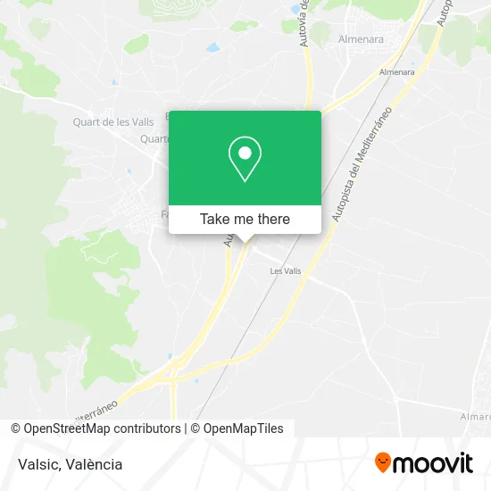
See Valsic, Sagunto, on the map
Public Transit to Valsic in Sagunto
Wondering how to get to Valsic in Sagunto? Moovit helps you find the best way to get to Valsic with step-by-step directions from the nearest public transit station.
Moovit provides free maps and live directions to help you navigate through your city. View schedules, routes, timetables, and find out how long does it take to get to Valsic in real time.
Looking for the nearest stop or station to Valsic? Check out this list of stops closest to your destination: Cv-309 Km 15,15 Asc - Ventorrillo; Les Valls.
Bus: L376.Train: C6.
Want to see if there’s another route that gets you there at an earlier time? Moovit helps you find alternative routes or times. Get directions from and directions to Valsic easily from the Moovit App or Website.
We make riding to Valsic easy, which is why over 1.5 million users, including users in Sagunto, trust Moovit as the best app for public transit. You don’t need to download an individual bus app or train app, Moovit is your all-in-one transit app that helps you find the best bus time or train time available.
For information on prices of bus and train, costs and ride fares to Valsic, please check the Moovit app.
Use the app to navigate to popular places including to the airport, hospital, stadium, grocery store, mall, coffee shop, school, college, and university.
Valsic Address: N-340, 6 46513 Estació de les Valls Sagunto street in Sagunto
- Ramón Gimeno S L Empresa,
- Autrasa S.L.,
- Estació de les Valls,
- Bar Restaurante El Ventorrillo,
- Xti Desarrollo Comerci,
- Cepsa,
- Valrotrans,
- Ajuntament Benifairo De Les Valls,
- Calle Proyecto 5,
- english summer school,
- Pol. Ind. La Foia,
- Estació de Tren - Les Valls,
- Reparaciones Sagunto S,
- Frutas Plasencia,
- Jessica,
- Gabriel Necula,
- Cerveceria La Tórtola,
- Crisco,
- Bar La Ronda,
- Solados de Levante
Places Near Valsic (Sagunto)
- Ikea, Alfafar,
- Port Saplaya,
- Malvarrosa, Valencia,
- Av. de la Constitución, Valencia,
- Bus lanzadera Estació del Nord-Joaquín Sorolla, Valencia,
- Hospital General, Valencia,
- HOSPITAL CASA DE SALUD, Valencia,
- Playa de la Malvarrosa (Valencia),
- Hospital IMED, Burjassot,
- Playa La Patacona,
- Centro Comercial El Saler, Valencia,
- Hospital Vithas 9 d'Octubre, Valencia,
- Hospital Clínico, Valencia,
- Kinepolis Valencia, Paterna,
- Parque Tecnológico de Paterna, Paterna,
- Estación De Autobuses De Valencia, Valencia,
- Nuevo Centro, Valencia,
- Avenida del Puerto, Valencia,
- Centro Comercial Bonaire, Aldaia,
- Plaza España, Valencia
How to get to popular places in València with public transit
Get around Sagunto by public transit!
Traveling around Sagunto has never been so easy. See step by step directions as you travel to any attraction, street or major public transit station. View bus and train schedules, arrival times, service alerts and detailed routes on a map, so you know exactly how to get to anywhere in Sagunto.
When traveling to any destination around Sagunto use Moovit's Live Directions with Get Off Notifications to know exactly where and how far to walk, how long to wait for your line, and how many stops are left. Moovit will alert you when it's time to get off — no need to constantly re-check whether yours is the next stop.
Wondering how to use public transit in Sagunto or how to pay for public transit in Sagunto? Moovit public transit app can help you navigate your way with public transit easily, and at minimum cost. It includes public transit fees, ticket prices, and costs. Looking for a map of Sagunto public transit lines? Moovit public transit app shows all public transit maps in Sagunto with all Bus, Train and Metrovalencia routes and stops on an interactive map.
València has 3 transit type(s), including: Bus, Train and Metrovalencia, operated by several transit agencies, including Metrovalencia, Renfe Cercanias, EMT, MetroBus, València Metropolitana Nord, València Metropolitana Sud, Transport urbà de Torrent (TorrentBus), La Hoya de Buñol - València, La Ribera - València, Montserrat - València, La Marina Gandiense, La Ribera Baixa – Algemesí – Alzira, València - Benifaió, Alcoi Metropolitano and València Metropolitana Nord-Oest