Directions to Valtec Shop (São José Dos Pinhais) with public transportation
The following transit lines have routes that pass near Valtec Shop
How to get to Valtec Shop by bus?
Click on the bus route to see step by step directions with maps, line arrival times and updated time schedules.
From Rua Dr. Bley Zorning, Boqueirão
49 minFrom Rua Izaac Ferreira da Cruz, Sítio Cercado
69 minFrom Avenida Victor Ferreira do Amaral, Tarumã
70 minFrom Avenida São José 300, Cristo Rei
69 minFrom Hospital Universitário Cajuru, Cristo Rei
68 minFrom Hospital Marcelino Champagnat, Jardim Botânico
58 minFrom Rua Jacob Macanhan, Pinhais
56 minFrom Mexico 70, Sítio Cercado
68 minFrom Rua São José dos Pinhais, Sítio Cercado
69 minFrom Avenida Marechal Floriano Peixoto 2509, Parolin
59 min
Bus stops near Valtec Shop in São José Dos Pinhais
Bus lines to Valtec Shop in São José Dos Pinhais
- 531 BAIRRO A BAIRRO - 1, Terminal Central São José → Terminal Afonso Pena,VIEW
- 530 BAIRRO A BAIRRO - 2, Terminal Afonso Pena → Terminal Central São José,VIEW
- 154 PRIMAVERA, Terminal Afonso Pena ↺ Primavera (Circular),VIEW
- 143 T. AFONSO PENA / INDEPENDÊNCIA, Terminal Afonso Pena ↺ Independência (Circular),VIEW
What are the closest stations to Valtec Shop?
The closest stations to Valtec Shop are:
- R. Almirante Alexandrino, 912 is 39 meters away, 1 min walk.
- Casa Do Papai Noel (Almirante Alexandrino) is 189 meters away, 3 min walk.
- R. Professora Marieta De Souza E Silva, 1562 is 294 meters away, 4 min walk.
- R. Lourenço José De Paula, 1630 is 349 meters away, 5 min walk.
Which bus lines stop near Valtec Shop?
These bus lines stop near Valtec Shop: 530 BAIRRO A BAIRRO - 2, 531 BAIRRO A BAIRRO - 1.
What’s the nearest bus station to Valtec Shop in São José Dos Pinhais?
The nearest bus station to Valtec Shop in São José Dos Pinhais is R. Almirante Alexandrino, 912. It’s a 1 min walk away.
What time is the first bus to Valtec Shop in São José Dos Pinhais?
The 143 T. AFONSO PENA / INDEPENDÊNCIA is the first bus that goes to Valtec Shop in São José Dos Pinhais. It stops nearby at 4:36 AM.
What time is the last bus to Valtec Shop in São José Dos Pinhais?
The 143 T. AFONSO PENA / INDEPENDÊNCIA is the last bus that goes to Valtec Shop in São José Dos Pinhais. It stops nearby at 1:00 AM.
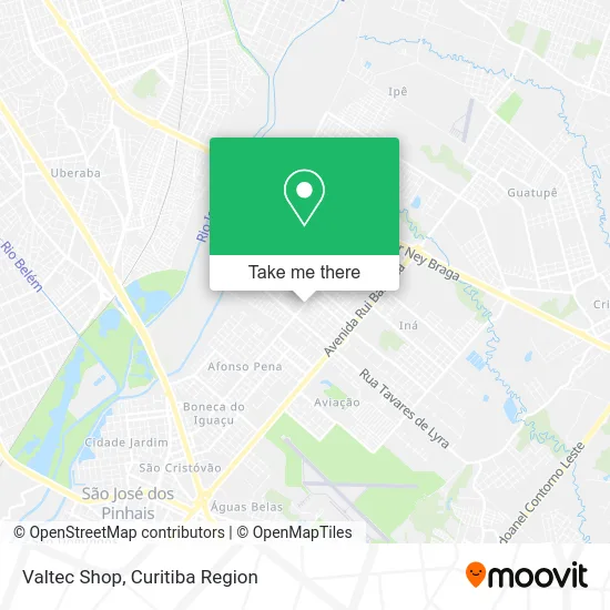
See Valtec Shop, São José Dos Pinhais, on the map
Public Transit to Valtec Shop in São José Dos Pinhais
Wondering how to get to Valtec Shop in São José Dos Pinhais? Moovit helps you find the best way to get to Valtec Shop with step-by-step directions from the nearest public transit station.
Moovit provides free maps and live directions to help you navigate through your city. View schedules, routes, timetables, and find out how long does it take to get to Valtec Shop in real time.
Looking for the nearest stop or station to Valtec Shop? Check out this list of stops closest to your destination: R. Almirante Alexandrino; Casa Do Papai Noel (Almirante Alexandrino); R. Professora Marieta De Souza E Silva; R. Lourenço José De Paula.
Bus: 530 BAIRRO A BAIRRO - 2, 531 BAIRRO A BAIRRO - 1, 154 PRIMAVERA, 143 T. AFONSO PENA / INDEPENDÊNCIA.
Want to see if there’s another route that gets you there at an earlier time? Moovit helps you find alternative routes or times. Get directions from and directions to Valtec Shop easily from the Moovit App or Website.
We make riding to Valtec Shop easy, which is why over 1.5 million users, including users in São José Dos Pinhais, trust Moovit as the best app for public transit. You don’t need to download an individual bus app or train app, Moovit is your all-in-one transit app that helps you find the best bus time or train time available.
For information on prices of bus, costs and ride fares to Valtec Shop, please check the Moovit app.
Use the app to navigate to popular places including to the airport, hospital, stadium, grocery store, mall, coffee shop, school, college, and university.
Valtec Shop Address: Rua Almirante Alexandrino, 960 Parque da Fonte São José dos Pinhais-PR 83040-420 street in São José Dos Pinhais
- Salao De Beleza - Debby Ester,
- Rua Almirante Alexandrino 1410,
- Góes,
- casa do Papai Noel- Parque da Fonte,
- Apr Comercios Em Geral,
- Amd Motors,
- Celeiro Produtos Naturais,
- Koppsul Administradora de Apolices de Seguros,
- Paróquia Nossa Senhora do Monte Claro,
- Rua Boleslau Sochaczewski 75,
- Rua Marieta De Souza E Silva,
- Suculentas, Cactos e Terrários Parque da Fonte,
- Cmei Trilha das Araucárias,
- Supermercados Goes Afonso Pena - São José,
- Comercial Monte Claro Peças Para Tratores,
- Ecolnews Comercio de Bombas e Equipamentos,
- Medserv - Serviços Médicos e Hospitalares Ltda,
- Supermercado Amigão,
- Carvalima Transportes,
- Rua Professor Antônio Dantas 471
Places Near Valtec Shop (São José Dos Pinhais)
- Hospital Da Cruz Vermelha, Batel,
- Pontifícia Universidade Católica do Paraná (PUCPR), Prado Velho,
- Park Shopping Barigüi, Mossunguê,
- Campo Largo, Campo,
- Rua Martim Afonso 558, Mercês,
- Hospital Nossa Senhora Das Graças, Mercês,
- Hospital Universitário Evangélico de Curitiba, Bigorrilho,
- Hospital Erasto Gaertner, Jardim Das Américas,
- Hhhhh, Fazendinha,
- Parque Barigui, Mercês,
- Hospital de Clínicas (HC - UFPR), Centro,
- Arena Da Baixada - Curitiba,
- Hospital do Rocio, Campo,
- Rua General Mário Tourinho, Campina Do Siqueira,
- Shopping Estação, Rebouças,
- Shopping Palladium, Portão,
- Hospital Angelina Caron, Campina Grande Do Sul,
- Jardim Botânico de Curitiba PR, Centro,
- Hospital Madalena Sofia, Bairro Alto,
- Jockey Plaza Shopping Center, Tarumã
How to get to popular places in Curitiba Region with public transit
Get around São José Dos Pinhais by public transit!
Traveling around São José Dos Pinhais has never been so easy. See step by step directions as you travel to any attraction, street or major public transit station. View bus and train schedules, arrival times, service alerts and detailed routes on a map, so you know exactly how to get to anywhere in São José Dos Pinhais.
When traveling to any destination around São José Dos Pinhais use Moovit's Live Directions with Get Off Notifications to know exactly where and how far to walk, how long to wait for your line, and how many stops are left. Moovit will alert you when it's time to get off — no need to constantly re-check whether yours is the next stop.
Wondering how to use public transit in São José Dos Pinhais or how to pay for public transit in São José Dos Pinhais? Moovit public transit app can help you navigate your way with public transit easily, and at minimum cost. It includes public transit fees, ticket prices, and costs. Looking for a map of São José Dos Pinhais public transit lines? Moovit public transit app shows all public transit maps in São José Dos Pinhais with all Bus and Cable Car routes and stops on an interactive map.
Curitiba Region has 2 transit type(s), including: Bus and Cable Car, operated by several transit agencies, including Sistema Integrado de Mobilidade (URBS), Sistema Integrado de Mobilidade (AMEP), URBS (Cartões bancários e Dinheiro), URBS (Cartões bancários / Cartão URBS), AMEP (Cartões bancários / Cartão MetroCard), AMEP (Cartões bancários / Cartão MetroCard / Dinheiro), Viação Colombo (Dinheiro), TRIAR (Cartão TRIAR / Dinheiro), Empresa Curitiba Cerro Azul (Dinheiro), Expresso Nossa Senhora da Penha (Dinheiro), Empresa Campo Alto Tijucas (Dinheiro), Auto Viação São José (Cartão VEM / Dinheiro), BRT S/A (Cartão VEM / Dinheiro), TransPiedade (Cartão Cidadão / Dinheiro) and Oceânica Sul (Cartão Transporte / Dinheiro)