How to get to Vargas Zueco Cesar by bus?
Click on the bus route to see step by step directions with maps, line arrival times and updated time schedules.
From Monumento Al Lagarto De Jaén, Jaén
33 minFrom Autoservicio Juani, Mancha Real
41 minFrom Fuente Don Diego 11, Jaén
25 minFrom Colegio Andrés de Vandelvira, Jaén
32 minFrom Hermanos Davila Morillas A.Ir, Mancha Real
38 minFrom Diseño Juvenil Mancha Real, Mancha Real
41 minFrom Blanca Gutiérrez R. m, Jaén
28 minFrom Papelería Tato, Jaén
19 minFrom Mancha Real, Mancha Real
37 minFrom Hiper Shop, Mancha Real
39 min
Bus stops near Vargas Zueco Cesar in Jaén
What are the closest stations to Vargas Zueco Cesar?
The closest stations to Vargas Zueco Cesar are:
- Urbanizacion Cerro Molina is 116 meters away, 2 min walk.
- Cerro Molina 1 is 116 meters away, 2 min walk.
Which bus lines stop near Vargas Zueco Cesar?
These bus lines stop near Vargas Zueco Cesar: 03, 13.
What’s the nearest bus station to Vargas Zueco Cesar in Jaén?
The nearest bus stations to Vargas Zueco Cesar in Jaén are Urbanizacion Cerro Molina and Cerro Molina 1. The closest one is a 2 min walk away.
What time is the first bus to Vargas Zueco Cesar in Jaén?
The 13 is the first bus that goes to Vargas Zueco Cesar in Jaén. It stops nearby at 7:40 AM.
What time is the last bus to Vargas Zueco Cesar in Jaén?
The 13 is the last bus that goes to Vargas Zueco Cesar in Jaén. It stops nearby at 10:46 PM.
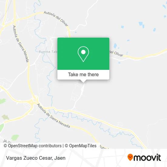
See Vargas Zueco Cesar, Jaén, on the map
Public Transit to Vargas Zueco Cesar in Jaén
Wondering how to get to Vargas Zueco Cesar in Jaén? Moovit helps you find the best way to get to Vargas Zueco Cesar with step-by-step directions from the nearest public transit station.
Moovit provides free maps and live directions to help you navigate through your city. View schedules, routes, timetables, and find out how long does it take to get to Vargas Zueco Cesar in real time.
Looking for the nearest stop or station to Vargas Zueco Cesar? Check out this list of stops closest to your destination: Urbanizacion Cerro Molina; Cerro Molina 1.
Bus: 03, 13.
Want to see if there’s another route that gets you there at an earlier time? Moovit helps you find alternative routes or times. Get directions from and directions to Vargas Zueco Cesar easily from the Moovit App or Website.
We make riding to Vargas Zueco Cesar easy, which is why over 1.5 million users, including users in Jaén, trust Moovit as the best app for public transit. You don’t need to download an individual bus app or train app, Moovit is your all-in-one transit app that helps you find the best bus time or train time available.
For information on prices of bus, costs and ride fares to Vargas Zueco Cesar, please check the Moovit app.
Use the app to navigate to popular places including to the airport, hospital, stadium, grocery store, mall, coffee shop, school, college, and university.
Location: Jaén, Jaen
- Morente Mejias Honorato,
- Franco Martinez Antonio Jose,
- Urbanización Cerro Molina,
- Electrojaen,
- Dinsamatig,
- Aceites Moral S.L.,
- Urbanizacion Cerro Molina,
- Casal Santa Ma,
- Urbanización La Manseguilla,
- Urbanización La Manseguilla,
- Gasolinera Petronor,
- Los Amigos,
- Altos Del Puente Nuevo,
- Urbanización Altos del Puente Nuevo,
- ESTACION SERVICIO LA YUCA, S.L.,
- Urbanización Los Amigos,
- Manuel Pulido Latorre,
- Rapimueble Jaen 3,
- Maderas y Secaderos Mo,
- Bule Bar Genuino Cafe
Places Near Vargas Zueco Cesar (Jaén)
- Puente De La Sierra, Jaén,
- Nuevo Estadio de la Victoria, Jaén,
- Centro Penitenciario De Jaén, Jaén,
- Hospital San Agustin, Linares,
- Castillo De Santa Catalina, Jaén,
- feria ubeda, el prendimiemto, Úbeda,
- Olivo Arena Jaén Paraíso Interior, Jaén,
- Hotel Ho Ciudad De Jaén, Jaén,
- Complejo Hospitalario De Jaén, Jaén,
- Polígono de los Olivares, Jaén,
- Catedral de Jaén, Jaén,
- Hospital Universitario Princesa de España, Jaén,
- Universidad De Jaén, Jaén,
- Hospital Neurotraumatológico Del H. U. De Jaén, Jaén,
- Carrefour, Jaén,
- Parador de Jaen, Jaén,
- Calle Catalina Mir Real, Jaén,
- Estacion de Autobuses de Jaen, Jaén,
- Jaén Plaza, Jaén,
- Ifeja, Jaén
How to get to popular places in Jaen with public transit
Get around Jaén by public transit!
Traveling around Jaén has never been so easy. See step by step directions as you travel to any attraction, street or major public transit station. View bus and train schedules, arrival times, service alerts and detailed routes on a map, so you know exactly how to get to anywhere in Jaén.
When traveling to any destination around Jaén use Moovit's Live Directions with Get Off Notifications to know exactly where and how far to walk, how long to wait for your line, and how many stops are left. Moovit will alert you when it's time to get off — no need to constantly re-check whether yours is the next stop.
Wondering how to use public transit in Jaén or how to pay for public transit in Jaén? Moovit public transit app can help you navigate your way with public transit easily, and at minimum cost. It includes public transit fees, ticket prices, and costs. Looking for a map of Jaén public transit lines? Moovit public transit app shows all public transit maps in Jaén with all bus routes and stops on an interactive map.
Jaen has 1 transit type(s), including: bus, operated by several transit agencies, including Empresa Castillo, ALSA, Red de Consorcios de Transporte de Andalucía - Área de Jaén, Transporte Urbano de Úbeda, Servicio de Transporte Urbano de Baeza and Transportes Urbanos de Linares