How to get to Variant Fit by bus?
Click on the bus route to see step by step directions with maps, line arrival times and updated time schedules.
From Central Park, Manhattan
71 minFrom Hospital for Special Surgery, Manhattan
70 minFrom 125th St & Park Ave, Manhattan
73 minFrom Randall's Island, Manhattan
91 minFrom The Jewish Museum, Manhattan
57 minFrom Queens Center Mall, Queens
74 minFrom Upper West Side, Manhattan
60 minFrom Mitsuwa Shuttle Bus Stop, Edgewater
63 min
How to get to Variant Fit by train?
Click on the train route to see step by step directions with maps, line arrival times and updated time schedules.
How to get to Variant Fit by subway?
Click on the subway route to see step by step directions with maps, line arrival times and updated time schedules.
Bus stops near Variant Fit in Manhattan
Subway stations near Variant Fit in Manhattan
Train station near Variant Fit in Manhattan
- Christopher Street, 6 min walk,VIEW
Bus lines to Variant Fit in Manhattan
- M21, Soho Washington St Crosstown,VIEW
- SIM7, Eltvlle Trans Ctr Via Hylan Via Richmond,VIEW
- SIM9, Eltingville Via F Cap Via Hylan Bl,VIEW
- SIM33, Mariners Harbor Via N Gannon Av,VIEW
- DOWNTOWN LOCAL, Midtown / W 39th Street,VIEW
- M20, Lincoln Center 66 St Via 8 Av,VIEW
- SIM1C, Eltingville - Manhattan Express,VIEW
- SIM3C, Pt. Richmond - Manhattan Express,VIEW
- SIM4C, Huguenot - Manhattan Express,VIEW
- SIM33C, Mariners Harbor - Greenwich Village Express,VIEW
- M55, 44 St 6 Av,VIEW
- SIM1, Eltingville - Lower Manhattan Express,VIEW
- SIM34, Mariners Harbor - Lower Manhattan Express,VIEW
What are the closest stations to Variant Fit?
The closest stations to Variant Fit are:
- West Houston St/Varick St is 59 yards away, 1 min walk.
- W Houston St & Varick St is 129 yards away, 2 min walk.
- 7 Av South/Clarkson St is 149 yards away, 2 min walk.
- 6 Av/Prince St is 312 yards away, 4 min walk.
- 6 Av/West Houston St is 317 yards away, 4 min walk.
- Christopher St-Stonewall is 370 yards away, 5 min walk.
- Christopher Street is 476 yards away, 6 min walk.
- W 4 St-Wash Sq is 608 yards away, 8 min walk.
Which bus lines stop near Variant Fit?
These bus lines stop near Variant Fit: DOWNTOWN LOCAL, M20, M21, X27.
Which train lines stop near Variant Fit?
These train lines stop near Variant Fit: BLU, PORT WASHINGTON BRANCH, YEL.
Which subway lines stop near Variant Fit?
These subway lines stop near Variant Fit: 1, B.
What’s the nearest subway station to Variant Fit in Manhattan?
The nearest subway station to Variant Fit in Manhattan is Christopher St-Stonewall. It’s a 5 min walk away.
What’s the nearest train station to Variant Fit in Manhattan?
The nearest train station to Variant Fit in Manhattan is Christopher Street. It’s a 6 min walk away.
What’s the nearest bus station to Variant Fit in Manhattan?
The nearest bus station to Variant Fit in Manhattan is West Houston St/Varick St. It’s a 1 min walk away.
What time is the first subway to Variant Fit in Manhattan?
The 2 is the first subway that goes to Variant Fit in Manhattan. It stops nearby at 3:02 AM.
What time is the last subway to Variant Fit in Manhattan?
The 2 is the last subway that goes to Variant Fit in Manhattan. It stops nearby at 4:03 AM.
What time is the first train to Variant Fit in Manhattan?
The ATW is the first train that goes to Variant Fit in Manhattan. It stops nearby at 3:15 AM.
What time is the last train to Variant Fit in Manhattan?
The ATW is the last train that goes to Variant Fit in Manhattan. It stops nearby at 3:15 AM.
What time is the first bus to Variant Fit in Manhattan?
The SIM1C is the first bus that goes to Variant Fit in Manhattan. It stops nearby at 3:53 AM.
What time is the last bus to Variant Fit in Manhattan?
The SIM1C is the last bus that goes to Variant Fit in Manhattan. It stops nearby at 2:53 AM.
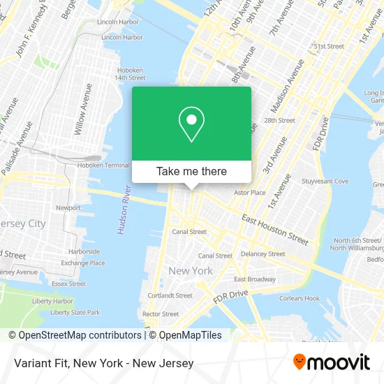
See Variant Fit, Manhattan, on the map
Public Transit to Variant Fit in Manhattan
Wondering how to get to Variant Fit in Manhattan? Moovit helps you find the best way to get to Variant Fit with step-by-step directions from the nearest public transit station.
Moovit provides free maps and live directions to help you navigate through your city. View schedules, routes, timetables, and find out how long does it take to get to Variant Fit in real time.
Looking for the nearest stop or station to Variant Fit? Check out this list of stops closest to your destination: West Houston St/Varick St; W Houston St & Varick St; 7 Av South/Clarkson St; 6 Av/Prince St; 6 Av/West Houston St; Christopher St-Stonewall; Christopher Street; W 4 St-Wash Sq.
Bus: DOWNTOWN LOCAL, M20, M21, X27, SIM7, SIM9, SIM33.Train: BLU, PORT WASHINGTON BRANCH, YEL, ATW.Subway: 1, B, 2, A, C, D, E.
Want to see if there’s another route that gets you there at an earlier time? Moovit helps you find alternative routes or times. Get directions from and directions to Variant Fit easily from the Moovit App or Website.
We make riding to Variant Fit easy, which is why over 1.5 million users, including users in Manhattan, trust Moovit as the best app for public transit. You don’t need to download an individual bus app or train app, Moovit is your all-in-one transit app that helps you find the best bus time or train time available.
For information on prices of subway, bus and train, costs and ride fares to Variant Fit, please check the Moovit app.
Use the app to navigate to popular places including to the airport, hospital, stadium, grocery store, mall, coffee shop, school, college, and university.
Variant Fit Address: 201 Varick St street in Manhattan
- National Urban Security Technology Laboratory,
- SOB's,
- Varick St W Houston St,
- Varick Street & West Houston Street,
- Hsbc Bank,
- MTA - Houston Street SUBWAY Station,
- Us Immigration Court,
- Nyc Board Of Election,
- Fedex Office Print & Ship Center,
- Bollywood Nights Nyc,
- U S Doj Eoir Varick Immigration Court,
- Destino América,
- Varick Street Federal Building,
- Webmd Fitness Center,
- Federal Building,
- ste 1023 w ho,
- 102,
- ste 1023 w,
- Neufeld Scheck Brustin Hoffmann & Freudenberger, Llp,
- Duotone Audio Group
Places Near Variant Fit (Manhattan)
- 911 Memorial, Manhattan,
- Queens Center Mall, Queens,
- Bellevue Hospital, Manhattan,
- Chinatown, Manhattan,
- Katz's Deli, Manhattan,
- 66 John Street, Manhattan,
- Wall Street, Manhattan,
- 111 Centre New York City Supreme Court, Manhattan,
- San Gennaro Feast, Manhattan,
- Mountainside Hospital, Glen Ridge,
- Rockefeller Center, Manhattan,
- qqqq, Manhattan,
- 1 Police Plaza, Manhattan,
- SoHo, Manhattan,
- Pier 83, Manhattan,
- Hudson Yards, Manhattan,
- Times Square, Manhattan,
- 26 Federal Plaza, Manhattan,
- 3 Stone St, Manhattan,
- 376 Hudson Street, Manhattan
How to get to popular places in New York - New Jersey with public transit
Get around Manhattan by public transit!
Traveling around Manhattan has never been so easy. See step by step directions as you travel to any attraction, street or major public transit station. View bus and train schedules, arrival times, service alerts and detailed routes on a map, so you know exactly how to get to anywhere in Manhattan.
When traveling to any destination around Manhattan use Moovit's Live Directions with Get Off Notifications to know exactly where and how far to walk, how long to wait for your line, and how many stops are left. Moovit will alert you when it's time to get off — no need to constantly re-check whether yours is the next stop.
Wondering how to use public transit in Manhattan or how to pay for public transit in Manhattan? Moovit public transit app can help you navigate your way with public transit easily, and at minimum cost. It includes public transit fees, ticket prices, and costs. Looking for a map of Manhattan public transit lines? Moovit public transit app shows all public transit maps in Manhattan with all Bus, Train, Subway, Light Rail, Ferry and Cable Car routes and stops on an interactive map.
New York - New Jersey has 6 transit type(s), including: Bus, Train, Subway, Light Rail, Ferry and Cable Car, operated by several transit agencies, including MTA Subway, Metro-North Railroad, LIRR, PATH, MTA New York City Transit - Express routes, MTA Bus, NJ Transit, NYC Ferry, NICE bus, Bee-Line Bus, NJ Transit Rail, Norwalk Transit District, Hartford Line, River Valley Transit and HART