Directions to Vasanello with public transportation
The following transit lines have routes that pass near Vasanello
 Bus: COTRAL.
How to get to Vasanello by bus?
Click on the bus route to see step by step directions with maps, line arrival times and updated time schedules.
Bus stops near Vasanello
- Vasanello | Provincial Road Calvin Street, 7 min walk,
Bus lines to Vasanello
- COTRAL, Viterbo - Orte Station,
- COTRAL, Canepina - Orte Station,
- COTRAL, Gallese Teverina Station - Soriano Nel Cimino,
- COTRAL, Soriano Nel Cimino - Orte Scalo,
- COTRAL, Vallerano - Orte Station,
- COTRAL, Gallese Teverina Station - Viterbo,
- COTRAL, Viterbo - Vasanello,
- COTRAL, Orte Scalo - Soriano Nel Cimino,
- COTRAL, Orte Scalo - Vallerano,
- COTRAL, Orte Scalo - Canepina,
- COTRAL, Orte Scalo - Viterbo,
- COTRAL, Vasanello - Soriano Nel Cimino,
What are the closest stations to Vasanello?
The closest stations to Vasanello are:
- Vasanello | Provincial Road Calvin Street stop is 506 meters away, 7 min walk.
Which bus line stops near Vasanello?
COTRAL (Viterbo via Riello→Vasanello | Piazza Repubblica)
What’s the nearest bus station to Vasanello?
The nearest bus station to Vasanello is Vasanello | Provincial Road Calvin Street. It’s a 7 min walk away.
What time is the first bus to Vasanello?
The COTRAL is the first bus that goes to Vasanello. It stops nearby at 4:33 AM.
What time is the last bus to Vasanello?
The COTRAL is the last bus that goes to Vasanello. It stops nearby at 8:46 PM.
See Vasanello on the map
Public Transportation to Vasanello
Wondering how to get to Vasanello? Moovit helps you find the best way to get to Vasanello with step-by-step directions from the nearest public transit station.
Moovit provides free maps and live directions to help you navigate through your city. View schedules, routes, timetables, and find out how long does it take to get to Vasanello in real time.
Looking for the nearest stop or station to Vasanello? Check out this list of stops closest to your destination: Vasanello | Provincial Road Calvin Street.
Bus: COTRAL.
Want to see if there’s another route that gets you there at an earlier time? Moovit helps you find alternative routes or times. Get directions from and directions to Vasanello easily from the Moovit App or Website.
We make riding to Vasanello easy, which is why over 1.7 billion users, including users in Rome and Lazio, trust Moovit as the best app for public transit. You don’t need to download an individual bus app or train app, Moovit is your all-in-one transit app that helps you find the best bus time or train time available.
For information on prices of bus, costs and ride fares to Vasanello, please check the Moovit app.
Use the app to navigate to popular places including to the airport, hospital, stadium, grocery store, mall, coffee shop, school, college, and university.
Location: Rome and Lazio
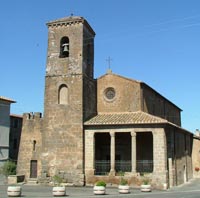
Vasanello is a comune (municipality) in the Province of Viterbo in the Italian region Lazio, located about 80 kilometres (50 mi) north of GRA (Rome) and about 27 kilometres (17 mi) east of Viterbo.Wiki
Popular routes to Vasanello
Popular routes from Vasanello
- Vignanello,
- Vallerano,
- Bassano In Teverina,
- Corchiano,
- Orte,
- Canepina,
- Fabrica Di Roma,
- Bomarzo,
- Gallese,
- Soriano Nel Cimino,
- Carbognano,
- Otricoli,
- Attigliano,
- Magliano Sabina,
- Vitorchiano,
- Caprarola,
- Graffignano,
- Ronciglione,
- Calvi dell'Umbria,
- Castel Sant' Elia
Places Near Vasanello
- Santa Maria Maggiore, Roma,
- IDI (Dermopatico Dell'Immacolata Institute), Roma,
- Tiber Island, Roma,
- Cristo Re Hospital, Roma,
- Gemelli Polyclinic, Roma,
- The Wow Side, Fiumicino,
- Roma Est Shopping Center, Roma,
- Trastevere Quarter, Roma,
- Scuderie Del Quirinale, Roma,
- Olympic Stadium, Rome, Roma,
- Tor Vergata, Roma,
- Coppedè Quarter, Roma,
- Casilino Polyclinic, Roma,
- The Sail, Roma,
- Paths, Roma,
- Sandro Pertini Hospital, Roma,
- Termini Station, Roma,
- Auditorium Music Park, Roma,
- Gravity, Roma,
- Villa Borghese, Roma
How to get to popular places in Rome and Lazio with public transit
Get around Rome and Lazio by public transit!
Traveling around Rome and Lazio has never been so easy. See step by step directions as you travel to any attraction, street or major public transit station. View bus and train schedules, arrival times, service alerts and detailed routes on a map, so you know exactly how to get to anywhere in Rome and Lazio.
When traveling to any destination around Rome and Lazio use Moovit's Live Directions with Get Off Notifications to know exactly where and how far to walk, how long to wait for your line, and how many stops are left. Moovit will alert you when it's time to get off — no need to constantly re-check whether yours is the next stop.
Wondering how to use public transit in Rome and Lazio or how to pay for public transit in Rome and Lazio? Moovit public transit app can help you navigate your way with public transit easily, and at minimum cost. It includes public transit fees, ticket prices, and costs. Looking for a map of Rome and Lazio public transit lines? Moovit public transit app shows all public transit maps in Rome and Lazio with all Bus, Train, Metro, Light Rail, Ferry, Funicular and Gondola routes and stops on an interactive map.
Rome and Lazio has 7 transit type(s), including: Bus, Train, Metro, Light Rail, Ferry, Funicular and Gondola, operated by several transit agencies, including ATAC, Cotral, Trenitalia, Troiani Transportation Services, BIS, ATR Mobility, Tuscia, Shuttle, Seatour, Troiani Bus Lines, CSC Mobility, Terravision, ATRAL, Tambus and Sitbus