Directions to Ve Science (Lindenhurst) with public transportation
The following transit lines have routes that pass near Ve Science
 Bus: 10, 3, 4.
- Train: BABYLON BRANCH, MONTAUK BRANCH.
How to get to Ve Science by bus?
Click on the bus route to see step by step directions with maps, line arrival times and updated time schedules.
From Brentwood, NY, Brentwood
64 minFrom Woodbury Long Island, Woodbury
123 minFrom Baxter Pavillion @ Good Sam, West Islip
46 minFrom Paramount, Huntington
121 minFrom Crest Hollow Country Club, Woodbury
119 minFrom Good Samaritan Hospital Medical Center, West Islip
83 minFrom Plainview, NY, Plainview
135 minFrom Tanger Outlets, Deer Park
53 minFrom Tanger Outlets, Deer Park, Deer Park
55 minFrom East Meadow, NY, East Meadow
118 min
How to get to Ve Science by train?
Click on the train route to see step by step directions with maps, line arrival times and updated time schedules.
Bus stop near Ve Science in Lindenhurst
- E John St/Centre Ave, 14 min walk,VIEW
Bus lines to Ve Science in Lindenhurst
- 10, Amityville Rr,VIEW
What are the closest stations to Ve Science?
The closest stations to Ve Science are:
- Copiague is 1021 yards away, 12 min walk.
- E John St/Centre Ave is 1175 yards away, 14 min walk.
- Babylon is 4809 yards away, 57 min walk.
Which bus lines stop near Ve Science?
These bus lines stop near Ve Science: 10, 3, 4.
Which train line stops near Ve Science?
BABYLON BRANCH (Babylon)
What’s the nearest train station to Ve Science in Lindenhurst?
The nearest train station to Ve Science in Lindenhurst is Copiague. It’s a 12 min walk away.
What’s the nearest bus station to Ve Science in Lindenhurst?
The nearest bus station to Ve Science in Lindenhurst is E John St/Centre Ave. It’s a 14 min walk away.
What time is the first train to Ve Science in Lindenhurst?
The BABYLON BRANCH is the first train that goes to Ve Science in Lindenhurst. It stops nearby at 3:14 AM.
What time is the last train to Ve Science in Lindenhurst?
The BABYLON BRANCH is the last train that goes to Ve Science in Lindenhurst. It stops nearby at 4:00 AM.
What time is the first bus to Ve Science in Lindenhurst?
The 10 is the first bus that goes to Ve Science in Lindenhurst. It stops nearby at 5:22 AM.
What time is the last bus to Ve Science in Lindenhurst?
The 10 is the last bus that goes to Ve Science in Lindenhurst. It stops nearby at 10:34 PM.
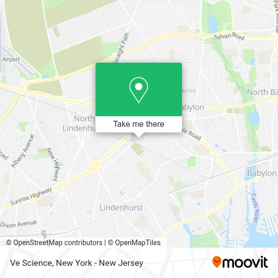
See Ve Science, Lindenhurst, on the map
Public Transit to Ve Science in Lindenhurst
Wondering how to get to Ve Science in Lindenhurst? Moovit helps you find the best way to get to Ve Science with step-by-step directions from the nearest public transit station.
Moovit provides free maps and live directions to help you navigate through your city. View schedules, routes, timetables, and find out how long does it take to get to Ve Science in real time.
Looking for the nearest stop or station to Ve Science? Check out this list of stops closest to your destination: Copiague; E John St/Centre Ave; Babylon.
Bus: 10, 3, 4.Train: BABYLON BRANCH, MONTAUK BRANCH.
Want to see if there’s another route that gets you there at an earlier time? Moovit helps you find alternative routes or times. Get directions from and directions to Ve Science easily from the Moovit App or Website.
We make riding to Ve Science easy, which is why over 1.5 million users, including users in Lindenhurst, trust Moovit as the best app for public transit. You don’t need to download an individual bus app or train app, Moovit is your all-in-one transit app that helps you find the best bus time or train time available.
For information on prices of bus and train, costs and ride fares to Ve Science, please check the Moovit app.
Use the app to navigate to popular places including to the airport, hospital, stadium, grocery store, mall, coffee shop, school, college, and university.
Ve Science Address: 690 N Queens Ave street in Lindenhurst
- One World Recycling, Inc : A Tunnel Hill Partner,
- Brothers Auto Glass,
- Longo Commercial Cabinets,
- The Lindenhurst Bubble,
- Top Quality Home Remodeling,
- La Furniture Store - NY,
- Phountain Water Filtration,
- Erlin Steel Of Long Island,
- Steven M. Levine, Md,
- Serge's Barber Shop,
- Northwell Health Physician Partners Family Medicine at Lindenhurst,
- Pep Boys Auto Service & Tires,
- Now Creative Design Agency,
- Tattoo Frenzy,
- South Shore Subaru,
- Century Building Materials,
- Century True Value,
- Sti Weigo,
- Revolution Kia,
- Li Ave Automotive Corp
Places Near Ve Science (Lindenhurst)
- Rockefeller Center, Manhattan,
- 376 Hudson Street, Manhattan,
- 26 Federal Plaza, Manhattan,
- 1 Police Plaza, Manhattan,
- Chinatown, Manhattan,
- Mountainside Hospital, Glen Ridge,
- Pier 83, Manhattan,
- SoHo, Manhattan,
- Hudson Yards, Manhattan,
- Queens Center Mall, Queens,
- Bellevue Hospital, Manhattan,
- 111 Centre New York City Supreme Court, Manhattan,
- qqqq, Manhattan,
- 3 Stone St, Manhattan,
- San Gennaro Feast, Manhattan,
- 911 Memorial, Manhattan,
- Times Square, Manhattan,
- 66 John Street, Manhattan,
- Katz's Deli, Manhattan,
- Wall Street, Manhattan
How to get to popular places in New York - New Jersey with public transit
Get around Lindenhurst by public transit!
Traveling around Lindenhurst has never been so easy. See step by step directions as you travel to any attraction, street or major public transit station. View bus and train schedules, arrival times, service alerts and detailed routes on a map, so you know exactly how to get to anywhere in Lindenhurst.
When traveling to any destination around Lindenhurst use Moovit's Live Directions with Get Off Notifications to know exactly where and how far to walk, how long to wait for your line, and how many stops are left. Moovit will alert you when it's time to get off — no need to constantly re-check whether yours is the next stop.
Wondering how to use public transit in Lindenhurst or how to pay for public transit in Lindenhurst? Moovit public transit app can help you navigate your way with public transit easily, and at minimum cost. It includes public transit fees, ticket prices, and costs. Looking for a map of Lindenhurst public transit lines? Moovit public transit app shows all public transit maps in Lindenhurst with all Bus, Train, Subway, Light Rail, Ferry and Cable Car routes and stops on an interactive map.
New York - New Jersey has 6 transit type(s), including: Bus, Train, Subway, Light Rail, Ferry and Cable Car, operated by several transit agencies, including MTA Subway, Metro-North Railroad, LIRR, PATH, MTA New York City Transit - Express routes, MTA Bus, NJ Transit, NYC Ferry, NICE bus, Bee-Line Bus, NJ Transit Rail, Norwalk Transit District, Hartford Line, River Valley Transit and HART