How to get to Velvet by bus?
Click on the bus route to see step by step directions with maps, line arrival times and updated time schedules.
From Talamantes Ponce, Aguascalientes
33 minFrom Residencial La Paloma, Aguascalientes
33 minFrom Jesús María, Aguascalientes
43 minFrom Clínica Santuario, Aguascalientes
45 minFrom Fracc. Los Pericos, Aguascalientes
29 minFrom Zona Centro, Aguascalientes
43 minFrom Mirador de las Culturas, Aguascalientes
33 minFrom Ruiseñores [Fraccionamiento], Aguascalientes
67 minFrom Avenida Vistas de Oriente, Aguascalientes
36 minFrom Fracc Rinconada Jesús María, Aguascalientes
69 min
Bus stops near Velvet in Aguascalientes
- Licenciado Adolfo López Mateos Oriente, 107, 1 min walk,VIEW
- Calle Cristobal Colon, 402, 3 min walk,VIEW
- Allende Oriente, 336, 4 min walk,VIEW
- Dr. Jesus Diaz De Leon, 111, 4 min walk,VIEW
- Centro (Rivero Y Gutiérrez), 5 min walk,VIEW
- Centro (Mercado Terán), 6 min walk,VIEW
- José María Morelos Y Pavón, 301, 7 min walk,VIEW
Bus lines to Velvet in Aguascalientes
- RUTA 23, Villa Montaña,VIEW
- RUTA 24, Vistas De Oriente - Los Negritos,VIEW
- RUTA 25, Las Palmas,VIEW
- RUTA 41, Terminal Oriente (Penal),VIEW
- RUTA 41, Terminal Oriente (Alameda),VIEW
- RUTA 39, Centro (Jardínde Zaragoza),VIEW
- RUTA 10, Uaa Sur,VIEW
- RUTA 03, La Ribera - UAA Sur,VIEW
- RUTA 04, Jesús María - Mahatma Gandhi,VIEW
- RUTA 05, Vicente Guerrero - La Ribera,VIEW
- RUTA 06, Jesús María - Mahatma Gandhi,VIEW
- RUTA 09, Cumbres III - Mahatma Gandhi,VIEW
- RUTA 09, Mahatma Gandhi - Los Laureles,VIEW
- RUTA 11, Mahatma Gandhi - Chichimeco,VIEW
- RUTA 12, Vicente Guerrero - Lunaria,VIEW
- RUTA 34, Villa Montaña - UPA,VIEW
- RUTA 37, UTMA - Hacienda San Marcos,VIEW
- RUTA 38, Vicente Guerrero - Paso Blanco,VIEW
- RUTA 43, UTMA - Lomas de New York - San Antonio,VIEW
- RUTA 43, San Antonio - UTMA,VIEW
What are the closest stations to Velvet?
The closest stations to Velvet are:
- Licenciado Adolfo López Mateos Oriente, 107 is 49 meters away, 1 min walk.
- Calle Cristobal Colon, 402 is 166 meters away, 3 min walk.
- Allende Oriente, 336 is 286 meters away, 4 min walk.
- Dr. Jesus Diaz De Leon, 111 is 301 meters away, 4 min walk.
- Centro (Rivero Y Gutiérrez) is 327 meters away, 5 min walk.
- Centro (Mercado Terán) is 401 meters away, 6 min walk.
- José María Morelos Y Pavón, 301 is 516 meters away, 7 min walk.
Which bus lines stop near Velvet?
These bus lines stop near Velvet: RUTA 04, RUTA 10, RUTA 11, RUTA 16, RUTA 38, RUTA 39.
What’s the nearest bus station to Velvet in Aguascalientes?
The nearest bus station to Velvet in Aguascalientes is Licenciado Adolfo López Mateos Oriente, 107. It’s a 1 min walk away.
What time is the first bus to Velvet in Aguascalientes?
The RUTA 41 is the first bus that goes to Velvet in Aguascalientes. It stops nearby at 5:54 AM.
What time is the last bus to Velvet in Aguascalientes?
The RUTA 07 is the last bus that goes to Velvet in Aguascalientes. It stops nearby at 10:46 PM.
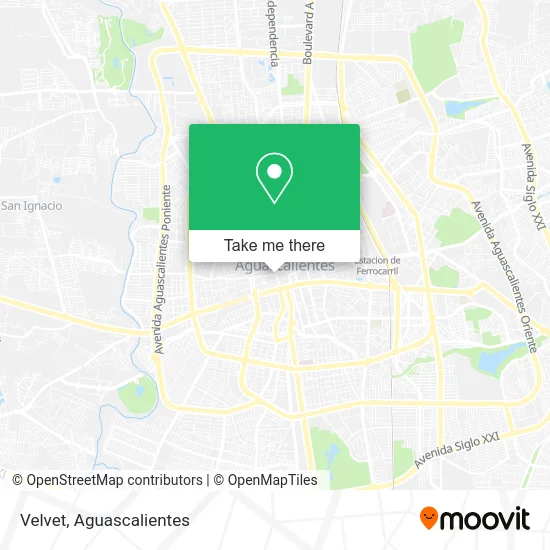
See Velvet, Aguascalientes, on the map
Public Transit to Velvet in Aguascalientes
Wondering how to get to Velvet in Aguascalientes? Moovit helps you find the best way to get to Velvet with step-by-step directions from the nearest public transit station.
Moovit provides free maps and live directions to help you navigate through your city. View schedules, routes, timetables, and find out how long does it take to get to Velvet in real time.
Looking for the nearest stop or station to Velvet? Check out this list of stops closest to your destination: Licenciado Adolfo López Mateos Oriente; Calle Cristobal Colon; Allende Oriente; Dr. Jesus Diaz De Leon; Centro (Rivero Y Gutiérrez); Centro (Mercado Terán); José María Morelos Y Pavón.
Bus: RUTA 04, RUTA 10, RUTA 11, RUTA 16, RUTA 38, RUTA 39, RUTA 23, RUTA 24, RUTA 25, RUTA 41, RUTA 41, RUTA 03, RUTA 05, RUTA 06, RUTA 09, RUTA 08, RUTA 19, RUTA 27, RUTA 28, RUTA 36.
Want to see if there’s another route that gets you there at an earlier time? Moovit helps you find alternative routes or times. Get directions from and directions to Velvet easily from the Moovit App or Website.
We make riding to Velvet easy, which is why over 1.5 million users, including users in Aguascalientes, trust Moovit as the best app for public transit. You don’t need to download an individual bus app or train app, Moovit is your all-in-one transit app that helps you find the best bus time or train time available.
For information on prices of bus, costs and ride fares to Velvet, please check the Moovit app.
Use the app to navigate to popular places including to the airport, hospital, stadium, grocery store, mall, coffee shop, school, college, and university.
Velvet Address: Avenida Venustiano Carranza 100, Aguascalientes Centro, 20000 Aguascalientes, Aguascalientes street in Aguascalientes
- El Ropero de Estefania,
- Umma Gumma,
- Grupo Teatral La Columna de Aguascalientes Oficial,
- Alt Rock Pub,
- Cajero Automático Bbva Bancomer,
- Venustiano Carranza 101,
- Escuela de Música,
- Iglesia Ave María,
- Casa de la Cultura Víctor Sandoval,
- Adoración Nocturna de Aguascalientes Templo Expiatorio Ave María,
- Calle Galeana Norte 112,
- Rocka Perforaciones,
- Scorpions Fitness Inc,
- Angel,
- La Boheme Apéritif,
- Banksy Café,
- Dragoncito, ags,
- Terraza Mediterránea Ags,
- Deshilados de Aguascalientes,
- Apperitti Restaurante
Places Near Velvet (Aguascalientes)
- Aeropuerto de Aguascalientes S.A. de C.V., Aguascalientes,
- Villasuncion, Aguascalientes,
- Blvd. Luis Donaldo Colosio, Aguascalientes,
- Parque Las Tres Centurias, Aguascalientes,
- Imss Clinica 1, Aguascalientes,
- Terminal De Combis, Aguascalientes,
- Nuevo Hospital Hidalgo, Aguascalientes,
- Hospital Imss No. 3, Aguascalientes,
- ESPACIOS, Aguascalientes,
- La Isla San Marcos, Aguascalientes,
- Universidad Autónoma de Aguascalientes, Aguascalientes,
- Central De Autobuses, Aguascalientes,
- Centro, Aguascalientes,
- Villas de Nuestra Señora de la Asunción, Aguascalientes,
- clinica 3 uaa, Aguascalientes,
- Isla San Marcos, Aguascalientes,
- Ciudad industrial, Aguascalientes,
- Agropecuario, Aguascalientes,
- Centro Comercial Altaria, Aguascalientes,
- Jesús María, Aguascalientes
How to get to popular places in Aguascalientes with public transit
Get around Aguascalientes by public transit!
Traveling around Aguascalientes has never been so easy. See step by step directions as you travel to any attraction, street or major public transit station. View bus and train schedules, arrival times, service alerts and detailed routes on a map, so you know exactly how to get to anywhere in Aguascalientes.
When traveling to any destination around Aguascalientes use Moovit's Live Directions with Get Off Notifications to know exactly where and how far to walk, how long to wait for your line, and how many stops are left. Moovit will alert you when it's time to get off — no need to constantly re-check whether yours is the next stop.
Wondering how to use public transit in Aguascalientes or how to pay for public transit in Aguascalientes? Moovit public transit app can help you navigate your way with public transit easily, and at minimum cost. It includes public transit fees, ticket prices, and costs. Looking for a map of Aguascalientes public transit lines? Moovit public transit app shows all public transit maps in Aguascalientes with all bus routes and stops on an interactive map.
Aguascalientes has 1 transit type(s), including: bus, operated by several transit agencies, including Coordinación General de Movilidad