How to get to Venta de Flores Naturales by bus?
Click on the bus route to see step by step directions with maps, line arrival times and updated time schedules.
From El Papa, Aguascalientes
35 minFrom Colonia Fatima, Aguascalientes
53 minFrom Dunkin' Donuts, Aguascalientes
57 minFrom El Cobano, Aguascalientes
42 minFrom Embotelladora Coca-Cola, Aguascalientes
61 minFrom Av Siglo XXI, Aguascalientes
50 minFrom La Aurora Residencial, Aguascalientes
79 minFrom Auditorio Silvia Luna Rodríguez, Aguascalientes
38 minFrom Universidad Del Valle De Mexico, Aguascalientes
54 minFrom Condominio Loretta, Aguascalientes
70 min
Bus stops near Venta de Flores Naturales in Aguascalientes
Bus lines to Venta de Flores Naturales in Aguascalientes
What are the closest stations to Venta de Flores Naturales?
The closest stations to Venta de Flores Naturales are:
- Avenida Poliducto, 230 is 214 meters away, 3 min walk.
- Avenida Siglo Xxi, 1502a is 611 meters away, 8 min walk.
Which bus lines stop near Venta de Flores Naturales?
These bus lines stop near Venta de Flores Naturales: RUTA 07, RUTA 35, RUTA 50.
What’s the nearest bus station to Venta de Flores Naturales in Aguascalientes?
The nearest bus station to Venta de Flores Naturales in Aguascalientes is Avenida Poliducto, 230. It’s a 3 min walk away.
What time is the first bus to Venta de Flores Naturales in Aguascalientes?
The RUTA 07 is the first bus that goes to Venta de Flores Naturales in Aguascalientes. It stops nearby at 5:56 AM.
What time is the last bus to Venta de Flores Naturales in Aguascalientes?
The RUTA 07 is the last bus that goes to Venta de Flores Naturales in Aguascalientes. It stops nearby at 11:09 PM.
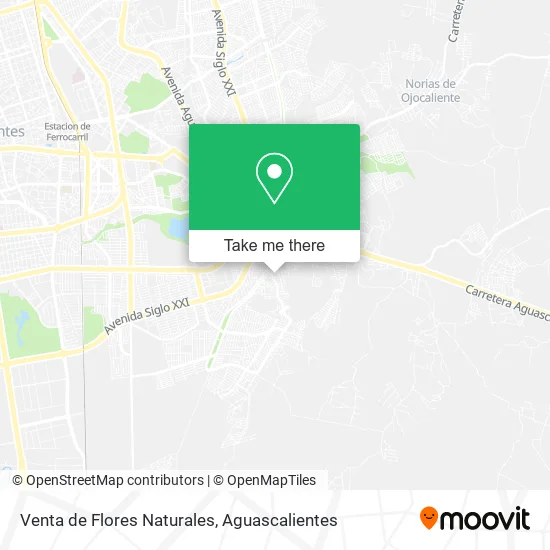
See Venta de Flores Naturales, Aguascalientes, on the map
Public Transit to Venta de Flores Naturales in Aguascalientes
Wondering how to get to Venta de Flores Naturales in Aguascalientes? Moovit helps you find the best way to get to Venta de Flores Naturales with step-by-step directions from the nearest public transit station.
Moovit provides free maps and live directions to help you navigate through your city. View schedules, routes, timetables, and find out how long does it take to get to Venta de Flores Naturales in real time.
Looking for the nearest stop or station to Venta de Flores Naturales? Check out this list of stops closest to your destination: Avenida Poliducto; Avenida Siglo Xxi.
Bus: RUTA 07, RUTA 35, RUTA 50, RUTA 12, RUTA 02, RUTA 42.
Want to see if there’s another route that gets you there at an earlier time? Moovit helps you find alternative routes or times. Get directions from and directions to Venta de Flores Naturales easily from the Moovit App or Website.
We make riding to Venta de Flores Naturales easy, which is why over 1.5 million users, including users in Aguascalientes, trust Moovit as the best app for public transit. You don’t need to download an individual bus app or train app, Moovit is your all-in-one transit app that helps you find the best bus time or train time available.
For information on prices of bus, costs and ride fares to Venta de Flores Naturales, please check the Moovit app.
Use the app to navigate to popular places including to the airport, hospital, stadium, grocery store, mall, coffee shop, school, college, and university.
Venta de Flores Naturales Address: Calle Acocote, Fraccionamiento Lomas del Chapulín, 20263 Aguascalientes, Aguascalientes street in Aguascalientes
- Artículos de Limpieza,
- Funerales Aguascalientes,
- Lomas del Gachupín,
- Club de Carmelita,
- Fraccionamiento Lomas del Chapulín,
- Papeleria Heydi,
- Calle Arroyo,
- Venta de Antojitos Mexicanos,
- Préstamo Seguro Sucursal Lomas del Chapulin,
- Tacos de Guisadfo El Corazón del Mar,
- Helados Helaty,
- Lomas del Chapulín,
- WESTERN UNION,
- Notaría Pública 63 Aguascalientes,
- Novedades Yadira,
- Lote de Carros Gascarts,
- Carnitas La Family,
- Dulcería Desechables G y G,
- Distribuidora de Gas Noel Lp 21082 Exp es 2018,
- Bazar de Ropa Americana
Places Near Venta de Flores Naturales (Aguascalientes)
- Hospital Imss No. 3, Aguascalientes,
- La Isla San Marcos, Aguascalientes,
- Imss Clinica 1, Aguascalientes,
- Jesús María, Aguascalientes,
- Ciudad industrial, Aguascalientes,
- Parque Las Tres Centurias, Aguascalientes,
- Blvd. Luis Donaldo Colosio, Aguascalientes,
- Isla San Marcos, Aguascalientes,
- Centro, Aguascalientes,
- Villas de Nuestra Señora de la Asunción, Aguascalientes,
- clinica 3 uaa, Aguascalientes,
- ESPACIOS, Aguascalientes,
- Aeropuerto de Aguascalientes S.A. de C.V., Aguascalientes,
- Universidad Autónoma de Aguascalientes, Aguascalientes,
- Villasuncion, Aguascalientes,
- Agropecuario, Aguascalientes,
- Centro Comercial Altaria, Aguascalientes,
- Central De Autobuses, Aguascalientes,
- Terminal De Combis, Aguascalientes,
- Nuevo Hospital Hidalgo, Aguascalientes
How to get to popular places in Aguascalientes with public transit
Get around Aguascalientes by public transit!
Traveling around Aguascalientes has never been so easy. See step by step directions as you travel to any attraction, street or major public transit station. View bus and train schedules, arrival times, service alerts and detailed routes on a map, so you know exactly how to get to anywhere in Aguascalientes.
When traveling to any destination around Aguascalientes use Moovit's Live Directions with Get Off Notifications to know exactly where and how far to walk, how long to wait for your line, and how many stops are left. Moovit will alert you when it's time to get off — no need to constantly re-check whether yours is the next stop.
Wondering how to use public transit in Aguascalientes or how to pay for public transit in Aguascalientes? Moovit public transit app can help you navigate your way with public transit easily, and at minimum cost. It includes public transit fees, ticket prices, and costs. Looking for a map of Aguascalientes public transit lines? Moovit public transit app shows all public transit maps in Aguascalientes with all bus routes and stops on an interactive map.
Aguascalientes has 1 transit type(s), including: bus, operated by several transit agencies, including Coordinación General de Movilidad