Directions to Verde Oliva (Bacacheri) with public transportation
The following transit lines have routes that pass near Verde Oliva
How to get to Verde Oliva by bus?
Click on the bus route to see step by step directions with maps, line arrival times and updated time schedules.
From Portão, Portão
47 minFrom Praça Da Ucrânia, Bigorrilho
36 minFrom Rua Professor Pedro Viriato Parigot de Souza, Campo Comprido
58 minFrom Rua Conde de São João das Duas Barras, Boqueirão
55 minFrom Rua Luiz Parigot de Souza, Portão
49 minFrom Rua Alferes Angelo Sampaio, Batel
39 minFrom Rua Carlos de Carvalho 1286, Batel
36 minFrom Shopping Pátio Batel, Batel
43 minFrom Rua Professora Maria De Assumpção, Boqueirão
55 minFrom Rua Deputado Heitor Alencar Furtado, Mossunguê
47 min
Bus stops near Verde Oliva in Bacacheri
Bus lines to Verde Oliva in Bacacheri
- S01 ROÇA GRANDE / GUADALUPE (VIA SANTA CÂNDIDA), ROÇA GRANDE / GUADALUPE (VIA SANTA CÂNDIDA),VIEW
- B72 COLOMBO / GUADALUPE (VIA T. ROÇA GRANDE), COLOMBO / GUADALUPE (via T. ROÇA GRANDE),VIEW
- B73 JARDIM OSASCO / GUADALUPE, JARDIM OSASCO / GUADALUPE,VIEW
- B76 SÃO SEBASTIÃO / GUADALUPE, SÃO SEBASTIÃO / GUADALUPE,VIEW
- B78 SÃO GABRIEL / GUADALUPE, SÃO GABRIEL / GUADALUPE,VIEW
- S89 SÃO SEBASTIÃO / GUADALUPE (VIA SÃO GABRIEL), SÃO SEBASTIÃO / GUADALUPE (via SÃO GABRIEL),VIEW
- B20 GUARAITUBA / CABRAL (VIA MARACANÃ), GUARAITUBA / CABRAL (via MARACANÃ),VIEW
- N61 CAMPINA GRANDE DO SUL / GUADALUPE, CAMPINA GRANDE DO SUL / GUADALUPE,VIEW
- N62 JARDIM PAULISTA / GUADALUPE, JARDIM PAULISTA / GUADALUPE,VIEW
- O62 QUATRO BARRAS / GUADALUPE (VIA ESTAÇÃO ATUBA), QUATRO BARRAS / GUADALUPE (via ESTAÇÃO ATUBA),VIEW
- B69 MAD. CURITIBA / SÃO DIMAS, MAD. CURITIBA / SÃO DIMAS,VIEW
- C72 VILA PALMITAL / GUADALUPE (VIA ESTAÇÃO ATUBA), VILA PALMITAL / GUADALUPE (via ESTAÇÃO ATUBA),VIEW
- N72 EUGÊNIA MARIA / GUADALUPE, EUGÊNIA MARIA / GUADALUPE,VIEW
- O74 QUATRO BARRAS / GUADALUPE, QUATRO BARRAS / GUADALUPE,VIEW
- B89 GUARAITUBA / RUI BARBOSA (VIA MARACANÃ / CABRAL), GUARAITUBA / RUI BARBOSA (via MARACANÃ / CABRAL),VIEW
- Y99 TUNAS DO PARANÁ / GUADALUPE, TUNAS DO PARANÁ / GUADALUPE,VIEW
- 212 SOLAR, SOLAR,VIEW
- 213 SÃO JOÃO, SÃO JOÃO,VIEW
- 214 TINGUI, TINGUI,VIEW
- 211 COLINA VERDE, Colina Verde → Terminal Cabral,VIEW
What are the closest stations to Verde Oliva?
The closest stations to Verde Oliva are:
- R. Canadá, 600 is 234 meters away, 4 min walk.
- R. Nicarágua, 820 (Cindacta II) is 236 meters away, 4 min walk.
- R. México, 37 is 272 meters away, 4 min walk.
- Holanda is 549 meters away, 7 min walk.
- Av. Paraná, 1692 is 562 meters away, 8 min walk.
Which bus lines stop near Verde Oliva?
These bus lines stop near Verde Oliva: 203 SANTA CÂNDIDA / CAPÃO RASO, 212 SOLAR, C72 VILA PALMITAL / GUADALUPE (VIA ESTAÇÃO ATUBA), N72 EUGÊNIA MARIA / GUADALUPE, O74 QUATRO BARRAS / GUADALUPE.
What’s the nearest bus station to Verde Oliva in Bacacheri?
The nearest bus stations to Verde Oliva in Bacacheri are R. Canadá, 600, R. Nicarágua, 820 (Cindacta II) and R. México, 37. The closest one is a 4 min walk away.
What time is the first bus to Verde Oliva in Bacacheri?
The 209 MAD. SANTA CÂNDIDA / CAPÃO RASO is the first bus that goes to Verde Oliva in Bacacheri. It stops nearby at 3:04 AM.
What time is the last bus to Verde Oliva in Bacacheri?
The 209 MAD. SANTA CÂNDIDA / CAPÃO RASO is the last bus that goes to Verde Oliva in Bacacheri. It stops nearby at 3:04 AM.
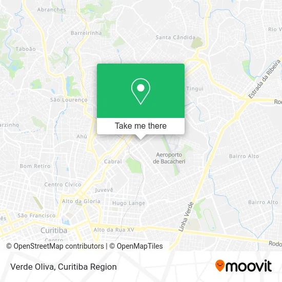
See Verde Oliva, Bacacheri, on the map
Public Transit to Verde Oliva in Bacacheri
Wondering how to get to Verde Oliva in Bacacheri? Moovit helps you find the best way to get to Verde Oliva with step-by-step directions from the nearest public transit station.
Moovit provides free maps and live directions to help you navigate through your city. View schedules, routes, timetables, and find out how long does it take to get to Verde Oliva in real time.
Looking for the nearest stop or station to Verde Oliva? Check out this list of stops closest to your destination: R. Canadá; R. Nicarágua; R. México; Holanda; Av. Paraná.
Bus: 203 SANTA CÂNDIDA / CAPÃO RASO, 212 SOLAR, C72 VILA PALMITAL / GUADALUPE (VIA ESTAÇÃO ATUBA), N72 EUGÊNIA MARIA / GUADALUPE, O74 QUATRO BARRAS / GUADALUPE, S01 ROÇA GRANDE / GUADALUPE (VIA SANTA CÂNDIDA), B72 COLOMBO / GUADALUPE (VIA T. ROÇA GRANDE), B73 JARDIM OSASCO / GUADALUPE, B76 SÃO SEBASTIÃO / GUADALUPE, B78 SÃO GABRIEL / GUADALUPE, B20 GUARAITUBA / CABRAL (VIA MARACANÃ), N61 CAMPINA GRANDE DO SUL / GUADALUPE, N62 JARDIM PAULISTA / GUADALUPE, O62 QUATRO BARRAS / GUADALUPE (VIA ESTAÇÃO ATUBA), B69 MAD. CURITIBA / SÃO DIMAS, 211 COLINA VERDE, 209 MAD. SANTA CÂNDIDA / CAPÃO RASO.
Want to see if there’s another route that gets you there at an earlier time? Moovit helps you find alternative routes or times. Get directions from and directions to Verde Oliva easily from the Moovit App or Website.
We make riding to Verde Oliva easy, which is why over 1.5 million users, including users in Bacacheri, trust Moovit as the best app for public transit. You don’t need to download an individual bus app or train app, Moovit is your all-in-one transit app that helps you find the best bus time or train time available.
For information on prices of bus, costs and ride fares to Verde Oliva, please check the Moovit app.
Use the app to navigate to popular places including to the airport, hospital, stadium, grocery store, mall, coffee shop, school, college, and university.
Verde Oliva Address: Rua Nicarágua, 623 Bacacheri Curitiba-PR 82510-170 street in Bacacheri
- Loja Verde Oliva,
- Habilitar Bacacheri: Centro de Avaliação de Condutores,
- Rua Nicarágua 560,
- Imove Studio de Treinamento,
- Consultório Odontológico Dr Yannes Patrial / Dra Vanessa Uhlmann,
- Itaú,
- Rua Holanda 202,
- Correios,
- CCV Chevrolet,
- Banco Santander Bacacheri,
- Sapataria e Chaveiro Vitória,
- Lyx Engenharia,
- Rua Nicarágua,
- Lavanderia Premium,
- Rua México & Avenida Prefeito Erasto Gaertner,
- Avenida Prefeito Erasto Gaertner 598,
- Ms Signore Comércio De Vestuário,
- Ótica Ponto De Visão - Bacacheri,
- Onibus Ctba/Quatro Barras,
- Corpo Da Guarda 20 BIB
Places Near Verde Oliva (Bacacheri)
- Hospital de Clínicas (HC - UFPR), Centro,
- Jockey Plaza Shopping Center, Tarumã,
- Hhhhh, Fazendinha,
- Shopping Palladium, Portão,
- Hospital Universitário Evangélico de Curitiba, Bigorrilho,
- Jardim Botânico de Curitiba PR, Centro,
- Arena Da Baixada - Curitiba,
- Parque Barigui, Mercês,
- Hospital Madalena Sofia, Bairro Alto,
- Hospital Da Cruz Vermelha, Batel,
- Hospital do Rocio, Campo,
- Pontifícia Universidade Católica do Paraná (PUCPR), Prado Velho,
- Hospital Nossa Senhora Das Graças, Mercês,
- Hospital Do Senhor - Madre Virgínia, São José Dos Pinhais,
- Shopping Estação, Rebouças,
- Rua General Mário Tourinho, Campina Do Siqueira,
- Hospital Erasto Gaertner, Jardim Das Américas,
- Hospital Angelina Caron, Campina Grande Do Sul,
- Rua Martim Afonso 558, Mercês,
- Park Shopping Barigüi, Mossunguê
How to get to popular places in Curitiba Region with public transit
Get around Bacacheri by public transit!
Traveling around Bacacheri has never been so easy. See step by step directions as you travel to any attraction, street or major public transit station. View bus and train schedules, arrival times, service alerts and detailed routes on a map, so you know exactly how to get to anywhere in Bacacheri.
When traveling to any destination around Bacacheri use Moovit's Live Directions with Get Off Notifications to know exactly where and how far to walk, how long to wait for your line, and how many stops are left. Moovit will alert you when it's time to get off — no need to constantly re-check whether yours is the next stop.
Wondering how to use public transit in Bacacheri or how to pay for public transit in Bacacheri? Moovit public transit app can help you navigate your way with public transit easily, and at minimum cost. It includes public transit fees, ticket prices, and costs. Looking for a map of Bacacheri public transit lines? Moovit public transit app shows all public transit maps in Bacacheri with all Bus and Cable Car routes and stops on an interactive map.
Curitiba Region has 2 transit type(s), including: Bus and Cable Car, operated by several transit agencies, including Sistema Integrado de Mobilidade (URBS), Sistema Integrado de Mobilidade (AMEP), URBS (Cartões bancários e Dinheiro), URBS (Cartões bancários / Cartão URBS), AMEP (Cartões bancários / Cartão MetroCard), AMEP (Cartões bancários / Cartão MetroCard / Dinheiro), Viação Colombo (Dinheiro), TRIAR (Cartão TRIAR / Dinheiro), Empresa Curitiba Cerro Azul (Dinheiro), Expresso Nossa Senhora da Penha (Dinheiro), Empresa Campo Alto Tijucas (Dinheiro), Auto Viação São José (Cartão VEM / Dinheiro), BRT S/A (Cartão VEM / Dinheiro), TransPiedade (Cartão Cidadão / Dinheiro) and Oceânica Sul (Cartão Transporte / Dinheiro)
Public transit lines with stations closest to Verde Oliva in Bacacheri
Bus lines with stations closest to Verde Oliva in Bacacheri
R. Canadá, 600
 S01 ROÇA GRANDE / GUADALUPE (VIA SANTA CÂNDIDA)ROÇA GRANDE / GUADALUPE (VIA SANTA CÂNDIDA)
- B72 COLOMBO / GUADALUPE (VIA T. ROÇA GRANDE)COLOMBO / GUADALUPE (via T. ROÇA GRANDE)
- B73 JARDIM OSASCO / GUADALUPEJARDIM OSASCO / GUADALUPE
- B76 SÃO SEBASTIÃO / GUADALUPESÃO SEBASTIÃO / GUADALUPE
- B78 SÃO GABRIEL / GUADALUPESÃO GABRIEL / GUADALUPE
R. Nicarágua, 820 (Cindacta II)
- B20 GUARAITUBA / CABRAL (VIA MARACANÃ)GUARAITUBA / CABRAL (via MARACANÃ)
- N61 CAMPINA GRANDE DO SUL / GUADALUPECAMPINA GRANDE DO SUL / GUADALUPE
- N62 JARDIM PAULISTA / GUADALUPEJARDIM PAULISTA / GUADALUPE
- O62 QUATRO BARRAS / GUADALUPE (VIA ESTAÇÃO ATUBA)QUATRO BARRAS / GUADALUPE (via ESTAÇÃO ATUBA)
- B69 MAD. CURITIBA / SÃO DIMASMAD. CURITIBA / SÃO DIMAS