How to get to Verizon Wireless by bus?
Click on the bus route to see step by step directions with maps, line arrival times and updated time schedules.
From The Capital Wheel at the National Harbor, Prince George's County
70 minFrom Long Bridge Aquatics & Fitness Center, Arlington County
67 minFrom Hyatt Regency Crystal City at Reagan National Airport, Arlington County
62 minFrom Franconia-Springfield Metro Station, Fairfax County
38 minFrom Shirlington, Arlington County
40 minFrom US Marine Corps War Memorial (Iwo Jima), Arlington County
60 minFrom Naval Research Lab, Washington
103 minFrom Bolling AFB, Washington
176 minFrom Arlington County Courthouse, Arlington County
68 minFrom Joint Base Myer – Henderson Hall (JBMHH) | Fort Myer area, Arlington County
66 min
How to get to Verizon Wireless by metro?
Click on the metro route to see step by step directions with maps, line arrival times and updated time schedules.
From Long Bridge Aquatics & Fitness Center, Arlington County
70 minFrom Hyatt Regency Crystal City at Reagan National Airport, Arlington County
61 minFrom Franconia-Springfield Metro Station, Fairfax County
37 minFrom US Marine Corps War Memorial (Iwo Jima), Arlington County
65 minFrom Arlington County Courthouse, Arlington County
65 min
Bus stops near Verizon Wireless in Alexandria
Metro station near Verizon Wireless in Alexandria
- Van Dorn Street Metro Station, 63 min walk,VIEW
Bus lines to Verizon Wireless in Alexandria
What are the closest stations to Verizon Wireless?
The closest stations to Verizon Wireless are:
- 101 S Van Dorn St is 58 yards away, 1 min walk.
- Hecht Av+Bay E is 842 yards away, 11 min walk.
- Van Dorn Street Metro Station is 5330 yards away, 63 min walk.
Which bus lines stop near Verizon Wireless?
These bus lines stop near Verizon Wireless: 30, 35, A27, A29.
Which metro line stops near Verizon Wireless?
BLUE (Franconia-Springfield)
What’s the nearest bus station to Verizon Wireless in Alexandria?
The nearest bus station to Verizon Wireless in Alexandria is 101 S Van Dorn St. It’s a 1 min walk away.
What time is the first metro to Verizon Wireless in Alexandria?
The BLUE is the first metro that goes to Verizon Wireless in Alexandria. It stops nearby at 5:05 AM.
What time is the last metro to Verizon Wireless in Alexandria?
The BLUE is the last metro that goes to Verizon Wireless in Alexandria. It stops nearby at 12:39 AM.
What time is the first bus to Verizon Wireless in Alexandria?
The 35 is the first bus that goes to Verizon Wireless in Alexandria. It stops nearby at 4:30 AM.
What time is the last bus to Verizon Wireless in Alexandria?
The 35 is the last bus that goes to Verizon Wireless in Alexandria. It stops nearby at 2:54 AM.
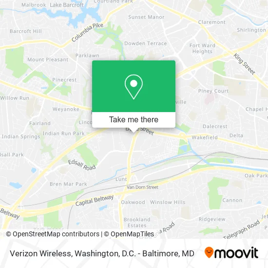
See Verizon Wireless, Alexandria, on the map
Public Transit to Verizon Wireless in Alexandria
Wondering how to get to Verizon Wireless in Alexandria? Moovit helps you find the best way to get to Verizon Wireless with step-by-step directions from the nearest public transit station.
Moovit provides free maps and live directions to help you navigate through your city. View schedules, routes, timetables, and find out how long does it take to get to Verizon Wireless in real time.
Looking for the nearest stop or station to Verizon Wireless? Check out this list of stops closest to your destination: 101 S Van Dorn St; Hecht Av+Bay E; Van Dorn Street Metro Station.
Bus: 30, 35, A27, A29, A28, F23, F24.Metro: BLUE.
Want to see if there’s another route that gets you there at an earlier time? Moovit helps you find alternative routes or times. Get directions from and directions to Verizon Wireless easily from the Moovit App or Website.
We make riding to Verizon Wireless easy, which is why over 1.5 million users, including users in Alexandria, trust Moovit as the best app for public transit. You don’t need to download an individual bus app or train app, Moovit is your all-in-one transit app that helps you find the best bus time or train time available.
For information on prices of bus and metro, costs and ride fares to Verizon Wireless, please check the Moovit app.
Use the app to navigate to popular places including to the airport, hospital, stadium, grocery store, mall, coffee shop, school, college, and university.
Verizon Wireless Address: 101 S Van Dorn St street in Alexandria
- AT&T,
- Meineke Car Care Center,
- 9round,
- BJ's Wholesale Club,
- TACO BELL,
- Passport MINI,
- Van Dorn Plaza,
- Bradzy's Place,
- Shahs Halal Food,
- unleashed by PETCO,
- Wiggley Field Dog Park,
- Certified Auto Glass Replacement Glass Auto,
- ABC Sports Complex,
- Best Buy,
- Caring Hands,
- Mason at van Dorn Apartments,
- Entrata, Inc.,
- Arlington-VA Chapter of the links,
- Elizabeth Arden Red Door Spas,
- WESTERN UNION
Places Near Verizon Wireless (Alexandria)
- Warner Theatre, Washington,
- Marriott Marquis Washington, DC, Washington,
- Basilica of the National Shrine, Washington,
- The Anthem, Washington,
- Pennsylvania Ave NW (3rd st and pennsylvania), Washington,
- Amazon Hq2, Arlington County,
- National Museum of African American History and Culture, Washington,
- Rock Creek Tennis Center, Washington,
- M&T Bank Stadium, Baltimore,
- Capital One Arena, Washington,
- Camden Yards, Baltimore,
- National Theatre, Washington,
- Westfield Montgomery Mall, Montgomery County,
- Washington National Cathedral, Washington,
- PG Mall, Prince George's County,
- Museum Of The Bible, Washington,
- Sibley Memorial Hospital, Washington,
- Georgetown, Washington,
- Washington DC VA Medical Center, Washington,
- National Zoo, Washington
How to get to popular places in Washington, D.C. - Baltimore, MD with public transit
Get around Alexandria by public transit!
Traveling around Alexandria has never been so easy. See step by step directions as you travel to any attraction, street or major public transit station. View bus and train schedules, arrival times, service alerts and detailed routes on a map, so you know exactly how to get to anywhere in Alexandria.
When traveling to any destination around Alexandria use Moovit's Live Directions with Get Off Notifications to know exactly where and how far to walk, how long to wait for your line, and how many stops are left. Moovit will alert you when it's time to get off — no need to constantly re-check whether yours is the next stop.
Wondering how to use public transit in Alexandria or how to pay for public transit in Alexandria? Moovit public transit app can help you navigate your way with public transit easily, and at minimum cost. It includes public transit fees, ticket prices, and costs. Looking for a map of Alexandria public transit lines? Moovit public transit app shows all public transit maps in Alexandria with all Bus, Train, Metro, Light Rail and Ferry routes and stops on an interactive map.
Washington, D.C. - Baltimore, MD has 5 transit type(s), including: Bus, Train, Metro, Light Rail and Ferry, operated by several transit agencies, including WMATA, Montgomery County Ride On, Fairfax Connector, TheBus, PRTC, DASH - Alexandria, Arlington Transit (ART), RTA of Central Maryland, MDOT MTA, MDOT MTA Light RailLink, MDOT MTA Commuter Bus, MDOT MTA Local Bus, FXBGO!, Virginia Railway Express (VRE) and MARC