How to get to Verizon Wireless by bus?
Click on the bus route to see step by step directions with maps, line arrival times and updated time schedules.
Bus stops near Verizon Wireless in Roanoke County
Bus lines to Verizon Wireless in Roanoke County
What are the closest stations to Verizon Wireless?
The closest stations to Verizon Wireless are:
- Hershberger Wb at Friends (Friendship Manor) is 422 yards away, 6 min walk.
- Hershberger Eb at Bluebell (Friendship Manor) is 583 yards away, 8 min walk.
Which bus line stops near Verizon Wireless?
25 (25 - Third Street Station To Airport)
What’s the nearest bus station to Verizon Wireless in Roanoke County?
The nearest bus station to Verizon Wireless in Roanoke County is Hershberger Wb at Friends (Friendship Manor). It’s a 6 min walk away.
What time is the first bus to Verizon Wireless in Roanoke County?
The 26 is the first bus that goes to Verizon Wireless in Roanoke County. It stops nearby at 5:51 AM.
What time is the last bus to Verizon Wireless in Roanoke County?
The 25 is the last bus that goes to Verizon Wireless in Roanoke County. It stops nearby at 8:32 PM.
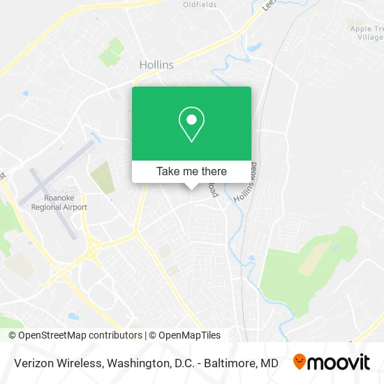
See Verizon Wireless, Roanoke County, on the map
Public Transit to Verizon Wireless in Roanoke County
Wondering how to get to Verizon Wireless in Roanoke County? Moovit helps you find the best way to get to Verizon Wireless with step-by-step directions from the nearest public transit station.
Moovit provides free maps and live directions to help you navigate through your city. View schedules, routes, timetables, and find out how long does it take to get to Verizon Wireless in real time.
Looking for the nearest stop or station to Verizon Wireless? Check out this list of stops closest to your destination: Hershberger Wb at Friends (Friendship Manor); Hershberger Eb at Bluebell (Friendship Manor).
Bus: 25, 26.
Want to see if there’s another route that gets you there at an earlier time? Moovit helps you find alternative routes or times. Get directions from and directions to Verizon Wireless easily from the Moovit App or Website.
We make riding to Verizon Wireless easy, which is why over 1.7 million users, including users in Roanoke County, trust Moovit as the best app for public transit. You don’t need to download an individual bus app or train app, Moovit is your all-in-one transit app that helps you find the best bus time or train time available.
For information on prices of bus and train, costs and ride fares to Verizon Wireless, please check the Moovit app.
Use the app to navigate to popular places including to the airport, hospital, stadium, grocery store, mall, coffee shop, school, college, and university.
Verizon Wireless Address: 4843 Oakland Blvd Roanoke, VA 24012 street in Roanoke County
- Stbo Dispatch Services,
- Safety & Compliance Services,
- Woodson, RB,
- Honeytree Aquatic Center,
- Hollow Creek Swim Club,
- Acknowledge It LC,
- Fresenius Kidney Care Friendship Manor,
- Roanoke County Station #1,
- Friendship Health and Rehab North West Wing Cafe,
- Friendship Outpatnt & Wellness Services,
- Friendship Manor,
- Fresenius Kidney Care,
- Fresenius Medical Care,
- Vista Heights,
- Edinburgh Square,
- AAA Plumbing Repair Service,
- Friendship Retirement Community,
- Club Friendship,
- Friendship Pharmacy,
- Church of the Brethren District Office
Places Near Verizon Wireless (Roanoke County)
- Warner Theatre, Washington,
- Rock Creek Tennis Center, Washington,
- National Zoo, Washington,
- Washington DC VA Medical Center, Washington,
- Marriott Marquis Washington, DC, Washington,
- Basilica of the National Shrine, Washington,
- Capital One Arena, Washington,
- Museum Of The Bible, Washington,
- Pennsylvania Ave NW (3rd st and pennsylvania), Washington,
- Georgetown, Washington,
- The Anthem, Washington,
- M&T Bank Stadium, Baltimore,
- Camden Yards, Baltimore,
- PG Mall, Prince George's County,
- National Museum of African American History and Culture, Washington,
- Sibley Memorial Hospital, Washington,
- Washington National Cathedral, Washington,
- Amazon Hq2, Arlington County,
- National Theatre, Washington,
- Westfield Montgomery Mall, Montgomery County
How to get to popular places in Washington, D.C. - Baltimore, MD with public transit
Get around Roanoke County by public transit!
Traveling around Roanoke County has never been so easy. See step by step directions as you travel to any attraction, street or major public transit station. View bus and train schedules, arrival times, service alerts and detailed routes on a map, so you know exactly how to get to anywhere in Roanoke County.
When traveling to any destination around Roanoke County use Moovit's Live Directions with Get Off Notifications to know exactly where and how far to walk, how long to wait for your line, and how many stops are left. Moovit will alert you when it's time to get off — no need to constantly re-check whether yours is the next stop.
Wondering how to use public transit in Roanoke County or how to pay for public transit in Roanoke County? Moovit public transit app can help you navigate your way with public transit easily, and at minimum cost. It includes public transit fees, ticket prices, and costs. Looking for a map of Roanoke County public transit lines? Moovit public transit app shows all public transit maps in Roanoke County with all Bus, Train, Metro, Light Rail and Ferry routes and stops on an interactive map.
Washington, D.C. - Baltimore, MD has 5 transit type(s), including: Bus, Train, Metro, Light Rail and Ferry, operated by several transit agencies, including WMATA, Montgomery County Ride On, Fairfax Connector, TheBus, PRTC, DASH - Alexandria, Arlington Transit (ART), RTA of Central Maryland, MDOT MTA, MDOT MTA Light RailLink, MDOT MTA Commuter Bus, MDOT MTA Local Bus, FXBGO!, Virginia Railway Express (VRE) and MARC