How to get to Vfb Clearing-Point by bus?
Click on the bus route to see step by step directions with maps, line arrival times and updated time schedules.
From Freie Evangelische Schule Stuttgart (Freie Evangelische Schule Stuttgart e.V.), Möhringen
176 minFrom Vöhringer's Flat Rate Puff, Weilimdorf
67 minFrom Bordell, Weilimdorf
58 minFrom STAGE Apollo Theater, Möhringen
100 minFrom SI-Suites, Möhringen
100 minFrom Johannesstraße / Schloßstraße, Stuttgart-West
35 minFrom Berkheim, Esslingen Am Neckar
82 minFrom Stuttgarter Kickers, Degerloch
104 minFrom Strümpfelbach, Weinstadt
111 minFrom Adalbert-Stifter-Straße, Stuttgart
68 min
How to get to Vfb Clearing-Point by train?
Click on the train route to see step by step directions with maps, line arrival times and updated time schedules.
How to get to Vfb Clearing-Point by subway?
Click on the subway route to see step by step directions with maps, line arrival times and updated time schedules.
From Freie Evangelische Schule Stuttgart (Freie Evangelische Schule Stuttgart e.V.), Möhringen
71 minFrom Vöhringer's Flat Rate Puff, Weilimdorf
69 minFrom Bordell, Weilimdorf
66 minFrom STAGE Apollo Theater, Möhringen
61 minFrom SI-Suites, Möhringen
66 minFrom Johannesstraße / Schloßstraße, Stuttgart-West
33 minFrom Berkheim, Esslingen Am Neckar
83 minFrom Stuttgarter Kickers, Degerloch
49 minFrom Adalbert-Stifter-Straße, Stuttgart
71 min
Bus stops near Vfb Clearing-Point in Bad Cannstatt
Subway stations near Vfb Clearing-Point in Bad Cannstatt
Light Rail stations near Vfb Clearing-Point in Bad Cannstatt
S-Bahn station near Vfb Clearing-Point in Bad Cannstatt
- Neckarpark, 13 min walk,VIEW
Bus lines to Vfb Clearing-Point in Bad Cannstatt
What are the closest stations to Vfb Clearing-Point?
The closest stations to Vfb Clearing-Point are:
- Fritz-Walter-Weg is 61 meters away, 2 min walk.
- Stuttgart Fritz-Walter-Weg is 112 meters away, 2 min walk.
- Stuttgart Neckarpark (Stadion) is 483 meters away, 7 min walk.
- Neckarpark (Stadion) is 483 meters away, 7 min walk.
- Stuttgart Kienbachstraße is 914 meters away, 12 min walk.
- Neckarpark is 970 meters away, 13 min walk.
- Stuttgart Neckarpark is 1062 meters away, 14 min walk.
- Blick is 2636 meters away, 34 min walk.
Which train lines stop near Vfb Clearing-Point?
These train lines stop near Vfb Clearing-Point: RB11, S3.
Which subway line stops near Vfb Clearing-Point?
U9 (Hedelfingen)
Which bus lines stop near Vfb Clearing-Point?
These bus lines stop near Vfb Clearing-Point: 42, 45, 61, N5, S2E.
What’s the nearest light rail station to Vfb Clearing-Point in Bad Cannstatt?
The nearest light rail station to Vfb Clearing-Point in Bad Cannstatt is Stuttgart Kienbachstraße. It’s a 12 min walk away.
What’s the nearest subway station to Vfb Clearing-Point in Bad Cannstatt?
The nearest subway station to Vfb Clearing-Point in Bad Cannstatt is Neckarpark (Stadion). It’s a 7 min walk away.
What’s the nearest bus station to Vfb Clearing-Point in Bad Cannstatt?
The nearest bus stations to Vfb Clearing-Point in Bad Cannstatt are Fritz-Walter-Weg and Stuttgart Fritz-Walter-Weg. The closest one is a 2 min walk away.
What’s the nearest S-Bahn station to Vfb Clearing-Point in Bad Cannstatt?
The nearest S-Bahn station to Vfb Clearing-Point in Bad Cannstatt is Neckarpark. It’s a 13 min walk away.
What time is the first light rail to Vfb Clearing-Point in Bad Cannstatt?
The S1 is the first light rail that goes to Vfb Clearing-Point in Bad Cannstatt. It stops nearby at 3:02 AM.
What time is the last light rail to Vfb Clearing-Point in Bad Cannstatt?
The S1 is the last light rail that goes to Vfb Clearing-Point in Bad Cannstatt. It stops nearby at 1:02 AM.
What time is the first subway to Vfb Clearing-Point in Bad Cannstatt?
The U13 is the first subway that goes to Vfb Clearing-Point in Bad Cannstatt. It stops nearby at 4:38 AM.
What time is the last subway to Vfb Clearing-Point in Bad Cannstatt?
The U13 is the last subway that goes to Vfb Clearing-Point in Bad Cannstatt. It stops nearby at 1:00 AM.
What time is the first bus to Vfb Clearing-Point in Bad Cannstatt?
The N5 is the first bus that goes to Vfb Clearing-Point in Bad Cannstatt. It stops nearby at 3:21 AM.
What time is the last bus to Vfb Clearing-Point in Bad Cannstatt?
The N5 is the last bus that goes to Vfb Clearing-Point in Bad Cannstatt. It stops nearby at 2:46 AM.
What time is the first S-Bahn to Vfb Clearing-Point in Bad Cannstatt?
The S1 is the first S-Bahn that goes to Vfb Clearing-Point in Bad Cannstatt. It stops nearby at 3:02 AM.
What time is the last S-Bahn to Vfb Clearing-Point in Bad Cannstatt?
The S1 is the last S-Bahn that goes to Vfb Clearing-Point in Bad Cannstatt. It stops nearby at 1:02 AM.
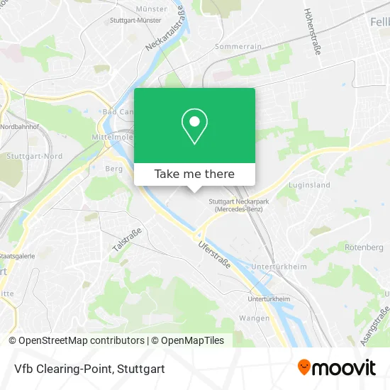
See Vfb Clearing-Point, Bad Cannstatt, on the map
Public Transit to Vfb Clearing-Point in Bad Cannstatt
Wondering how to get to Vfb Clearing-Point in Bad Cannstatt? Moovit helps you find the best way to get to Vfb Clearing-Point with step-by-step directions from the nearest public transit station.
Moovit provides free maps and live directions to help you navigate through your city. View schedules, routes, timetables, and find out how long does it take to get to Vfb Clearing-Point in real time.
Looking for the nearest stop or station to Vfb Clearing-Point? Check out this list of stops closest to your destination: Fritz-Walter-Weg; Stuttgart Fritz-Walter-Weg; Stuttgart Neckarpark (Stadion); Neckarpark (Stadion); Stuttgart Kienbachstraße; Neckarpark; Stuttgart Neckarpark; Blick.
Train: RB11, S3.S-Bahn: S1.Subway: U9, U11, U19, U13.Bus: 42, 45, 61, N5, S2E, U19.
Want to see if there’s another route that gets you there at an earlier time? Moovit helps you find alternative routes or times. Get directions from and directions to Vfb Clearing-Point easily from the Moovit App or Website.
We make riding to Vfb Clearing-Point easy, which is why over 1.5 million users, including users in Bad Cannstatt, trust Moovit as the best app for public transit. You don’t need to download an individual bus app or train app, Moovit is your all-in-one transit app that helps you find the best bus time or train time available.
For information on prices of bus, subway, S-Bahn, train and light rail, costs and ride fares to Vfb Clearing-Point, please check the Moovit app.
Use the app to navigate to popular places including to the airport, hospital, stadium, grocery store, mall, coffee shop, school, college, and university.
Vfb Clearing-Point Address: Mercedesstraße street in Bad Cannstatt
- Mercedes-Benz Arena Stuttgart,
- Mercedes-Benz Arena (Gottlieb-Daimler-Stadion),
- Mercedes-Benz Arena (Stuttgart Stadium),
- Mercedes-Benz Arena (Stadion Stuttgart),
- Mercedes-Benz Arena,
- Gottlieb-Daimler-Stadion,
- Mercedes Benz Arena Cocktail Bar,
- Eingang Cannstatter Kurve,
- VfB Stuttgart Fan-Center,
- Wm Denkmal,
- Cannstatter Kurve,
- Vfb Fan-Center,
- Fan Center Stuttgart (VfB Fan-Center),
- Carl-Benz-Center,
- Hilton Garden Inn Stuttga. Neckarp.,
- Carl Benz Arena,
- Untertürkheimer Kurve,
- SCHARRena (Scharrena Stuttgart),
- Palm Beach,
- VfB Reha-Welt
Places Near Vfb Clearing-Point (Bad Cannstatt)
- Hanns-Martin-Schleyer-Halle, Bad Cannstatt,
- Gleis 101/102 (tief), Stuttgart-Mitte,
- SI-Centrum, Möhringen,
- Wilhelma (U-Bahn Wilhelma), Bad Cannstatt,
- Klinikum Stuttgart - Katharinenhospital, Stuttgart-Mitte,
- Pariser Platz Stuttgart, Stuttgart-Mitte,
- Geilhaus Haus 33a, Reutlingen-Betzingen,
- Mettingen Eros-Center Puff Laufhaus, Esslingen Am Neckar,
- FlixBus Haltestelle, Stuttgart,
- Hauptbahnhof Stuttgart, Stuttgart-Mitte,
- Schleyerhalle, Bad Cannstatt,
- Mercedes-Benz Museum, Bad Cannstatt,
- Porsche Museum, Zuffenhausen,
- Porsche-Arena, Bad Cannstatt,
- Marmorsaal Im Weissenburgpark, Stuttgart-Süd,
- Waldfriedhof, Degerloch,
- Gasometer Pforzheim, Pforzheim,
- Mercedes-Benz Museum (Mercedes Museum Stuttgart), Bad Cannstatt,
- Hanns-Martin-Schleyer-Halle (Stuttgart Hans-Martin-Schleyerhalle), Bad Cannstatt,
- Im Wizemann (Halle), Bad Cannstatt
How to get to popular places in Stuttgart with public transit
Get around Bad Cannstatt by public transit!
Traveling around Bad Cannstatt has never been so easy. See step by step directions as you travel to any attraction, street or major public transit station. View bus and train schedules, arrival times, service alerts and detailed routes on a map, so you know exactly how to get to anywhere in Bad Cannstatt.
When traveling to any destination around Bad Cannstatt use Moovit's Live Directions with Get Off Notifications to know exactly where and how far to walk, how long to wait for your line, and how many stops are left. Moovit will alert you when it's time to get off — no need to constantly re-check whether yours is the next stop.
Wondering how to use public transit in Bad Cannstatt or how to pay for public transit in Bad Cannstatt? Moovit public transit app can help you navigate your way with public transit easily, and at minimum cost. It includes public transit fees, ticket prices, and costs. Looking for a map of Bad Cannstatt public transit lines? Moovit public transit app shows all public transit maps in Bad Cannstatt with all Bus, Train, Subway, Light Rail, Ferry, S-Bahn and Funicular routes and stops on an interactive map.
Stuttgart has 7 transit type(s), including: Bus, Train, Subway, Light Rail, Ferry, S-Bahn and Funicular, operated by several transit agencies, including SSB - Stadtbahn, SSB, SSB - Seilbahn / Zacke, S-Bahn Stuttgart, Rhein-Neckar-Verkehr GmbH (rnv), Karlsruher Verkehrsverbund, DB AG, DB Regiobus BW, Arverio Baden-Württemberg GmbH, DB RegioNetz Verkehrs GmbH Westfrankenbahn, DB Regio AG Baden-Württemberg, Südwestdeutsche Verkehrs-AG, DB Regio AG Mitte Region Hessen, DB and Bodensee-Oberschwaben-Bahn