Rogoredo Street Monte Popera Street stop - Thursday schedule
| Line | Direction | Time |
|---|---|---|
| S19 | Albairate-Vermezzo | 5:43 AM |
| S19 | Albairate-Vermezzo | 6:03 AM |
| S19 | Albairate-Vermezzo | 6:20 AM |
| S19 | Albairate-Vermezzo | 6:38 AM |
| S19 | Albairate-Vermezzo | 6:55 AM |
| S19 | Albairate-Vermezzo | 7:11 AM |
| S19 | Albairate-Vermezzo | 7:27 AM |
| S19 | Albairate-Vermezzo | 7:43 AM |
| S19 | Albairate-Vermezzo | 7:59 AM |
| S19 | Albairate-Vermezzo | 8:15 AM |
| S19 | Albairate-Vermezzo | 8:32 AM |
| S19 | Albairate-Vermezzo | 8:49 AM |
| S19 | Albairate-Vermezzo | 9:06 AM |
| S19 | Albairate-Vermezzo | 9:23 AM |
| S19 | Albairate-Vermezzo | 9:43 AM |
| S19 | Albairate-Vermezzo | 10:03 AM |
| S19 | Albairate-Vermezzo | 10:23 AM |
| S19 | Albairate-Vermezzo | 10:43 AM |
| S19 | Albairate-Vermezzo | 11:03 AM |
| S19 | Albairate-Vermezzo | 11:23 AM |
| S19 | Albairate-Vermezzo | 11:43 AM |
| S19 | Albairate-Vermezzo | 12:03 PM |
| S19 | Albairate-Vermezzo | 12:23 PM |
| S19 | Albairate-Vermezzo | 12:43 PM |
| S19 | Albairate-Vermezzo | 1:04 PM |
Directions to Rogoredo Street Monte Popera Street stop (Milan) with public transit
The following transit lines have routes that pass near Rogoredo Street Monte Popera Street
 Bus: 77, 95, Q88, 121.
- Train: R34, S1, S13, RV, RV.
- Metro: M3.
- Light Rail: 24.
How to get to Rogoredo Street Monte Popera Street stop by bus?
Click on the bus route to see step by step directions with maps, line arrival times and updated time schedules.
How to get to Rogoredo Street Monte Popera Street stop by train?
Click on the train route to see step by step directions with maps, line arrival times and updated time schedules.
How to get to Rogoredo Street Monte Popera Street stop by metro?
Click on the metro route to see step by step directions with maps, line arrival times and updated time schedules.
How to get to Rogoredo Street Monte Popera Street stop by light rail?
Click on the light rail route to see step by step directions with maps, line arrival times and updated time schedules.
Bus stops near Rogoredo Street Monte Popera Street stop in Milan
- Rogoredo Street Monte Popera Street, 1 min walk,
- Mount Popera Street Mount Cengio Street, 3 min walk,
- Impastato Street Rogoredo Street, 6 min walk,
- Rogoredo Railway Station M3, 7 min walk,
- Monte Penice Street Via Pizzolpasso, 9 min walk,
Train stations near Rogoredo Street Monte Popera Street station in Milan
- Milan Rogoredo, 7 min walk,
Metro stations near Rogoredo Street Monte Popera Street station in Milan
- Rogoredo Station, 8 min walk,
Bus lines to Rogoredo Street Monte Popera Street stop in Milan
- 77, Poasco,
- Q88, Ungheria Avenue,
- 121, San Giuliano Station,
- NM3, San Donato,
- 88, Linate,
What are the closest stations to Rogoredo Street Monte Popera Street?
The closest stations to Rogoredo Street Monte Popera Street are:
- Rogoredo Street Monte Popera Street stop is 10 meters away, 1 min walk.
- Mount Popera Street Mount Cengio Street stop is 177 meters away, 3 min walk.
- Impastato Street Rogoredo Street stop is 423 meters away, 6 min walk.
- Rogoredo Railway Station M3 is 495 meters away, 7 min walk.
- Milan Rogoredo station is 524 meters away, 9 min walk.
- Rogoredo Station is 578 meters away, 8 min walk.
- Monte Penice Street Via Pizzolpasso stop is 673 meters away, 9 min walk.
Which bus lines stop near Rogoredo Street Monte Popera Street?
These bus lines stop near Rogoredo Street Monte Popera Street: 77, 95.
Which train lines stop near Rogoredo Street Monte Popera Street?
These train lines stop near Rogoredo Street Monte Popera Street: R34, S1, S13.
Which metro line stops near Rogoredo Street Monte Popera Street?
M3 (San Donato)
Which light rail line stops near Rogoredo Street Monte Popera Street?
24 (Ungheria Avenue)
What’s the nearest metro station to Rogoredo Street Monte Popera Street in Milan?
The nearest metro station to Rogoredo Street Monte Popera Street in Milan is Rogoredo Station. It’s a 8 min walk away.
What’s the nearest train station to Rogoredo Street Monte Popera Street in Milan?
The nearest train station to Rogoredo Street Monte Popera Street in Milan is Milan Rogoredo. It’s a 9 min walk away.
What’s the nearest bus station to Rogoredo Street Monte Popera Street in Milan?
The nearest bus station to Rogoredo Street Monte Popera Street in Milan is Rogoredo Street Monte Popera Street. It’s a 1 min walk away.
What time is the first metro to Rogoredo Street Monte Popera Street in Milan?
The M3 is the first metro that goes to Rogoredo Street Monte Popera Street in Milan. It stops nearby at 6:00 AM.
What time is the last metro to Rogoredo Street Monte Popera Street in Milan?
The M3 is the last metro that goes to Rogoredo Street Monte Popera Street in Milan. It stops nearby at 12:50 AM.
What time is the first train to Rogoredo Street Monte Popera Street in Milan?
The RV is the first train that goes to Rogoredo Street Monte Popera Street in Milan. It stops nearby at 5:27 AM.
What time is the last train to Rogoredo Street Monte Popera Street in Milan?
The S13 is the last train that goes to Rogoredo Street Monte Popera Street in Milan. It stops nearby at 12:08 AM.
What time is the first bus to Rogoredo Street Monte Popera Street in Milan?
The NM3 is the first bus that goes to Rogoredo Street Monte Popera Street in Milan. It stops nearby at 3:04 AM.
What time is the last bus to Rogoredo Street Monte Popera Street in Milan?
The NM3 is the last bus that goes to Rogoredo Street Monte Popera Street in Milan. It stops nearby at 3:44 AM.
Rogoredo Street Monte Popera Street station
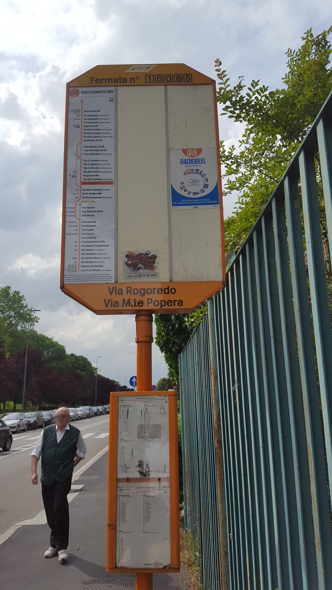 Taken by Luis A.
See Rogoredo Street Monte Popera Street stop, Milan, on the map
Public transit to Rogoredo Street Monte Popera Street stop (ID: 17074) in Milan
Looking for directions to Rogoredo Street Monte Popera Street in Milan, Italy?
Download the Moovit App to find the current schedule and step-by-step directions for Metro, Bus, Light Rail or Train routes that pass through Rogoredo Street Monte Popera Street.
Looking for the nearest stops closest to Rogoredo Street Monte Popera Street ? Check out this list of closest stops to your destination: Rogoredo Street Monte Popera Street; Mount Popera Street Mount Cengio Street; Impastato Street Rogoredo Street; Rogoredo Railway Station M3; Milan Rogoredo; Rogoredo Station; Monte Penice Street Via Pizzolpasso.
Bus: 77, 95, Q88, 121.Train: R34, S1, S13, RV, RV, RV, S2, EC.Metro: M3.Light Rail: 24.
We make riding on public transit to Rogoredo Street Monte Popera Street easy, which is why over 1.7 billion users, including users in Milan trust Moovit as the best app for public transit.
Use the app to navigate to popular places including to the airport, hospital, stadium, grocery store, mall, coffee shop, school, college, and university.
Rogoredo Street Monte Popera Street stop’s code is 17074
The first line to this stop is S19, at 5:43 AM, and the last line is Q88 at 1:51 AM.
Via Rogoredo, Milano, Italy
This stop serves Trenord and ATM’s lines
- Rogoredo Street Monte Popera Street,
- Mount Popera Street Mount Cengio Street,
- Impastato Street Rogoredo Street,
- Rogoredo Railway Station M3,
- Monte Penice Street Via Pizzolpasso
Bus stops near Rogoredo Street Monte Popera Street stop
- Milan Rogoredo
Train station near Rogoredo Street Monte Popera Street station
- Rogoredo Station
Metro station near Rogoredo Street Monte Popera Street station
- Malpensa Arrivals Terminal 1 - Bus Stop 6 (Exit Doors 2/3),
- Wagner M1,
- Como - Tibaldi Street, 6 (Tavernola),
- Lorenteggio Street Bisceglie Street,
- Bicocca (University),
- Livigno, Bus Station, Isola/Prestefan,
- Lainate V. Rho 72,
- Botticelli Street Saldini Street,
- Segrate,
- Lunga Fiera -,
- Gorini Square (Cancer Institute),
- Gaggiano,
- Milan Street Stelvio Street (Bollate),
- Canegrate,
- Como - Domus Mariae (Camnago),
- Pola Street Rosellini Street (INPS),
- Lambrate Cemetery,
- Milan Cadorna,
- Crocetta Metro Line 3,
- Orta San Giulio - Prarondo Square
Popular public transit stations in Milan
Get around Milan by public transit!
Traveling around Milan has never been so easy. See step by step directions as you travel to any attraction, street or major public transit station. View bus and train schedules, arrival times, service alerts and detailed routes on a map, so you know exactly how to get to anywhere in Milan.
When traveling to any destination around Milan use Moovit's Live Directions with Get Off Notifications to know exactly where and how far to walk, how long to wait for your line, and how many stops are left. Moovit will alert you when it's time to get off — no need to constantly re-check whether yours is the next stop.
Wondering how to use public transit in Milan or how to pay for public transit in Milan? Moovit public transit app can help you navigate your way with public transit easily, and at minimum cost. It includes public transit fees, ticket prices, and costs. Looking for a map of Milan public transit lines? Moovit public transit app shows all public transit maps in Milan with all Bus, Train, Metro, Light Rail, Ferry, Cable Car, Funicular and Gondola routes and stops on an interactive map.
Milan and Lombardy has 8 transit type(s), including: Bus, Train, Metro, Light Rail, Ferry, Cable Car, Funicular and Gondola, operated by several transit agencies, including ATM, Trenord, Trenitalia, NET, Movibus, ASF Bus Lines, Autostradale Ltd, Terravision, AirPullman, Flibco, Star Mobility, TEB, ATB, AVT and Brescia Mobility