How to get to View at Blue Ridge Commons by bus?
Click on the bus route to see step by step directions with maps, line arrival times and updated time schedules.
Bus stops near View at Blue Ridge Commons in Roanoke
Bus lines to View at Blue Ridge Commons in Roanoke
What are the closest stations to View at Blue Ridge Commons?
The closest stations to View at Blue Ridge Commons are:
- Ferncliff at Hoback is 506 yards away, 7 min walk.
- Cove at Hershberger is 525 yards away, 7 min walk.
- Hoback at Big Lots Parking Lot is 564 yards away, 8 min walk.
- Hershberger Wb at Cove (Valley View Garden Apartments) is 678 yards away, 9 min walk.
Which bus line stops near View at Blue Ridge Commons?
11 (11-Third Street Station To Valley View Mall)
What’s the nearest bus station to View at Blue Ridge Commons in Roanoke?
The nearest bus stations to View at Blue Ridge Commons in Roanoke are Ferncliff at Hoback and Cove at Hershberger. The closest one is a 7 min walk away.
What time is the first bus to View at Blue Ridge Commons in Roanoke?
The 12 is the first bus that goes to View at Blue Ridge Commons in Roanoke. It stops nearby at 5:45 AM.
What time is the last bus to View at Blue Ridge Commons in Roanoke?
The 15 is the last bus that goes to View at Blue Ridge Commons in Roanoke. It stops nearby at 8:45 PM.
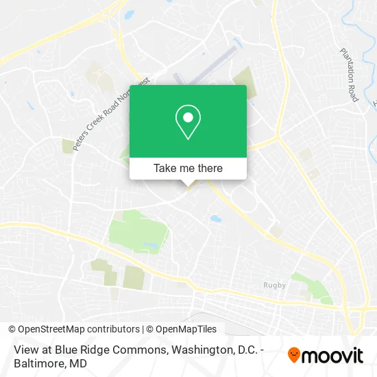
See View at Blue Ridge Commons, Roanoke, on the map
Public Transit to View at Blue Ridge Commons in Roanoke
Wondering how to get to View at Blue Ridge Commons in Roanoke? Moovit helps you find the best way to get to View at Blue Ridge Commons with step-by-step directions from the nearest public transit station.
Moovit provides free maps and live directions to help you navigate through your city. View schedules, routes, timetables, and find out how long does it take to get to View at Blue Ridge Commons in real time.
Looking for the nearest stop or station to View at Blue Ridge Commons? Check out this list of stops closest to your destination: Ferncliff at Hoback; Cove at Hershberger; Hoback at Big Lots Parking Lot; Hershberger Wb at Cove (Valley View Garden Apartments).
Bus: 11, 12, 86, 15, 85.
Want to see if there’s another route that gets you there at an earlier time? Moovit helps you find alternative routes or times. Get directions from and directions to View at Blue Ridge Commons easily from the Moovit App or Website.
We make riding to View at Blue Ridge Commons easy, which is why over 1.5 million users, including users in Roanoke, trust Moovit as the best app for public transit. You don’t need to download an individual bus app or train app, Moovit is your all-in-one transit app that helps you find the best bus time or train time available.
For information on prices of bus and train, costs and ride fares to View at Blue Ridge Commons, please check the Moovit app.
Use the app to navigate to popular places including to the airport, hospital, stadium, grocery store, mall, coffee shop, school, college, and university.
View at Blue Ridge Commons Address: 2801 Hershberger Rd NW Roanoke, VA 24017 street in Roanoke
- The Associated Press,
- Exxon,
- VA Lottery - Nishi Foo,
- Citizens Bank N A,
- Farmers Insurance - Charlotte Wyrick,
- Muneris,
- Tate Family Dentistry,
- Ets Dental,
- Farmers Insurance,
- Semtner Dental,
- Gregory S Hughes DDS,
- Zaxby's,
- Kennedy Business Service Limited,
- U-Haul,
- Wdbj7,
- Big Lots - North Roanoke,
- Cusine Kreyol,
- ATM,
- Trinty Family Church,
- Kingdom Harvest Church Intl
Places Near View at Blue Ridge Commons (Roanoke)
- Pennsylvania Ave NW (3rd st and pennsylvania), Washington,
- Capital One Arena, Washington,
- Warner Theatre, Washington,
- Rock Creek Tennis Center, Washington,
- Georgetown, Washington,
- Sibley Memorial Hospital, Washington,
- Marriott Marquis Washington, DC, Washington,
- Washington DC VA Medical Center, Washington,
- PG Mall, Prince George's County,
- M&T Bank Stadium, Baltimore,
- Basilica of the National Shrine, Washington,
- Camden Yards, Baltimore,
- Westfield Montgomery Mall, Montgomery County,
- The Anthem, Washington,
- Washington National Cathedral, Washington,
- National Zoo, Washington,
- National Mall, Washington,
- Amazon Hq2, Arlington County,
- Museum Of The Bible, Washington,
- National Museum of African American History and Culture, Washington
How to get to popular places in Washington, D.C. - Baltimore, MD with public transit
Get around Roanoke by public transit!
Traveling around Roanoke has never been so easy. See step by step directions as you travel to any attraction, street or major public transit station. View bus and train schedules, arrival times, service alerts and detailed routes on a map, so you know exactly how to get to anywhere in Roanoke.
When traveling to any destination around Roanoke use Moovit's Live Directions with Get Off Notifications to know exactly where and how far to walk, how long to wait for your line, and how many stops are left. Moovit will alert you when it's time to get off — no need to constantly re-check whether yours is the next stop.
Wondering how to use public transit in Roanoke or how to pay for public transit in Roanoke? Moovit public transit app can help you navigate your way with public transit easily, and at minimum cost. It includes public transit fees, ticket prices, and costs. Looking for a map of Roanoke public transit lines? Moovit public transit app shows all public transit maps in Roanoke with all Bus, Train, Metro, Light Rail and Ferry routes and stops on an interactive map.
Washington, D.C. - Baltimore, MD has 5 transit type(s), including: Bus, Train, Metro, Light Rail and Ferry, operated by several transit agencies, including WMATA, Montgomery County Ride On, Fairfax Connector, TheBus, PRTC, DASH - Alexandria, Arlington Transit (ART), RTA of Central Maryland, MDOT MTA, MDOT MTA Light RailLink, MDOT MTA Commuter Bus, MDOT MTA Local Bus, FXBGO!, Virginia Railway Express (VRE) and MARC