How to get to Virginia ABC by bus?
Click on the bus route to see step by step directions with maps, line arrival times and updated time schedules.
From Lorton, VA, Fairfax County
205 minFrom Rose Gaming Resort, Prince William County
221 minFrom Potomac Mills Mall, Prince William County
196 minFrom Lorton, VA - Amtrak Auto Train Station (LOR), Fairfax County
211 minFrom UVA Hospital Medical Center, Charlottesville
285 minFrom Woodbridge, VA, Prince William County
140 minFrom Amazon Fulfillment Center-Ric3, Richmond
70 min
How to get to Virginia ABC by train?
Click on the train route to see step by step directions with maps, line arrival times and updated time schedules.
Bus stops near Virginia ABC in Richmond
Train station near Virginia ABC in Richmond
- Pathrichmond Main Street Amtrak Station, 10 min walk,VIEW
Bus lines to Virginia ABC in Richmond
What are the closest stations to Virginia ABC?
The closest stations to Virginia ABC are:
- Main + 26th is 44 yards away, 1 min walk.
- Main + 25th is 178 yards away, 3 min walk.
- Shockoe Bottom Eastbound Station is 201 yards away, 3 min walk.
- Marshall + 27th is 633 yards away, 8 min walk.
- Pathrichmond Main Street Amtrak Station is 794 yards away, 10 min walk.
Which bus line stops near Virginia ABC?
BRT (Broad/Main/Rocketts)
Which train line stops near Virginia ABC?
NORTHEAST REGIONAL (Philadelphia)
What’s the nearest train station to Virginia ABC in Richmond?
The nearest train station to Virginia ABC in Richmond is Pathrichmond Main Street Amtrak Station. It’s a 10 min walk away.
What’s the nearest bus station to Virginia ABC in Richmond?
The nearest bus station to Virginia ABC in Richmond is Main + 26th. It’s a 1 min walk away.
What time is the first train to Virginia ABC in Richmond?
The NORTHEAST REGIONAL is the first train that goes to Virginia ABC in Richmond. It stops nearby at 5:19 AM.
What time is the last train to Virginia ABC in Richmond?
The NORTHEAST REGIONAL is the last train that goes to Virginia ABC in Richmond. It stops nearby at 6:57 PM.
What time is the first bus to Virginia ABC in Richmond?
The BRT is the first bus that goes to Virginia ABC in Richmond. It stops nearby at 5:04 AM.
What time is the last bus to Virginia ABC in Richmond?
The BRT is the last bus that goes to Virginia ABC in Richmond. It stops nearby at 1:33 AM.
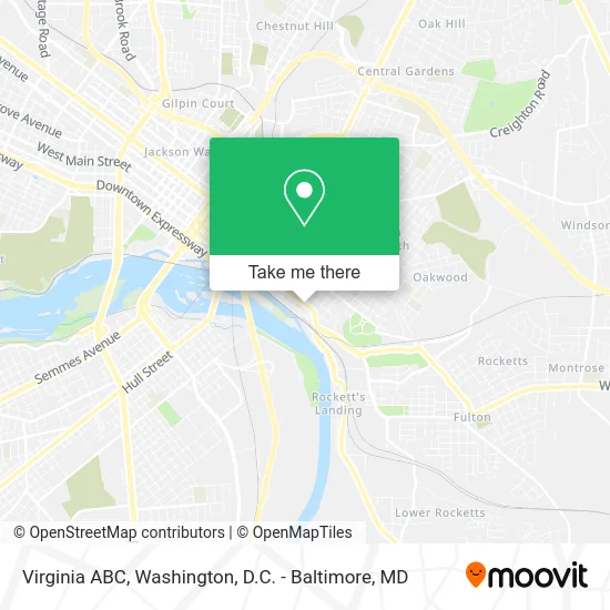
See Virginia ABC, Richmond, on the map
Public Transit to Virginia ABC in Richmond
Wondering how to get to Virginia ABC in Richmond? Moovit helps you find the best way to get to Virginia ABC with step-by-step directions from the nearest public transit station.
Moovit provides free maps and live directions to help you navigate through your city. View schedules, routes, timetables, and find out how long does it take to get to Virginia ABC in real time.
Looking for the nearest stop or station to Virginia ABC? Check out this list of stops closest to your destination: Main + 26th; Main + 25th; Shockoe Bottom Eastbound Station; Marshall + 27th; Pathrichmond Main Street Amtrak Station.
Bus: BRT, 4A, 4B, 12, 14, 56.Train: NORTHEAST REGIONAL.
Want to see if there’s another route that gets you there at an earlier time? Moovit helps you find alternative routes or times. Get directions from and directions to Virginia ABC easily from the Moovit App or Website.
We make riding to Virginia ABC easy, which is why over 1.5 million users, including users in Richmond, trust Moovit as the best app for public transit. You don’t need to download an individual bus app or train app, Moovit is your all-in-one transit app that helps you find the best bus time or train time available.
For information on prices of bus and train, costs and ride fares to Virginia ABC, please check the Moovit app.
Use the app to navigate to popular places including to the airport, hospital, stadium, grocery store, mall, coffee shop, school, college, and university.
Virginia ABC Address: 2525 E Main St Richmond, VA 23223 street in Richmond
- Bp,
- BP,
- Main2525,
- Quality Healthcare,
- Emerald Tires,
- 2500 East Cary Street,
- Cvs Pharmacy,
- Cameron Kinney Lofts,
- Second Alabama Hospital,
- Shiplock Views,
- Luther Libby Home,
- Great Ship Lock Park,
- Starbucks,
- Great Shiplock Park - James River Park System,
- Redbox,
- Libby Hill Park,
- American Cigar Lofts,
- Subway,
- Hall Of Fades,
- Main2323
Places Near Virginia ABC (Richmond)
- Westfield Montgomery Mall, Montgomery County,
- Rock Creek Tennis Center, Washington,
- Museum Of The Bible, Washington,
- Pennsylvania Ave NW (3rd st and pennsylvania), Washington,
- PG Mall, Prince George's County,
- M&T Bank Stadium, Baltimore,
- Sibley Memorial Hospital, Washington,
- Washington National Cathedral, Washington,
- Warner Theatre, Washington,
- Basilica of the National Shrine, Washington,
- Washington DC VA Medical Center, Washington,
- The Anthem, Washington,
- Camden Yards, Baltimore,
- Capital One Arena, Washington,
- Georgetown, Washington,
- Marriott Marquis Washington, DC, Washington,
- National Zoo, Washington,
- National Museum of African American History and Culture, Washington,
- Amazon Hq2, Arlington County,
- National Theatre, Washington
How to get to popular places in Washington, D.C. - Baltimore, MD with public transit
Get around Richmond by public transit!
Traveling around Richmond has never been so easy. See step by step directions as you travel to any attraction, street or major public transit station. View bus and train schedules, arrival times, service alerts and detailed routes on a map, so you know exactly how to get to anywhere in Richmond.
When traveling to any destination around Richmond use Moovit's Live Directions with Get Off Notifications to know exactly where and how far to walk, how long to wait for your line, and how many stops are left. Moovit will alert you when it's time to get off — no need to constantly re-check whether yours is the next stop.
Wondering how to use public transit in Richmond or how to pay for public transit in Richmond? Moovit public transit app can help you navigate your way with public transit easily, and at minimum cost. It includes public transit fees, ticket prices, and costs. Looking for a map of Richmond public transit lines? Moovit public transit app shows all public transit maps in Richmond with all Bus, Train, Metro, Light Rail and Ferry routes and stops on an interactive map.
Washington, D.C. - Baltimore, MD has 5 transit type(s), including: Bus, Train, Metro, Light Rail and Ferry, operated by several transit agencies, including WMATA, Montgomery County Ride On, Fairfax Connector, TheBus, PRTC, DASH - Alexandria, Arlington Transit (ART), RTA of Central Maryland, MDOT MTA, MDOT MTA Light RailLink, MDOT MTA Commuter Bus, MDOT MTA Local Bus, FXBGO!, Virginia Railway Express (VRE) and MARC