Directions to Virginia Linen Service, Inc. (Fairfax County) with public transportation
The following transit lines have routes that pass near Virginia Linen Service, Inc.
 Bus: 231, 232, 353.
- Train: FREDERICKSBURG LINE.
- Metro: BLUE.
How to get to Virginia Linen Service, Inc. by bus?
Click on the bus route to see step by step directions with maps, line arrival times and updated time schedules.
From Burke, VA, Fairfax County
80 minFrom United States Patent & Trademark Office (USPTO), Alexandria
41 minFrom Baileys Crossroads, Fairfax County
58 minFrom Northern Virginia Community College - Annandale Campus, Fairfax County
73 minFrom Seven Corners Center (Seven Corners Shopping Center Falls Church VA), Fairfax County
72 minFrom Del Ray, Alexandria
76 minFrom Sheraton Suites Old Town Alexandria, Alexandria
83 minFrom Alexandria Courthouse, Alexandria
53 minFrom Shirlington, Arlington County
56 minFrom Thomas Jefferson High School for Science and Technology, Fairfax County
75 min
How to get to Virginia Linen Service, Inc. by train?
Click on the train route to see step by step directions with maps, line arrival times and updated time schedules.
How to get to Virginia Linen Service, Inc. by metro?
Click on the metro route to see step by step directions with maps, line arrival times and updated time schedules.
Bus stops near Virginia Linen Service, Inc. in Fairfax County
Metro station near Virginia Linen Service, Inc. in Fairfax County
- Franconia-Springfield Metro, 33 min walk,VIEW
Train station near Virginia Linen Service, Inc. in Fairfax County
- Franconia-Springfield Vre Station, 37 min walk,VIEW
Bus lines to Virginia Linen Service, Inc. in Fairfax County
What are the closest stations to Virginia Linen Service, Inc.?
The closest stations to Virginia Linen Service, Inc. are:
- Beulah St @ Burnett St is 414 yards away, 5 min walk.
- Beulah St @ Darleon Pl is 504 yards away, 7 min walk.
- Walker Ln @ Beulah St is 563 yards away, 7 min walk.
- Franconia-Springfield Metro is 2803 yards away, 33 min walk.
- Franconia-Springfield Vre Station is 2982 yards away, 37 min walk.
Which bus lines stop near Virginia Linen Service, Inc.?
These bus lines stop near Virginia Linen Service, Inc.: 231, 232.
Which train line stops near Virginia Linen Service, Inc.?
FREDERICKSBURG LINE (Spotsylvania)
Which metro line stops near Virginia Linen Service, Inc.?
BLUE (Franconia-Springfield)
What’s the nearest bus station to Virginia Linen Service, Inc. in Fairfax County?
The nearest bus station to Virginia Linen Service, Inc. in Fairfax County is Beulah St @ Burnett St. It’s a 5 min walk away.
What time is the first metro to Virginia Linen Service, Inc. in Fairfax County?
The BLUE is the first metro that goes to Virginia Linen Service, Inc. in Fairfax County. It stops nearby at 5:00 AM.
What time is the last metro to Virginia Linen Service, Inc. in Fairfax County?
The BLUE is the last metro that goes to Virginia Linen Service, Inc. in Fairfax County. It stops nearby at 12:44 AM.
What time is the first train to Virginia Linen Service, Inc. in Fairfax County?
The FREDERICKSBURG LINE is the first train that goes to Virginia Linen Service, Inc. in Fairfax County. It stops nearby at 6:13 AM.
What time is the last train to Virginia Linen Service, Inc. in Fairfax County?
The FREDERICKSBURG LINE is the last train that goes to Virginia Linen Service, Inc. in Fairfax County. It stops nearby at 7:24 PM.
What time is the first bus to Virginia Linen Service, Inc. in Fairfax County?
The 231 is the first bus that goes to Virginia Linen Service, Inc. in Fairfax County. It stops nearby at 5:10 AM.
What time is the last bus to Virginia Linen Service, Inc. in Fairfax County?
The 231 is the last bus that goes to Virginia Linen Service, Inc. in Fairfax County. It stops nearby at 10:08 PM.
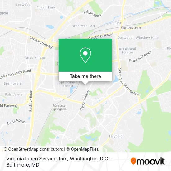
See Virginia Linen Service, Inc., Fairfax County, on the map
Public Transit to Virginia Linen Service, Inc. in Fairfax County
Wondering how to get to Virginia Linen Service, Inc. in Fairfax County? Moovit helps you find the best way to get to Virginia Linen Service, Inc. with step-by-step directions from the nearest public transit station.
Moovit provides free maps and live directions to help you navigate through your city. View schedules, routes, timetables, and find out how long does it take to get to Virginia Linen Service, Inc. in real time.
Looking for the nearest stop or station to Virginia Linen Service, Inc.? Check out this list of stops closest to your destination: Beulah St @ Burnett St; Beulah St @ Darleon Pl; Walker Ln @ Beulah St; Franconia-Springfield Metro; Franconia-Springfield Vre Station.
Bus: 231, 232, 353.Train: FREDERICKSBURG LINE.Metro: BLUE.
Want to see if there’s another route that gets you there at an earlier time? Moovit helps you find alternative routes or times. Get directions from and directions to Virginia Linen Service, Inc. easily from the Moovit App or Website.
We make riding to Virginia Linen Service, Inc. easy, which is why over 1.5 million users, including users in Fairfax County, trust Moovit as the best app for public transit. You don’t need to download an individual bus app or train app, Moovit is your all-in-one transit app that helps you find the best bus time or train time available.
For information on prices of bus, metro and train, costs and ride fares to Virginia Linen Service, Inc., please check the Moovit app.
Use the app to navigate to popular places including to the airport, hospital, stadium, grocery store, mall, coffee shop, school, college, and university.
Virginia Linen Service, Inc. Address: 6694 Fleet Dr Alexandria, VA 22310 street in Fairfax County
- Yomei Wellness,
- Physiotherapist Alexandria Therapist,
- Cornerstone Private Wealth Planning - Stifel,
- Local Auto Repair Shops Me Auto Repair,
- A2b Moving and Storage,
- Davey Tree Expert Company,
- Krain Building Services,
- Lighting Maintenance,
- Metrotec,
- Cintas Uniform Rental Work Apparel,
- New Homes in Alexandria VA,
- Lopez Y Asociados,
- Justgetjohnny,
- TSA Human Resources Service Center,
- Pinyo Bhulipongsanon,
- Sherwood Cofer II,
- Mirlogic,
- Stephanie D Johnson - Smiling Real Estate Group,
- Karen Reynoso -Major Key Real Estate Group,
- Booz Allen Hamilton
Places Near Virginia Linen Service, Inc. (Fairfax County)
- Georgetown, Washington,
- Westfield Montgomery Mall, Montgomery County,
- Pennsylvania Ave NW (3rd st and pennsylvania), Washington,
- Washington National Cathedral, Washington,
- Marriott Marquis Washington, DC, Washington,
- Basilica of the National Shrine, Washington,
- National Zoo, Washington,
- Camden Yards, Baltimore,
- PG Mall, Prince George's County,
- Sibley Memorial Hospital, Washington,
- Warner Theatre, Washington,
- M&T Bank Stadium, Baltimore,
- Amazon Hq2, Arlington County,
- Rock Creek Tennis Center, Washington,
- Museum Of The Bible, Washington,
- Washington DC VA Medical Center, Washington,
- National Theatre, Washington,
- The Anthem, Washington,
- Capital One Arena, Washington,
- National Museum of African American History and Culture, Washington
How to get to popular places in Washington, D.C. - Baltimore, MD with public transit
Get around Fairfax County by public transit!
Traveling around Fairfax County has never been so easy. See step by step directions as you travel to any attraction, street or major public transit station. View bus and train schedules, arrival times, service alerts and detailed routes on a map, so you know exactly how to get to anywhere in Fairfax County.
When traveling to any destination around Fairfax County use Moovit's Live Directions with Get Off Notifications to know exactly where and how far to walk, how long to wait for your line, and how many stops are left. Moovit will alert you when it's time to get off — no need to constantly re-check whether yours is the next stop.
Wondering how to use public transit in Fairfax County or how to pay for public transit in Fairfax County? Moovit public transit app can help you navigate your way with public transit easily, and at minimum cost. It includes public transit fees, ticket prices, and costs. Looking for a map of Fairfax County public transit lines? Moovit public transit app shows all public transit maps in Fairfax County with all Bus, Train, Metro, Light Rail and Ferry routes and stops on an interactive map.
Washington, D.C. - Baltimore, MD has 5 transit type(s), including: Bus, Train, Metro, Light Rail and Ferry, operated by several transit agencies, including WMATA, Montgomery County Ride On, Fairfax Connector, TheBus, PRTC, DASH - Alexandria, Arlington Transit (ART), RTA of Central Maryland, MDOT MTA, MDOT MTA Light RailLink, MDOT MTA Commuter Bus, MDOT MTA Local Bus, FXBGO!, Virginia Railway Express (VRE) and MARC