How to get to Vision Care Optical by bus?
Click on the bus route to see step by step directions with maps, line arrival times and updated time schedules.
From Lummus Park, Miami Beach
55 minFrom NW 3rd Ave, Miami
56 minFrom Miami Escorts, Miami Beach
47 minFrom Versace Mansion, Miami Beach
57 minFrom Soundscape Park, Miami Beach
56 minFrom SW 8th St / SW 62nd Ave, Miami
46 minFrom Miami Open Tennis, Key Biscayne
70 minFrom Fillmore Miami Beach/Jackie Gleason Theater, Miami Beach
56 minFrom Ocean Reef Suites Miami Beach FL USA, Miami Beach
55 minFrom Red Coach, Miami
53 min
Bus stops near Vision Care Optical in Miami
Train station near Vision Care Optical in Miami
- Santa Clara, 29 min walk,VIEW
Light Rail stations near Vision Care Optical in Miami
- Government Center Station, 48 min walk,VIEW
Bus lines to Vision Care Optical in Miami
What are the closest stations to Vision Care Optical?
The closest stations to Vision Care Optical are:
- Nw 22 Av & Nw 2 St is 89 yards away, 2 min walk.
- W Flagler St @ Nw 22 Av is 254 yards away, 4 min walk.
- Beacom Bd @ Sw 1 St is 408 yards away, 5 min walk.
- Sw 1 St @ Sw 21 Ct is 445 yards away, 6 min walk.
- Santa Clara is 2416 yards away, 29 min walk.
- Government Center Station is 4039 yards away, 48 min walk.
Which bus lines stop near Vision Care Optical?
These bus lines stop near Vision Care Optical: 11, 22, MIAHAVA.
What’s the nearest train station to Vision Care Optical in Miami?
The nearest train station to Vision Care Optical in Miami is Santa Clara. It’s a 29 min walk away.
What’s the nearest bus station to Vision Care Optical in Miami?
The nearest bus station to Vision Care Optical in Miami is Nw 22 Av & Nw 2 St. It’s a 2 min walk away.
What time is the first light rail to Vision Care Optical in Miami?
The MMI is the first light rail that goes to Vision Care Optical in Miami. It stops nearby at 5:30 AM.
What time is the last light rail to Vision Care Optical in Miami?
The MMO is the last light rail that goes to Vision Care Optical in Miami. It stops nearby at 10:12 PM.
What time is the first train to Vision Care Optical in Miami?
The ORANGE is the first train that goes to Vision Care Optical in Miami. It stops nearby at 5:12 AM.
What time is the last train to Vision Care Optical in Miami?
The GREEN is the last train that goes to Vision Care Optical in Miami. It stops nearby at 12:50 AM.
What time is the first bus to Vision Care Optical in Miami?
The 11 is the first bus that goes to Vision Care Optical in Miami. It stops nearby at 3:09 AM.
What time is the last bus to Vision Care Optical in Miami?
The 11 is the last bus that goes to Vision Care Optical in Miami. It stops nearby at 2:36 AM.
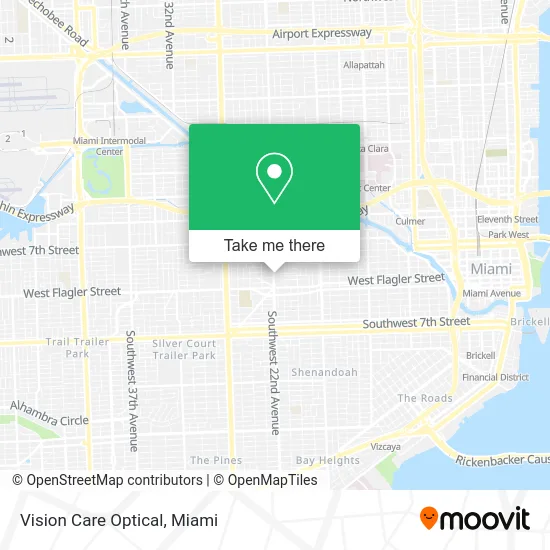
See Vision Care Optical, Miami, on the map
Public Transit to Vision Care Optical in Miami
Wondering how to get to Vision Care Optical in Miami? Moovit helps you find the best way to get to Vision Care Optical with step-by-step directions from the nearest public transit station.
Moovit provides free maps and live directions to help you navigate through your city. View schedules, routes, timetables, and find out how long does it take to get to Vision Care Optical in real time.
Looking for the nearest stop or station to Vision Care Optical? Check out this list of stops closest to your destination: Nw 22 Av & Nw 2 St; W Flagler St @ Nw 22 Av; Beacom Bd @ Sw 1 St; Sw 1 St @ Sw 21 Ct; Santa Clara; Government Center Station.
Bus: 11, 22, MIAHAVA, 208, 207.Train: GREEN, ORANGE.
Want to see if there’s another route that gets you there at an earlier time? Moovit helps you find alternative routes or times. Get directions from and directions to Vision Care Optical easily from the Moovit App or Website.
We make riding to Vision Care Optical easy, which is why over 1.5 million users, including users in Miami, trust Moovit as the best app for public transit. You don’t need to download an individual bus app or train app, Moovit is your all-in-one transit app that helps you find the best bus time or train time available.
For information on prices of bus, light rail and train, costs and ride fares to Vision Care Optical, please check the Moovit app.
Use the app to navigate to popular places including to the airport, hospital, stadium, grocery store, mall, coffee shop, school, college, and university.
Vision Care Optical Address: 111 NW 22nd Ave Miami, FL 33125 street in Miami
- Justo Tire Corp.Sales Tire New or Use Tire All Tires Brands,
- American Liberty Clinic,
- Top Aerial Solutions,
- Exco Locksmith,
- Dilectus Restaurant,
- Gorilla Car Wash,
- Tabernáculo de Vida-Iglesia Cristiana-Christian Church,
- Ministerio Apostólico Casa de Misericordia,
- 13 NW Marti ter Parking,
- Jessie's Cafe Restaurant,
- Maria Rosa Hot Dog,
- Cano Dental - Little Havana,
- Sara Jays Self Care,
- Sunshine Concrete Design,
- Sergito Kool Cut's Barber Shop,
- Pa Kuba Fashion,
- W Flagler St & NW 22 Ave,
- 2285 NW 2nd St Parking,
- Joel Electronics,
- SW 22nd Ave Rd / W Flagler St
Places Near Vision Care Optical (Miami)
- Dolphin Mall Bus, Miami,
- Port of Miami Cruise Terminal, Miami,
- Zoo Miami, Miami,
- Richard E. Gerstein Justice Building, Miami,
- Marlins Park, Miami,
- Little Havana, Miami,
- Miami Freedom Park, Miami,
- Brickell City Centre, Miami,
- Sawgrass mall ( FL ), Miami Beach,
- Dolphin Mall, Miami,
- Miami VA Hospital, Miami,
- Keiser University Flagship Campus, West Palm Beach,
- Bayside Marketplace, Miami,
- Aventura Mall, Miami Beach,
- Hard Rock Stadium, Miami Gardens,
- Wynwood, Miami,
- Sawgrass Mall, Miami,
- Aventura Mall, Miami,
- Miami Design District, Miami,
- Miami-Dade County Courthouse, Miami
How to get to popular places in Miami with public transit
Get around Miami by public transit!
Traveling around Miami has never been so easy. See step by step directions as you travel to any attraction, street or major public transit station. View bus and train schedules, arrival times, service alerts and detailed routes on a map, so you know exactly how to get to anywhere in Miami.
When traveling to any destination around Miami use Moovit's Live Directions with Get Off Notifications to know exactly where and how far to walk, how long to wait for your line, and how many stops are left. Moovit will alert you when it's time to get off — no need to constantly re-check whether yours is the next stop.
Wondering how to use public transit in Miami or how to pay for public transit in Miami? Moovit public transit app can help you navigate your way with public transit easily, and at minimum cost. It includes public transit fees, ticket prices, and costs. Looking for a map of Miami public transit lines? Moovit public transit app shows all public transit maps in Miami with all Bus, Train, Light Rail and Ferry routes and stops on an interactive map.
Miami has 4 transit type(s), including: Bus, Train, Light Rail and Ferry, operated by several transit agencies, including Broward County Transit, Miami-Dade Transit, Metrorail, Palm Tran, Tri-Rail, Brightline, MARTY, City of Homestead Trolley, Key West Transit, Treasure Coast Connector, GoLine IRT, Amtrak, Greyhound-us, FlixBus-us and Aventura Express Shuttle Bus