How to get to Vision Launch by bus?
Click on the bus route to see step by step directions with maps, line arrival times and updated time schedules.
From Flagler & 57 Ave, Miami
66 minFrom Coconut Grove, Miami
77 minFrom Alamo Rent A Car, Miami
44 minFrom Collins Ave, Miami Beach
52 minFrom Mercy Hospital, Miami
65 minFrom North Beach, Miami Beach
47 minFrom Tru by Hilton Miami West Brickell, Miami
40 minFrom Bay Harbor Islands, Miami Beach
66 minFrom Macy's, Miami Beach
42 minFrom Miami Springs Senior High School, Miami
71 min
How to get to Vision Launch by train?
Click on the train route to see step by step directions with maps, line arrival times and updated time schedules.
Bus stops near Vision Launch in Miami
Light Rail stations near Vision Launch in Miami
- School Board, 13 min walk,VIEW
Train station near Vision Launch in Miami
- Allapattah Station, 36 min walk,VIEW
Bus lines to Vision Launch in Miami
What are the closest stations to Vision Launch?
The closest stations to Vision Launch are:
- Nw 36 St & Nw 1 Av is 66 yards away, 2 min walk.
- N Miami Ave @ Ne 34th Ter is 267 yards away, 4 min walk.
- Nw 2 Av @ Nw 35 St is 349 yards away, 5 min walk.
- School Board is 1014 yards away, 13 min walk.
- Allapattah Station is 3019 yards away, 36 min walk.
Which bus lines stop near Vision Launch?
These bus lines stop near Vision Launch: 2, 36, 9.
Which train lines stop near Vision Launch?
These train lines stop near Vision Launch: GREEN, ORANGE.
What’s the nearest light rail station to Vision Launch in Miami?
The nearest light rail station to Vision Launch in Miami is School Board. It’s a 13 min walk away.
What’s the nearest bus station to Vision Launch in Miami?
The nearest bus station to Vision Launch in Miami is Nw 36 St & Nw 1 Av. It’s a 2 min walk away.
What time is the first light rail to Vision Launch in Miami?
The MMO is the first light rail that goes to Vision Launch in Miami. It stops nearby at 5:32 AM.
What time is the last light rail to Vision Launch in Miami?
The MMO is the last light rail that goes to Vision Launch in Miami. It stops nearby at 10:10 PM.
What time is the first train to Vision Launch in Miami?
The ORANGE is the first train that goes to Vision Launch in Miami. It stops nearby at 5:10 AM.
What time is the last train to Vision Launch in Miami?
The GREEN is the last train that goes to Vision Launch in Miami. It stops nearby at 12:34 AM.
What time is the first bus to Vision Launch in Miami?
The 36 is the first bus that goes to Vision Launch in Miami. It stops nearby at 4:22 AM.
What time is the last bus to Vision Launch in Miami?
The 36 is the last bus that goes to Vision Launch in Miami. It stops nearby at 12:55 AM.
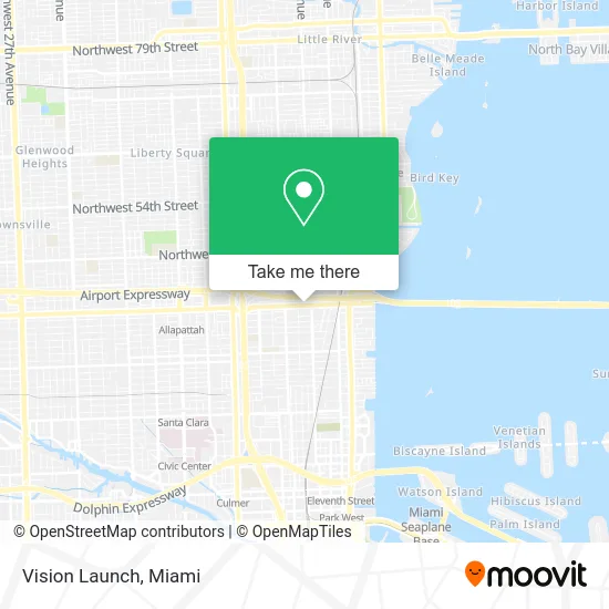
See Vision Launch, Miami, on the map
Public Transit to Vision Launch in Miami
Wondering how to get to Vision Launch in Miami? Moovit helps you find the best way to get to Vision Launch with step-by-step directions from the nearest public transit station.
Moovit provides free maps and live directions to help you navigate through your city. View schedules, routes, timetables, and find out how long does it take to get to Vision Launch in real time.
Looking for the nearest stop or station to Vision Launch? Check out this list of stops closest to your destination: Nw 36 St & Nw 1 Av; N Miami Ave @ Ne 34th Ter; Nw 2 Av @ Nw 35 St; School Board; Allapattah Station.
Bus: 2, 36, 9, MIAHAIT, MIAWYNW, MIABIS.Train: GREEN, ORANGE.
Want to see if there’s another route that gets you there at an earlier time? Moovit helps you find alternative routes or times. Get directions from and directions to Vision Launch easily from the Moovit App or Website.
We make riding to Vision Launch easy, which is why over 1.5 million users, including users in Miami, trust Moovit as the best app for public transit. You don’t need to download an individual bus app or train app, Moovit is your all-in-one transit app that helps you find the best bus time or train time available.
For information on prices of bus and train, costs and ride fares to Vision Launch, please check the Moovit app.
Use the app to navigate to popular places including to the airport, hospital, stadium, grocery store, mall, coffee shop, school, college, and university.
Vision Launch Address: 55 NW 36th St street in Miami
- LMNT,
- PS Social,
- Kavachnina Contemporary Gallery,
- Nma,
- Tidelli,
- Windwood Walls Art District,
- NW 1st Ave / NW 36th St,
- Northwest 36th Street & North Miami Avenue,
- Todd B Tragash AIA,
- PETSMART,
- Loftvr Arcade,
- Natuzzi Italia,
- Subway,
- Massage Envy - Midtown Miami,
- Furniture Assembly,
- Cubix Services,
- Paramount Residential Mortgage Group - PRMG,
- Prime Showers,
- Rubin Studio Gallery,
- Pediatric Mobile Clinic
Places Near Vision Launch (Miami)
- Miami-Dade County Courthouse, Miami,
- Port of Miami Cruise Terminal, Miami,
- Richard E. Gerstein Justice Building, Miami,
- Hard Rock Stadium, Miami Gardens,
- Dolphin Mall Bus, Miami,
- Dolphin Mall, Miami,
- Aventura Mall, Miami Beach,
- Miami Freedom Park, Miami,
- Sawgrass Mall, Miami,
- Aventura Mall, Miami,
- Little Havana, Miami,
- Miami Design District, Miami,
- Miami VA Hospital, Miami,
- Brickell City Centre, Miami,
- Zoo Miami, Miami,
- Sawgrass mall ( FL ), Miami Beach,
- Keiser University Flagship Campus, West Palm Beach,
- Wynwood, Miami,
- Bayside Marketplace, Miami,
- Marlins Park, Miami
How to get to popular places in Miami with public transit
Get around Miami by public transit!
Traveling around Miami has never been so easy. See step by step directions as you travel to any attraction, street or major public transit station. View bus and train schedules, arrival times, service alerts and detailed routes on a map, so you know exactly how to get to anywhere in Miami.
When traveling to any destination around Miami use Moovit's Live Directions with Get Off Notifications to know exactly where and how far to walk, how long to wait for your line, and how many stops are left. Moovit will alert you when it's time to get off — no need to constantly re-check whether yours is the next stop.
Wondering how to use public transit in Miami or how to pay for public transit in Miami? Moovit public transit app can help you navigate your way with public transit easily, and at minimum cost. It includes public transit fees, ticket prices, and costs. Looking for a map of Miami public transit lines? Moovit public transit app shows all public transit maps in Miami with all Bus, Train, Light Rail and Ferry routes and stops on an interactive map.
Miami has 4 transit type(s), including: Bus, Train, Light Rail and Ferry, operated by several transit agencies, including Broward County Transit, Miami-Dade Transit, Metrorail, Palm Tran, Tri-Rail, Brightline, MARTY, City of Homestead Trolley, Key West Transit, Treasure Coast Connector, GoLine IRT, Amtrak, Greyhound-us, FlixBus-us and Aventura Express Shuttle Bus