How to get to Vision Tech by bus?
Click on the bus route to see step by step directions with maps, line arrival times and updated time schedules.
From Dudulgaon, Pune & Velhe
37 minFrom Morwadi Court, Pune & Velhe
50 minFrom Amazon-PNQ3, Rajgurunagar
60 minFrom Ramkrishna More Prekshagruh, Pune & Velhe
49 minFrom RTO Pimpri Chinchwad, Pune & Velhe
33 minFrom Dr D Y Patil Institute of Management & Research, Pune & Velhe
70 minFrom Pimpri Chinchwad Science Park, Pune & Velhe
47 minFrom D Y Patil Medical College, Pune & Velhe
69 minFrom Chaphekar Chowk, Pune & Velhe
43 minFrom Sant Tukaram Nagar, Pune & Velhe
71 min
Bus stop near Vision Tech in Pune & Velhe
- Talwade Jakat Naka, 1 min walk,VIEW
Bus lines to Vision Tech in Pune & Velhe
What are the closest stations to Vision Tech?
The closest stations to Vision Tech are:
- Talwade Jakat Naka is 51 meters away, 1 min walk.
Which bus lines stop near Vision Tech?
These bus lines stop near Vision Tech: 309, 314, 350.
What’s the nearest bus station to Vision Tech in Pune & Velhe?
The nearest bus station to Vision Tech in Pune & Velhe is Talwade Jakat Naka. It’s a 1 min walk away.
What time is the first bus to Vision Tech in Pune & Velhe?
The 350 is the first bus that goes to Vision Tech in Pune & Velhe. It stops nearby at 5:01 AM.
What time is the last bus to Vision Tech in Pune & Velhe?
The 350 is the last bus that goes to Vision Tech in Pune & Velhe. It stops nearby at 11:49 PM.
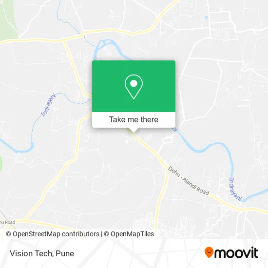
See Vision Tech, Pune & Velhe, on the map
Public Transit to Vision Tech in Pune & Velhe
Wondering how to get to Vision Tech in Pune & Velhe? Moovit helps you find the best way to get to Vision Tech with step-by-step directions from the nearest public transit station.
Moovit provides free maps and live directions to help you navigate through your city. View schedules, routes, timetables, and find out how long does it take to get to Vision Tech in real time.
Looking for the nearest stop or station to Vision Tech? Check out this list of stops closest to your destination: Talwade Jakat Naka.
Bus: 309, 314, 350, 330, 376A, 330C.
Want to see if there’s another route that gets you there at an earlier time? Moovit helps you find alternative routes or times. Get directions from and directions to Vision Tech easily from the Moovit App or Website.
We make riding to Vision Tech easy, which is why over 1.5 million users, including users in Pune & Velhe, trust Moovit as the best app for public transit. You don’t need to download an individual bus app or train app, Moovit is your all-in-one transit app that helps you find the best bus time or train time available.
For information on prices of bus, costs and ride fares to Vision Tech, please check the Moovit app.
Use the app to navigate to popular places including to the airport, hospital, stadium, grocery store, mall, coffee shop, school, college, and university.
Vision Tech Address: 3-VITTHAL Wadi Dehu Alandi Road हवेली 412109 MH street in Pune & Velhe
- Wonderland,
- Shri Kantilal V Kalokhe,
- Vinayak Steel Cement Agency,
- Hotel Sai Prasad,
- Tasty Kathi Kabab Rolls,
- Vinay Snack Centre,
- Vaishnavi Enterprises,
- Siddhgiri Enterprise,
- Shri Swami Samarth Washing Center,
- Hotel Anushka Pure Veg,
- Fresh Chicken & Mutton Center,
- Sairaj Traders,
- Hotel Janai,
- Shri Swami Samarth,
- Shiv Temple,
- Maharashtra Natural Gas,
- Hindustan Petroleum,
- Poonam Traders,
- Mauli Motors Denting,
- Ganraj Cement Industries
Places Near Vision Tech (Pune & Velhe)
- Pune Okayama Friendship Garden, Pune & Velhe,
- Dagadusheth Halwai Ganapati Temple, Pune & Velhe,
- Cognizant Deccan Campus (CDC), Paud,
- Ion Digital Zone, Pune & Velhe,
- Vishwakarma Institute Of Technology (Vit), Pune & Velhe,
- ISKCON Pune, Pune & Velhe,
- Laxmi Road, Pune & Velhe,
- BAPS Shri Swaminarayan Mandir, Pune & Velhe,
- Swaminarayan Mandir, Pune & Velhe,
- Westend Mall, Pune & Velhe,
- Dagdusheth Halwai Ganpati Mandir, Pune & Velhe,
- M G Road, Pune & Velhe,
- Pvr Icon - Pavilion Mall, Pune & Velhe,
- Symbiosis Lavale Bus Stop, Pune & Velhe,
- Sarasbaug, Pune & Velhe,
- Tulshibaug, Pune & Velhe,
- Senapati Bapat Road, Pune & Velhe,
- Chaturshringi Temple, Pune & Velhe,
- Fc Road, Pune & Velhe,
- ISKCON Nvcc Temple, Pune & Velhe
How to get to popular places in Pune with public transit
Get around Pune & Velhe by public transit!
Traveling around Pune & Velhe has never been so easy. See step by step directions as you travel to any attraction, street or major public transit station. View bus and train schedules, arrival times, service alerts and detailed routes on a map, so you know exactly how to get to anywhere in Pune & Velhe.
When traveling to any destination around Pune & Velhe use Moovit's Live Directions with Get Off Notifications to know exactly where and how far to walk, how long to wait for your line, and how many stops are left. Moovit will alert you when it's time to get off — no need to constantly re-check whether yours is the next stop.
Wondering how to use public transit in Pune & Velhe or how to pay for public transit in Pune & Velhe? Moovit public transit app can help you navigate your way with public transit easily, and at minimum cost. It includes public transit fees, ticket prices, and costs. Looking for a map of Pune & Velhe public transit lines? Moovit public transit app shows all public transit maps in Pune & Velhe with all Bus, Train and Metro routes and stops on an interactive map.
Pune has 3 transit type(s), including: Bus, Train and Metro, operated by several transit agencies, including Pune Metro (Maha Metro), PMPML, PMPML Night Bus Service (Ratrani) and Central Railways (Indian Railways)