How to get to Visual by bus?
Click on the bus route to see step by step directions with maps, line arrival times and updated time schedules.
From Le Marché de Sarcelles, Sarcelles
56 minFrom Marché, Sevran
54 minFrom Hôpital Robert Ballanger, Villepinte
51 minFrom Hopital De Gonesse, Gonesse
16 minFrom Le Bourget, Le Bourget
76 minFrom Coubron, Coubron
77 minFrom Gonesse, Gonesse
19 minFrom Aéroport du Bourget, Le Bourget
67 minFrom Villeparisis, Villeparisis
68 minFrom Sarcelles, Sarcelles
49 min
Bus stops near Visual in Roissy-En-France
Bus lines to Visual in Roissy-En-France
- 27, Roissypole - Aéroport Cdg1 (d2) - Puits La Marlière,VIEW
- 32, Victor Basch - Gare De Roissypole - Aéroport Cdg1 (g3),VIEW
- FILÉO GSV, Gare De Roissypole - Aéroport Cdg1 (g3) - Les Coteaux,VIEW
- FILÉO SAR, Gare De Roissypole - Aéroport Cdg1 (b4) - Gare De Sarcelles - Saint-Brice,VIEW
- FILÉO VLB, Puits La Marlière - Roissypole - Aéroport Cdg1 (d2),VIEW
- 9502, Gare de Sarcelles - Saint-Brice,VIEW
- EX 93, Gare de Roissypole - Aéroport Cdg 1 (D1),VIEW
- R111, Passerelle,VIEW
- R113, Lycée Léonard de Vinci,VIEW
- R106, Calvaire,VIEW
- 100, Gare de Persan - Beaumont,VIEW
- 350, Porte de la Chapelle,VIEW
- 351, Roissypôle,VIEW
- 9518, Gare de Cergy Préfecture - Quai B,VIEW
- 32 ZA, Gare de Goussainville,VIEW
- T'BUS 1, Roissypole - Aéroport Cdg1 (C2),VIEW
What are the closest stations to Visual?
The closest stations to Visual are:
- Airapolis is 25 meters away, 1 min walk.
- Chesneau is 146 meters away, 3 min walk.
- Entretien Nord is 854 meters away, 11 min walk.
Which bus lines stop near Visual?
These bus lines stop near Visual: 27, 9502, EX 93.
What’s the nearest bus station to Visual in Roissy-En-France?
The nearest bus station to Visual in Roissy-En-France is Airapolis. It’s a 1 min walk away.
What time is the first bus to Visual in Roissy-En-France?
The FILÉO VLB is the first bus that goes to Visual in Roissy-En-France. It stops nearby at 3:08 AM.
What time is the last bus to Visual in Roissy-En-France?
The FILÉO SAR is the last bus that goes to Visual in Roissy-En-France. It stops nearby at 3:42 AM.
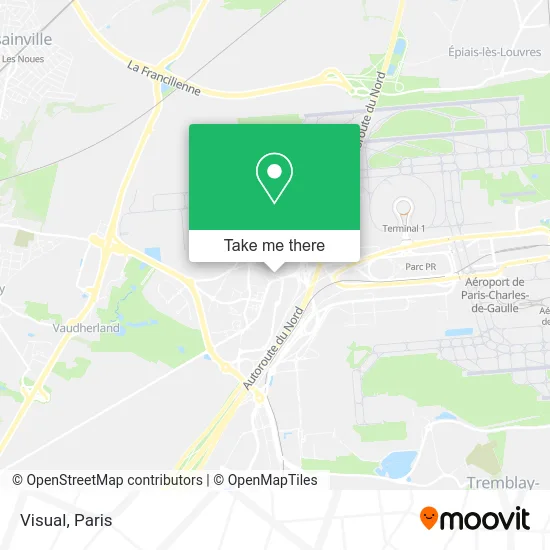
See Visual, Roissy-En-France, on the map
Public Transit to Visual in Roissy-En-France
Wondering how to get to Visual in Roissy-En-France? Moovit helps you find the best way to get to Visual with step-by-step directions from the nearest public transit station.
Moovit provides free maps and live directions to help you navigate through your city. View schedules, routes, timetables, and find out how long does it take to get to Visual in real time.
Looking for the nearest stop or station to Visual? Check out this list of stops closest to your destination: Airapolis; Chesneau; Entretien Nord.
Bus: 27, 9502, EX 93, 32, FILÉO GSV, FILÉO SAR, FILÉO VLB, R111, R113, R106, 100, 350, 351, 9518, 32 ZA.
Want to see if there’s another route that gets you there at an earlier time? Moovit helps you find alternative routes or times. Get directions from and directions to Visual easily from the Moovit App or Website.
We make riding to Visual easy, which is why over 1.5 million users, including users in Roissy-En-France, trust Moovit as the best app for public transit. You don’t need to download an individual bus app or train app, Moovit is your all-in-one transit app that helps you find the best bus time or train time available.
For information on prices of bus and RER, costs and ride fares to Visual, please check the Moovit app.
Use the app to navigate to popular places including to the airport, hospital, stadium, grocery store, mall, coffee shop, school, college, and university.
Visual Address: 6 Avenue Heinz Gloor 95700 Roissy-en-France street in Roissy-En-France
- Hampton by Hilton-Paris Charles de Gaulle Airport,
- Hotel ibis Styles Paris Roissy CDG,
- 2 Avenue Heinz Gloor,
- Pandora,
- Boulangerie Patisserie Gautier,
- Rond-Point de la Porte de France,
- Alis,
- Onet Airport Services - Roissy Cdg,
- Dimotrans,
- 73 Avenue Charles de Gaulle,
- M'Bar,
- Hôtel Millenium,
- Millennium Hotel Paris Charles de Gaulle,
- Zone Hôtelière,
- Hôtel Best Western Paris CDG Airport,
- Best Western Hotel Paris CDG Airport,
- gendarmerie roissy en france,
- Best Western PLUS,
- Best Western Plus Paris Roissy,
- Orangerie
Places Near Visual (Roissy-En-France)
- Hôpital Saint-Joseph, Paris,
- Institut Curie, Paris,
- Hôpital Necker, Paris,
- Hôpital Beaujon, Clichy,
- Théâtre Mogador, Paris,
- Hôpital Henri Mondor, Creteil,
- Hôpital Pitié Salpêtrière, Paris,
- Galeries Lafayette Haussmann, Paris,
- Hopital Foch, Suresnes,
- Marché Saint-Pierre, Paris,
- Hopital Lariboisière, Paris,
- Gare Routière Flixbus, Paris,
- Hôpital de la Pitié-Salpêtrière, Paris,
- Fondation Louis Vuitton, Paris,
- Centre Hospitalier des 15/20, Paris,
- Atelier Des Lumieres, Paris,
- Galeries Lafayette, Paris,
- Créteil Soleil, Creteil,
- Hôpital Cochin, Paris,
- 29 Rue Manin, Paris
How to get to popular places in Paris with public transit
Get around Roissy-En-France by public transit!
Traveling around Roissy-En-France has never been so easy. See step by step directions as you travel to any attraction, street or major public transit station. View bus and train schedules, arrival times, service alerts and detailed routes on a map, so you know exactly how to get to anywhere in Roissy-En-France.
When traveling to any destination around Roissy-En-France use Moovit's Live Directions with Get Off Notifications to know exactly where and how far to walk, how long to wait for your line, and how many stops are left. Moovit will alert you when it's time to get off — no need to constantly re-check whether yours is the next stop.
Wondering how to use public transit in Roissy-En-France or how to pay for public transit in Roissy-En-France? Moovit public transit app can help you navigate your way with public transit easily, and at minimum cost. It includes public transit fees, ticket prices, and costs. Looking for a map of Roissy-En-France public transit lines? Moovit public transit app shows all public transit maps in Roissy-En-France with all Bus, Train, Metro, Light Rail, RER, Funicular and Gondola routes and stops on an interactive map.
Paris has 7 transit type(s), including: Bus, Train, Metro, Light Rail, RER, Funicular and Gondola, operated by several transit agencies, including RATP, RER, RER Bus de remplacement, Train, Train Bus de remplacement, Tramway Bus de remplacement, TER, ADP, Magical Shuttle, Argenteuil - Boucles de Seine, Autocars Dominique, Bièvre, Brie et 2 Morin, Le Bus - C.C. du Clermontois and Cœur d’Essonne
Public transit lines with stations closest to Visual in Roissy-En-France
Bus lines with stations closest to Visual in Roissy-En-France
Airapolis
 27Roissypole - Aéroport Cdg1 (d2) - Puits La Marlière
- 32Victor Basch - Gare De Roissypole - Aéroport Cdg1 (g3)
- FILÉO GSVGare De Roissypole - Aéroport Cdg1 (g3) - Les Coteaux
- FILÉO SARGare De Roissypole - Aéroport Cdg1 (b4) - Gare De Sarcelles - Saint-Brice
- FILÉO VLBPuits La Marlière - Roissypole - Aéroport Cdg1 (d2)