Directions to Vital Records Control (Alleghany County) with public transportation
The following transit lines have routes that pass near Vital Records Control
 Bus: THE MOUNTAIN EXPRESS.
How to get to Vital Records Control by bus?
Click on the bus route to see step by step directions with maps, line arrival times and updated time schedules.
Bus stop near Vital Records Control in Alleghany County
- Low Moor Post Office, 2 min walk,VIEW
Bus lines to Vital Records Control in Alleghany County
- THE MOUNTAIN EXPRESS, Clifton Forge/ Iron Gate,VIEW
What are the closest stations to Vital Records Control?
The closest stations to Vital Records Control are:
- Low Moor Post Office is 92 yards away, 2 min walk.
Which bus line stops near Vital Records Control?
THE MOUNTAIN EXPRESS (Clifton Forge/ Iron Gate)
What’s the nearest bus station to Vital Records Control in Alleghany County?
The nearest bus station to Vital Records Control in Alleghany County is Low Moor Post Office. It’s a 2 min walk away.
What time is the first bus to Vital Records Control in Alleghany County?
The THE MOUNTAIN EXPRESS is the first bus that goes to Vital Records Control in Alleghany County. It stops nearby at 8:12 AM.
What time is the last bus to Vital Records Control in Alleghany County?
The THE MOUNTAIN EXPRESS is the last bus that goes to Vital Records Control in Alleghany County. It stops nearby at 4:47 PM.
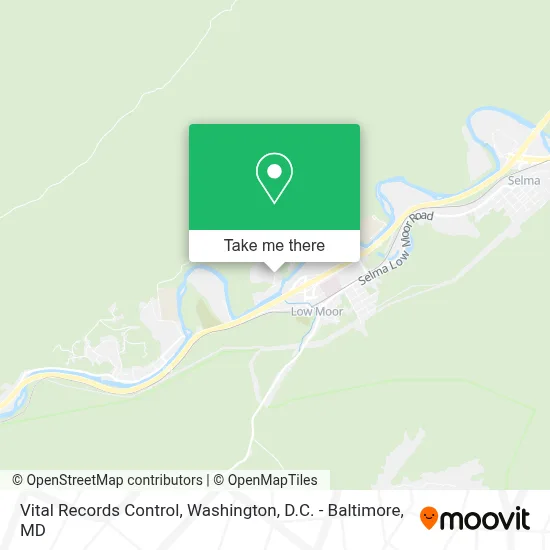
See Vital Records Control, Alleghany County, on the map
Public Transit to Vital Records Control in Alleghany County
Wondering how to get to Vital Records Control in Alleghany County? Moovit helps you find the best way to get to Vital Records Control with step-by-step directions from the nearest public transit station.
Moovit provides free maps and live directions to help you navigate through your city. View schedules, routes, timetables, and find out how long does it take to get to Vital Records Control in real time.
Looking for the nearest stop or station to Vital Records Control? Check out this list of stops closest to your destination: Low Moor Post Office.
Bus: THE MOUNTAIN EXPRESS.
Want to see if there’s another route that gets you there at an earlier time? Moovit helps you find alternative routes or times. Get directions from and directions to Vital Records Control easily from the Moovit App or Website.
We make riding to Vital Records Control easy, which is why over 1.7 million users, including users in Alleghany County, trust Moovit as the best app for public transit. You don’t need to download an individual bus app or train app, Moovit is your all-in-one transit app that helps you find the best bus time or train time available.
For information on prices of bus, costs and ride fares to Vital Records Control, please check the Moovit app.
Use the app to navigate to popular places including to the airport, hospital, stadium, grocery store, mall, coffee shop, school, college, and university.
Vital Records Control Address: 1000 Commerce Center Dr street in Alleghany County
- Suburban Propane,
- Bacova Guild Ltd.,
- Love's Travel Stops And Country Stores,
- Travelodge by Wyndham Low Moor Near Covington,
- Blue Rhino Propane Exchange,
- Alleghany County Governmental Complex,
- Western Union,
- Pig Iron Country Store & Bbq,
- Lowmoor Country Grill,
- Par Mar #229,
- Quiznos,
- Low Moor Presbyterian Church,
- Lewisgale Physicians Cardiology - Low Moor,
- Lewisgale Physicians Women's Health Specialists - Low Moor,
- Brian Center Rehabilitation And Nursing Care,
- Mount Carmel Cemetery,
- Alleghany County Parks And Recreation,
- Alleghany Highlands Economic Development Corporation,
- Low Moor,
- Jackson River Surgical Specialists
Places Near Vital Records Control (Alleghany County)
- Westfield Montgomery Mall, Montgomery County,
- Amazon Hq2, Arlington County,
- Sibley Memorial Hospital, Washington,
- Georgetown, Washington,
- The Anthem, Washington,
- Warner Theatre, Washington,
- National Theatre, Washington,
- Washington National Cathedral, Washington,
- Pennsylvania Ave NW (3rd st and pennsylvania), Washington,
- National Museum of African American History and Culture, Washington,
- Capital One Arena, Washington,
- M&T Bank Stadium, Baltimore,
- Washington DC VA Medical Center, Washington,
- Basilica of the National Shrine, Washington,
- Camden Yards, Baltimore,
- National Zoo, Washington,
- Marriott Marquis Washington, DC, Washington,
- Museum Of The Bible, Washington,
- PG Mall, Prince George's County,
- Rock Creek Tennis Center, Washington
How to get to popular places in Washington, D.C. - Baltimore, MD with public transit
Get around Alleghany County by public transit!
Traveling around Alleghany County has never been so easy. See step by step directions as you travel to any attraction, street or major public transit station. View bus and train schedules, arrival times, service alerts and detailed routes on a map, so you know exactly how to get to anywhere in Alleghany County.
When traveling to any destination around Alleghany County use Moovit's Live Directions with Get Off Notifications to know exactly where and how far to walk, how long to wait for your line, and how many stops are left. Moovit will alert you when it's time to get off — no need to constantly re-check whether yours is the next stop.
Wondering how to use public transit in Alleghany County or how to pay for public transit in Alleghany County? Moovit public transit app can help you navigate your way with public transit easily, and at minimum cost. It includes public transit fees, ticket prices, and costs. Looking for a map of Alleghany County public transit lines? Moovit public transit app shows all public transit maps in Alleghany County with all Bus, Train, Metro, Light Rail and Ferry routes and stops on an interactive map.
Washington, D.C. - Baltimore, MD has 5 transit type(s), including: Bus, Train, Metro, Light Rail and Ferry, operated by several transit agencies, including WMATA, Montgomery County Ride On, Fairfax Connector, TheBus, PRTC, DASH - Alexandria, Arlington Transit (ART), RTA of Central Maryland, MDOT MTA, MDOT MTA Light RailLink, MDOT MTA Commuter Bus, MDOT MTA Local Bus, FXBGO!, Virginia Railway Express (VRE) and MARC