How to get to Vitusvet by bus?
Click on the bus route to see step by step directions with maps, line arrival times and updated time schedules.
From Medstar Harbor Hospital, Baltimore
47 minFrom MVA Glen Burnie, Anne Arundel County
58 minFrom Franklin Square Dr (franklin hospital), Baltimore County
44 minFrom Coppin State University, Baltimore
52 minFrom Sinai Hospital, Baltimore
65 minFrom Hampden, Baltimore
48 minFrom Walmart Supercenter, Baltimore County
56 minFrom Amazon Fulfillment Center-DCA1, Baltimore County
40 minFrom Horseshoe Casino Baltimore, Baltimore
49 minFrom Medstar Franklin Square Medical Center, Baltimore County
41 min
Bus stops near Vitusvet in Baltimore
Ferry stations near Vitusvet in Baltimore
Metro station near Vitusvet in Baltimore
- Johns Hopkins Metro, 28 min walk,VIEW
Bus lines to Vitusvet in Baltimore
What are the closest stations to Vitusvet?
The closest stations to Vitusvet are:
- Clinton St & Boston St Sb is 163 yards away, 3 min walk.
- Hudson & Highland Wb is 390 yards away, 5 min walk.
- Maritime Park is 531 yards away, 7 min walk.
- O'Donnell St & Dean St is 757 yards away, 9 min walk.
- Pier Five is 1500 yards away, 18 min walk.
- Canton Waterfront Park is 1621 yards away, 20 min walk.
- Johns Hopkins Metro is 2310 yards away, 28 min walk.
Which bus lines stop near Vitusvet?
These bus lines stop near Vitusvet: 22, CITYLINK NAVY.
What’s the nearest metro station to Vitusvet in Baltimore?
The nearest metro station to Vitusvet in Baltimore is Johns Hopkins Metro. It’s a 28 min walk away.
What’s the nearest bus station to Vitusvet in Baltimore?
The nearest bus station to Vitusvet in Baltimore is Clinton St & Boston St Sb. It’s a 3 min walk away.
What’s the nearest ferry station to Vitusvet in Baltimore?
The nearest ferry station to Vitusvet in Baltimore is Maritime Park. It’s a 7 min walk away.
What time is the first metro to Vitusvet in Baltimore?
The METRO is the first metro that goes to Vitusvet in Baltimore. It stops nearby at 4:21 AM.
What time is the last metro to Vitusvet in Baltimore?
The METRO is the last metro that goes to Vitusvet in Baltimore. It stops nearby at 12:29 AM.
What time is the first bus to Vitusvet in Baltimore?
The 65 is the first bus that goes to Vitusvet in Baltimore. It stops nearby at 3:04 AM.
What time is the last bus to Vitusvet in Baltimore?
The CITYLINK NAVY is the last bus that goes to Vitusvet in Baltimore. It stops nearby at 3:19 AM.
What time is the first ferry to Vitusvet in Baltimore?
The HC2 is the first ferry that goes to Vitusvet in Baltimore. It stops nearby at 6:00 AM.
What time is the last ferry to Vitusvet in Baltimore?
The HC3 is the last ferry that goes to Vitusvet in Baltimore. It stops nearby at 8:07 PM.
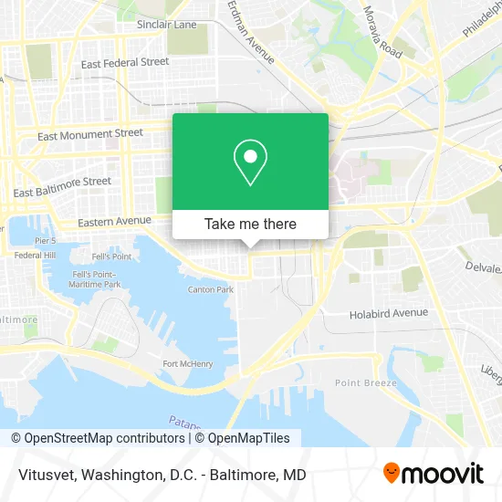
See Vitusvet, Baltimore, on the map
Public Transit to Vitusvet in Baltimore
Wondering how to get to Vitusvet in Baltimore? Moovit helps you find the best way to get to Vitusvet with step-by-step directions from the nearest public transit station.
Moovit provides free maps and live directions to help you navigate through your city. View schedules, routes, timetables, and find out how long does it take to get to Vitusvet in real time.
Looking for the nearest stop or station to Vitusvet? Check out this list of stops closest to your destination: Clinton St & Boston St Sb; Hudson & Highland Wb; Maritime Park; O'Donnell St & Dean St; Pier Five; Canton Waterfront Park; Johns Hopkins Metro.
Bus: 22, CITYLINK NAVY, 21, 65.Metro: METRO.Ferry: HC1, HC3.
Want to see if there’s another route that gets you there at an earlier time? Moovit helps you find alternative routes or times. Get directions from and directions to Vitusvet easily from the Moovit App or Website.
We make riding to Vitusvet easy, which is why over 1.7 million users, including users in Baltimore, trust Moovit as the best app for public transit. You don’t need to download an individual bus app or train app, Moovit is your all-in-one transit app that helps you find the best bus time or train time available.
For information on prices of bus, costs and ride fares to Vitusvet, please check the Moovit app.
Use the app to navigate to popular places including to the airport, hospital, stadium, grocery store, mall, coffee shop, school, college, and university.
Vitusvet Address: 3600 Odonnell St street in Baltimore
- Canton City of Baltimore MD USA,
- Canton, Maryland,
- Brewers Hill,
- Xfinity Store by Comcast,
- The Shops At Canton Crossing,
- Target Baltimore East,
- Blink Charging,
- Canton,
- Water Taxi Landing 16 - Canton Waterfront Park,
- Avam,
- Highlandtown,
- Tindeco Wharf Pool,
- BJ's Wholesale Club,
- Highlandtown Elementary / Middle School No. 215,
- I-895 Exit 11 (O'Donnell / Boston St),
- Ponca St and Boston St,
- Greektown,
- Constellation Energy Group,
- Hazlo International Foods,
- Haven St and E Lombard St
Places Near Vitusvet (Baltimore)
- National Theatre, Washington,
- Capital One Arena, Washington,
- Rock Creek Tennis Center, Washington,
- Westfield Montgomery Mall, Montgomery County,
- The Anthem, Washington,
- Pennsylvania Ave NW (3rd st and pennsylvania), Washington,
- Warner Theatre, Washington,
- Camden Yards, Baltimore,
- M&T Bank Stadium, Baltimore,
- PG Mall, Prince George's County,
- Georgetown, Washington,
- Museum Of The Bible, Washington,
- Marriott Marquis Washington, DC, Washington,
- Sibley Memorial Hospital, Washington,
- Amazon Hq2, Arlington County,
- National Zoo, Washington,
- National Museum of African American History and Culture, Washington,
- Washington DC VA Medical Center, Washington,
- Washington National Cathedral, Washington,
- Basilica of the National Shrine, Washington
How to get to popular places in Washington, D.C. - Baltimore, MD with public transit
Get around Baltimore by public transit!
Traveling around Baltimore has never been so easy. See step by step directions as you travel to any attraction, street or major public transit station. View bus and train schedules, arrival times, service alerts and detailed routes on a map, so you know exactly how to get to anywhere in Baltimore.
When traveling to any destination around Baltimore use Moovit's Live Directions with Get Off Notifications to know exactly where and how far to walk, how long to wait for your line, and how many stops are left. Moovit will alert you when it's time to get off — no need to constantly re-check whether yours is the next stop.
Wondering how to use public transit in Baltimore or how to pay for public transit in Baltimore? Moovit public transit app can help you navigate your way with public transit easily, and at minimum cost. It includes public transit fees, ticket prices, and costs. Looking for a map of Baltimore public transit lines? Moovit public transit app shows all public transit maps in Baltimore with all Bus, Train, Metro, Light Rail and Ferry routes and stops on an interactive map.
Washington, D.C. - Baltimore, MD has 5 transit type(s), including: Bus, Train, Metro, Light Rail and Ferry, operated by several transit agencies, including WMATA, Montgomery County Ride On, Fairfax Connector, TheBus, PRTC, DASH - Alexandria, Arlington Transit (ART), RTA of Central Maryland, MDOT MTA, MDOT MTA Light RailLink, MDOT MTA Commuter Bus, MDOT MTA Local Bus, FXBGO!, Virginia Railway Express (VRE) and MARC