How to get to Vk7 2000 Locadora by bus?
Click on the bus route to see step by step directions with maps, line arrival times and updated time schedules.
From Cemitério Parque da Paz, São Gonçalo
45 minFrom Campo de São Bento, Niterói
47 minFrom Supermercados Guanabara - São Gonçalo, São Gonçalo
33 minFrom Bairro de Fátima, Niterói
47 minFrom 770 - Itaipu x Candelária, Niterói
59 minFrom Avenida Roberto Silveira, Niterói
58 minFrom Alcântara, São Gonçalo
29 minFrom Alameda, Niterói
41 minFrom Hospital Estadual Azevedo Lima, Niterói
44 minFrom Rua Acadêmico Walter Gonçalves 1, Niterói
43 min
Bus stops near Vk7 2000 Locadora in São Gonçalo
Bus lines to Vk7 2000 Locadora in São Gonçalo
- 14C, Jardim Catarina - Shopping (Via Coroado / Visconde de Seabra),VIEW
- 20, Maria Rita - Alcântara,VIEW
- 35, Shopping - Alcântara (Via Av. Maricá),VIEW
- 42, Pontal - Alcantâra (Via Porto da Pedra),VIEW
- 526M, Antonina - Niterói (Via Porto da Pedra),VIEW
- 443, Boa Vista,VIEW
- 523, Praia Das Pedrinhas,VIEW
- 536, Niterói,VIEW
- 45, Shopping,VIEW
What are the closest stations to Vk7 2000 Locadora?
The closest stations to Vk7 2000 Locadora are:
- Rua Abílio José De Mattos, 2737 is 49 meters away, 1 min walk.
- Rua Abílio José De Mattos, 2314 is 125 meters away, 2 min walk.
- Rua Abílio José De Mattos, 3053 is 251 meters away, 4 min walk.
- Rua Alfredo Azamor, 2631 is 369 meters away, 5 min walk.
Which bus lines stop near Vk7 2000 Locadora?
These bus lines stop near Vk7 2000 Locadora: 20, 35, 443, 526M.
What’s the nearest bus station to Vk7 2000 Locadora in São Gonçalo?
The nearest bus station to Vk7 2000 Locadora in São Gonçalo is Rua Abílio José De Mattos, 2737. It’s a 1 min walk away.
What time is the first bus to Vk7 2000 Locadora in São Gonçalo?
The 536 is the first bus that goes to Vk7 2000 Locadora in São Gonçalo. It stops nearby at 3:38 AM.
What time is the last bus to Vk7 2000 Locadora in São Gonçalo?
The 536 is the last bus that goes to Vk7 2000 Locadora in São Gonçalo. It stops nearby at 2:43 AM.
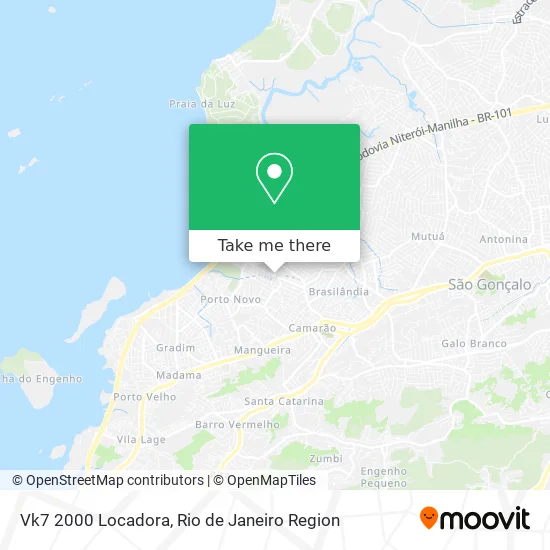
See Vk7 2000 Locadora, São Gonçalo, on the map
Public Transit to Vk7 2000 Locadora in São Gonçalo
Wondering how to get to Vk7 2000 Locadora in São Gonçalo? Moovit helps you find the best way to get to Vk7 2000 Locadora with step-by-step directions from the nearest public transit station.
Moovit provides free maps and live directions to help you navigate through your city. View schedules, routes, timetables, and find out how long does it take to get to Vk7 2000 Locadora in real time.
Looking for the nearest stop or station to Vk7 2000 Locadora? Check out this list of stops closest to your destination: Rua Abílio José De Mattos; Rua Abílio José De Mattos; Rua Abílio José De Mattos; Rua Alfredo Azamor.
Bus: 20, 35, 443, 526M, 14C, 42, 523, 536, 45.
Want to see if there’s another route that gets you there at an earlier time? Moovit helps you find alternative routes or times. Get directions from and directions to Vk7 2000 Locadora easily from the Moovit App or Website.
We make riding to Vk7 2000 Locadora easy, which is why over 1.5 million users, including users in São Gonçalo, trust Moovit as the best app for public transit. You don’t need to download an individual bus app or train app, Moovit is your all-in-one transit app that helps you find the best bus time or train time available.
For information on prices of bus, costs and ride fares to Vk7 2000 Locadora, please check the Moovit app.
Use the app to navigate to popular places including to the airport, hospital, stadium, grocery store, mall, coffee shop, school, college, and university.
Vk7 2000 Locadora Address: Rua Abílio José Mattos, 2398 Porto da Pedra São Gonçalo-RJ 24436-000 street in São Gonçalo
- 417 M- Manilha x Niterói,
- Casa Masullo Festas e Eventos,
- Avenida Governador Macedo Soares 1828,
- Posto De Saúde Barbosa Lima Sobrinho,
- Conjunto Habitacional Boa Vista,
- Rua Mossoró, 1921,
- Notícias Bairros Porto da Pedra,Porto Novo,Boa Vista,Gradim,
- ônibus linha 35 estrela,
- Banco Bradesco,
- Universidade Estácio De Sá - São Gonçalo,
- Curva do S - Porto Da Pedra,
- Rua Otávio Mafra Próximo ao 250,
- Av. São Gonçalo 100,
- Churrasquinho do Léo,
- Rejane Mathias,
- Rua Dona Rosa, 120,
- Rua Januário Piza,
- tamarilandia,
- Clube Tamarilândia II (Jamil Ferreira dos Santos),
- Rua Jurandir Moiano 356
Places Near Vk7 2000 Locadora (São Gonçalo)
- Rio De Janeiro,
- Feirão De Malhas, Duque De Caxias,
- Shopping Rio Sul, Botafogo,
- Hospital Federal Do Andaraí, Andaraí,
- Shopping Nova América, Del Castilho,
- Avenida Rio Branco, Centro,
- Praia do Arpoador, Ipanema,
- Shopping Downtown, Barra Da Tijuca,
- Avenida Venezuela 134, Saúde,
- Norte Shopping, Cachambi,
- Rodoviária Novo Rio (Rodoviária do Rio de Janeiro), Santo Cristo,
- Rua Ulysses Guimarães 16, Cidade Nova,
- Niterói, Niterói,
- Rua Licínio Cardoso, São Francisco Xavier,
- Museu Do Amanhã, Centro,
- Feira Livre da Gloria, Glória,
- Hospital Pedro Ernesto, Vila Isabel,
- Shopping RioSul, Botafogo,
- Hospital Municipal Ronaldo Gazolla, Acari,
- Hospital Federal Cardoso Fontes, Jacarepaguá
How to get to popular places in Rio de Janeiro Region with public transit
Get around São Gonçalo by public transit!
Traveling around São Gonçalo has never been so easy. See step by step directions as you travel to any attraction, street or major public transit station. View bus and train schedules, arrival times, service alerts and detailed routes on a map, so you know exactly how to get to anywhere in São Gonçalo.
When traveling to any destination around São Gonçalo use Moovit's Live Directions with Get Off Notifications to know exactly where and how far to walk, how long to wait for your line, and how many stops are left. Moovit will alert you when it's time to get off — no need to constantly re-check whether yours is the next stop.
Wondering how to use public transit in São Gonçalo or how to pay for public transit in São Gonçalo? Moovit public transit app can help you navigate your way with public transit easily, and at minimum cost. It includes public transit fees, ticket prices, and costs. Looking for a map of São Gonçalo public transit lines? Moovit public transit app shows all public transit maps in São Gonçalo with all Bus, Train, Metro, Light Rail, Ferry, Cable Car, Gondola and Funicular routes and stops on an interactive map.
Rio de Janeiro Region has 8 transit type(s), including: Bus, Train, Metro, Light Rail, Ferry, Cable Car, Gondola and Funicular, operated by several transit agencies, including TrensRJ, Metrô Rio, VLT Carioca, Barcas Rio, BRT MOBI-Rio, Auto Viação Alpha, Auto Viação Tijuca, Gire Transportes, Transurb, Viação Nossa Senhora das Graças, Consórcio INTERSUL, Braso Lisboa (Municipal), Caprichosa Auto Ônibus, Auto Viação Três Amigos and Rodoviária Âncora Matias