How to get to Voasomali by bus?
Click on the bus route to see step by step directions with maps, line arrival times and updated time schedules.
From Avalon Theatre, Washington
64 minFrom Quarterdeck, Arlington County
61 minFrom Tanger Outlets, Prince George's County
52 minFrom Knollwood, Washington
78 minFrom The Cheesecake Factory, Washington
61 minFrom Providence Hospital, Washington
71 minFrom Costco, Washington
63 minFrom Chinese Embassy Visa Section, Washington
37 minFrom Embassy Suites at the Chevy Chase Pavilion, Washington
61 minFrom Marcus Bles Building, Georgetown University, Washington
44 min
How to get to Voasomali by metro?
Click on the metro route to see step by step directions with maps, line arrival times and updated time schedules.
Bus stops near Voasomali in Washington
Metro stations near Voasomali in Washington
Bus lines to Voasomali in Washington
- 281, H ST & 4TH ST - Stone Ridge II,VIEW
- 481, H ST & 4TH ST - Leesburg P&R,VIEW
- 483, H ST & 4TH ST - Harmony Park and Ride,VIEW
- 484, H ST & 4TH ST - Harmony Park and Ride,VIEW
- 486, H ST & 4TH ST - Loudoun Gateway Metro Station,VIEW
- 230, 230/9 Annapolis,VIEW
- 250, 250/1 Washington Dc,VIEW
- 305, 305/3 Washington Dc,VIEW
- 315, 315/2 Washington Dc,VIEW
- 325, 325/6 Columbia,VIEW
- 335, 335/3 Washington Dc,VIEW
- 345, 345/2 Washington Dc,VIEW
- 630, 630/10 La Plata,VIEW
- 725, 725/1 Washington Dc,VIEW
- 735, 735/4 Washington Dc,VIEW
- 850, 850/2 Suitland / Washington Dc,VIEW
- 681, East Gate Via Stone Ridge II,VIEW
- 881, Loudoun Gateway,VIEW
- 883, Harmony,VIEW
- 884, Loudoun Gateway/Leesburg/Harmony,VIEW
What are the closest stations to Voasomali?
The closest stations to Voasomali are:
- Independence & 6th St is 140 yards away, 2 min walk.
- Independence Ave & 7&6 St SW Mid Eb is 145 yards away, 2 min walk.
- L'Enfant Plaza is 166 yards away, 3 min walk.
- 4th St & C St SW Sb is 268 yards away, 4 min walk.
- Independence St Ave & 6th St is 292 yards away, 4 min walk.
- D St Sw+6 St SW is 297 yards away, 4 min walk.
- Independence Av Sw+3 St SW is 454 yards away, 7 min walk.
- Judiciary Square is 505 yards away, 7 min walk.
- Independence Ave & 4th St SW Wb is 596 yards away, 8 min walk.
Which bus lines stop near Voasomali?
These bus lines stop near Voasomali: 610, D10, D1X.
Which metro lines stop near Voasomali?
These metro lines stop near Voasomali: BLUE, GREEN, ORANGE, SILVER, YELLOW.
What’s the nearest metro station to Voasomali in Washington?
The nearest metro station to Voasomali in Washington is L'Enfant Plaza. It’s a 3 min walk away.
What’s the nearest bus station to Voasomali in Washington?
The nearest bus stations to Voasomali in Washington are Independence & 6th St and Independence Ave & 7&6 St SW Mid Eb. The closest one is a 2 min walk away.
What time is the first metro to Voasomali in Washington?
The BLUE is the first metro that goes to Voasomali in Washington. It stops nearby at 5:14 AM.
What time is the last metro to Voasomali in Washington?
The GREEN is the last metro that goes to Voasomali in Washington. It stops nearby at 12:16 AM.
What time is the first train to Voasomali in Washington?
The MANASSAS LINE is the first train that goes to Voasomali in Washington. It stops nearby at 6:12 AM.
What time is the last train to Voasomali in Washington?
The MANASSAS LINE is the last train that goes to Voasomali in Washington. It stops nearby at 7:08 PM.
What time is the first bus to Voasomali in Washington?
The D10 is the first bus that goes to Voasomali in Washington. It stops nearby at 3:03 AM.
What time is the last bus to Voasomali in Washington?
The D50 is the last bus that goes to Voasomali in Washington. It stops nearby at 3:34 AM.
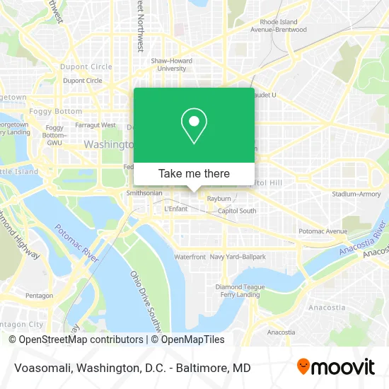
See Voasomali, Washington, on the map
Public Transit to Voasomali in Washington
Wondering how to get to Voasomali in Washington? Moovit helps you find the best way to get to Voasomali with step-by-step directions from the nearest public transit station.
Moovit provides free maps and live directions to help you navigate through your city. View schedules, routes, timetables, and find out how long does it take to get to Voasomali in real time.
Looking for the nearest stop or station to Voasomali? Check out this list of stops closest to your destination: Independence & 6th St; Independence Ave & 7&6 St SW Mid Eb; L'Enfant Plaza; 4th St & C St SW Sb; Independence St Ave & 6th St; D St Sw+6 St SW; Independence Av Sw+3 St SW; Judiciary Square; Independence Ave & 4th St SW Wb.
Bus: 610, D10, D1X, 281, 481, 483, 484, 486, 230, 250, 305, 315, 325, 735, 850, 681, 881, 883, 884, 885.Metro: BLUE, GREEN, ORANGE, SILVER, YELLOW, RED.
Want to see if there’s another route that gets you there at an earlier time? Moovit helps you find alternative routes or times. Get directions from and directions to Voasomali easily from the Moovit App or Website.
We make riding to Voasomali easy, which is why over 1.7 million users, including users in Washington, trust Moovit as the best app for public transit. You don’t need to download an individual bus app or train app, Moovit is your all-in-one transit app that helps you find the best bus time or train time available.
For information on prices of bus and metro, costs and ride fares to Voasomali, please check the Moovit app.
Use the app to navigate to popular places including to the airport, hospital, stadium, grocery store, mall, coffee shop, school, college, and university.
Voasomali Address: 330 Independence Ave SW street in Washington
- Wilbur J. Cohen Federal Building,
- Voice of America,
- Independence Ave & 4th / 3rd St SW Eb,
- Switzer Building - Department of Health And Human Services,
- 2353 Rayburn House Office Building,
- U.S. Department of Health and Human Services (HHS),
- Mary E. Switzer Building,
- Mary E Switzer Memorial Building,
- 3rd St SW Independence Ave,
- Mary E. Switzer Memorial Building (Switzer Nine Cafz),
- National Museum of the American Indian,
- Hubert H. Humphrey Building,
- Humphrey Cafe,
- McDonald's,
- Lyndon Baines Johnson Department of Education Building,
- Museum Of The Bible,
- Museo de la Biblia,
- Milk + Honey Café,
- Federal Center SW Metro Station,
- Fema Headquarters
Places Near Voasomali (Washington)
- Museum Of The Bible, Washington,
- Sibley Memorial Hospital, Washington,
- Warner Theatre, Washington,
- The Anthem, Washington,
- Basilica of the National Shrine, Washington,
- National Zoo, Washington,
- Marriott Marquis Washington, DC, Washington,
- National Museum of African American History and Culture, Washington,
- National Theatre, Washington,
- Washington National Cathedral, Washington,
- Pennsylvania Ave NW (3rd st and pennsylvania), Washington,
- M&T Bank Stadium, Baltimore,
- Westfield Montgomery Mall, Montgomery County,
- Camden Yards, Baltimore,
- PG Mall, Prince George's County,
- Washington DC VA Medical Center, Washington,
- Capital One Arena, Washington,
- Georgetown, Washington,
- Amazon Hq2, Arlington County,
- Rock Creek Tennis Center, Washington
How to get to popular places in Washington, D.C. - Baltimore, MD with public transit
Get around Washington by public transit!
Traveling around Washington has never been so easy. See step by step directions as you travel to any attraction, street or major public transit station. View bus and train schedules, arrival times, service alerts and detailed routes on a map, so you know exactly how to get to anywhere in Washington.
When traveling to any destination around Washington use Moovit's Live Directions with Get Off Notifications to know exactly where and how far to walk, how long to wait for your line, and how many stops are left. Moovit will alert you when it's time to get off — no need to constantly re-check whether yours is the next stop.
Wondering how to use public transit in Washington or how to pay for public transit in Washington? Moovit public transit app can help you navigate your way with public transit easily, and at minimum cost. It includes public transit fees, ticket prices, and costs. Looking for a map of Washington public transit lines? Moovit public transit app shows all public transit maps in Washington with all Bus, Train, Metro, Light Rail and Ferry routes and stops on an interactive map.
Washington, D.C. - Baltimore, MD has 5 transit type(s), including: Bus, Train, Metro, Light Rail and Ferry, operated by several transit agencies, including WMATA, Montgomery County Ride On, Fairfax Connector, TheBus, PRTC, DASH - Alexandria, Arlington Transit (ART), RTA of Central Maryland, MDOT MTA, MDOT MTA Light RailLink, MDOT MTA Commuter Bus, MDOT MTA Local Bus, FXBGO!, Virginia Railway Express (VRE) and MARC