How to get to Volta by bus?
Click on the bus route to see step by step directions with maps, line arrival times and updated time schedules.
From Tysons Galleria, Fairfax County
36 minFrom Liberty Crossing, Fairfax County
78 minFrom Thomas Jefferson High School for Science and Technology, Fairfax County
40 minFrom Cia Headquarters, Fairfax County
61 minFrom Freddie Mac, Fairfax County
38 minFrom McLean, Virginia, Fairfax County
74 minFrom Eden Center, Falls Church
47 minFrom Hilton McLean Tysons Corner, Fairfax County
38 minFrom Seven Corners Center (Seven Corners Shopping Center Falls Church VA), Fairfax County
49 minFrom EagleBank Arena, Fairfax County
38 min
How to get to Volta by metro?
Click on the metro route to see step by step directions with maps, line arrival times and updated time schedules.
From Tysons Galleria, Fairfax County
54 minFrom Liberty Crossing, Fairfax County
64 minFrom Freddie Mac, Fairfax County
72 minFrom Eden Center, Falls Church
53 minFrom Hilton McLean Tysons Corner, Fairfax County
66 minFrom Seven Corners Center (Seven Corners Shopping Center Falls Church VA), Fairfax County
58 min
Bus stops near Volta in Fairfax
Metro station near Volta in Fairfax
- Vienna Metro Station, 16 min walk,VIEW
Bus lines to Volta in Fairfax
What are the closest stations to Volta?
The closest stations to Volta are:
- Fairfax Blvd And Pickett Road is 93 yards away, 2 min walk.
- Pickett Rd+Arlington Bl is 254 yards away, 4 min walk.
- Blenheim Blvd at Scout (Nb) is 383 yards away, 5 min walk.
- Vienna Metro Station is 1342 yards away, 16 min walk.
Which bus lines stop near Volta?
These bus lines stop near Volta: F24, F50, F60, GOLD 1, GREEN 1, GREEN 2.
Which metro line stops near Volta?
ORANGE (Vienna)
What’s the nearest metro station to Volta in Fairfax?
The nearest metro station to Volta in Fairfax is Vienna Metro Station. It’s a 16 min walk away.
What’s the nearest bus station to Volta in Fairfax?
The nearest bus station to Volta in Fairfax is Fairfax Blvd And Pickett Road. It’s a 2 min walk away.
What time is the first metro to Volta in Fairfax?
The ORANGE is the first metro that goes to Volta in Fairfax. It stops nearby at 5:00 AM.
What time is the last metro to Volta in Fairfax?
The ORANGE is the last metro that goes to Volta in Fairfax. It stops nearby at 12:32 AM.
What time is the first bus to Volta in Fairfax?
The F60 is the first bus that goes to Volta in Fairfax. It stops nearby at 5:19 AM.
What time is the last bus to Volta in Fairfax?
The F24 is the last bus that goes to Volta in Fairfax. It stops nearby at 11:03 PM.
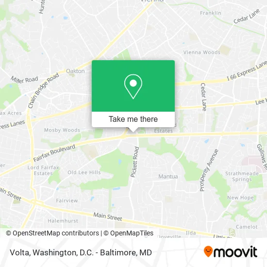
See Volta, Fairfax, on the map
Public Transit to Volta in Fairfax
Wondering how to get to Volta in Fairfax? Moovit helps you find the best way to get to Volta with step-by-step directions from the nearest public transit station.
Moovit provides free maps and live directions to help you navigate through your city. View schedules, routes, timetables, and find out how long does it take to get to Volta in real time.
Looking for the nearest stop or station to Volta? Check out this list of stops closest to your destination: Fairfax Blvd And Pickett Road; Pickett Rd+Arlington Bl; Blenheim Blvd at Scout (Nb); Vienna Metro Station.
Bus: F24, F50, F60, GOLD 1, GREEN 1, GREEN 2, GOLD 2.Metro: ORANGE.
Want to see if there’s another route that gets you there at an earlier time? Moovit helps you find alternative routes or times. Get directions from and directions to Volta easily from the Moovit App or Website.
We make riding to Volta easy, which is why over 1.5 million users, including users in Fairfax, trust Moovit as the best app for public transit. You don’t need to download an individual bus app or train app, Moovit is your all-in-one transit app that helps you find the best bus time or train time available.
For information on prices of bus and metro, costs and ride fares to Volta, please check the Moovit app.
Use the app to navigate to popular places including to the airport, hospital, stadium, grocery store, mall, coffee shop, school, college, and university.
Volta Address: 9410 Fairfax Blvd Fairfax, VA 22031 street in Fairfax
- Roots Natural Kitchen,
- PNC Bank,
- Coinstar,
- Giant Food,
- Allcare Primary & Immediate Care,
- Wolverine World Wide,
- Salon Lofts - Fairfax,
- Japanese Hair Straightening Salon,
- Starbucks,
- Pick US-50,
- Arlington Blvd and Blake Ln,
- Arlington Blvd Fai Blvd,
- Fairfax Blvd & Blake Ln,
- Arlington Blvd and Pick Rd,
- Highway 50,
- Blake US-50,
- Fairf VA-237,
- Fairf US-50,
- Pickett Rd and US-50,
- Fairfax Cross County Trail
Places Near Volta (Fairfax)
- National Mall, Washington,
- Georgetown, Washington,
- Warner Theatre, Washington,
- Sibley Memorial Hospital, Washington,
- Rock Creek Tennis Center, Washington,
- Camden Yards, Baltimore,
- PG Mall, Prince George's County,
- M&T Bank Stadium, Baltimore,
- Museum Of The Bible, Washington,
- Washington DC VA Medical Center, Washington,
- Westfield Montgomery Mall, Montgomery County,
- Amazon Hq2, Arlington County,
- Marriott Marquis Washington, DC, Washington,
- Basilica of the National Shrine, Washington,
- Capital One Arena, Washington,
- Washington National Cathedral, Washington,
- Pennsylvania Ave NW (3rd st and pennsylvania), Washington,
- National Zoo, Washington,
- National Museum of African American History and Culture, Washington,
- The Anthem, Washington
How to get to popular places in Washington, D.C. - Baltimore, MD with public transit
Get around Fairfax by public transit!
Traveling around Fairfax has never been so easy. See step by step directions as you travel to any attraction, street or major public transit station. View bus and train schedules, arrival times, service alerts and detailed routes on a map, so you know exactly how to get to anywhere in Fairfax.
When traveling to any destination around Fairfax use Moovit's Live Directions with Get Off Notifications to know exactly where and how far to walk, how long to wait for your line, and how many stops are left. Moovit will alert you when it's time to get off — no need to constantly re-check whether yours is the next stop.
Wondering how to use public transit in Fairfax or how to pay for public transit in Fairfax? Moovit public transit app can help you navigate your way with public transit easily, and at minimum cost. It includes public transit fees, ticket prices, and costs. Looking for a map of Fairfax public transit lines? Moovit public transit app shows all public transit maps in Fairfax with all Bus, Train, Metro, Light Rail and Ferry routes and stops on an interactive map.
Washington, D.C. - Baltimore, MD has 5 transit type(s), including: Bus, Train, Metro, Light Rail and Ferry, operated by several transit agencies, including WMATA, Montgomery County Ride On, Fairfax Connector, TheBus, PRTC, DASH - Alexandria, Arlington Transit (ART), RTA of Central Maryland, MDOT MTA, MDOT MTA Light RailLink, MDOT MTA Commuter Bus, MDOT MTA Local Bus, FXBGO!, Virginia Railway Express (VRE) and MARC