Directions to Voltz Coding (Almirante Tamandaré) with public transportation
The following transit lines have routes that pass near Voltz Coding
How to get to Voltz Coding by bus?
Click on the bus route to see step by step directions with maps, line arrival times and updated time schedules.
From Madalosso, Santa Felicidade
94 minFrom Rua XV de Novembro, Colombo
69 minFrom Mercês, Mercês
67 minFrom hospital das clínicas, Centro
55 minFrom COREN-PR, Centro
59 minFrom Restaurante Madalosso, Santa Felicidade
93 minFrom Rua Barão do Serro Azul 134, Centro
56 minFrom Hospital das nações, Jardim Social
59 minFrom Largo da Ordem, São Francisco
69 minFrom Capela Vaticano, São Francisco
63 min
Bus stops near Voltz Coding in Almirante Tamandaré
Bus lines to Voltz Coding in Almirante Tamandaré
- A17 SÃO JORGE / SÃO VENÂNCIO, Terminal Cachoeira ↺ São Venâncio (Circular),VIEW
- A05 MAD. CURITIBA / TAMANDARÉ (VIA GRAZIELA), Praça Rui Barbosa → Tamandaré,VIEW
- A12 JARDIM MONTE SANTO (VIA SÃO JORGE), Terminal Cachoeira → Jardim Monte Santo,VIEW
- A13 JARDIM MONTE SANTO, Terminal Cachoeira → Jardim Monte Santo ,VIEW
- A14 JARDIM GRAMADOS, Terminal Cachoeira ↺ Jardim Gramados (Circular),VIEW
- A18 TAMANDARÉ / CABRAL, Terminal Cabral → Terminal Tamandaré,VIEW
- A89 CACHOEIRA / CURITIBA (TAMANDARÉ / CABRAL), Terminal Tamandaré → Terminal Cabral (Ultima Viagem),VIEW
- A01 CACHOEIRA / CURITIBA (MOREIRA GARCEZ), Moreira Garcez → Terminal Cachoeira,VIEW
- I90 CACHOEIRA / MARACANÃ, Terminal Maracanã → Terminal Cachoeira,VIEW
What are the closest stations to Voltz Coding?
The closest stations to Voltz Coding are:
- Rua Stanislau Borowski, 550 is 164 meters away, 3 min walk.
- R. Antônio Johnson, 4850 is 843 meters away, 11 min walk.
- Av. Francisco Kruger, 5706 is 1236 meters away, 16 min walk.
Which bus lines stop near Voltz Coding?
These bus lines stop near Voltz Coding: A18 TAMANDARÉ / CABRAL, I90 CACHOEIRA / MARACANÃ.
What’s the nearest bus station to Voltz Coding in Almirante Tamandaré?
The nearest bus station to Voltz Coding in Almirante Tamandaré is Rua Stanislau Borowski, 550. It’s a 3 min walk away.
What time is the first bus to Voltz Coding in Almirante Tamandaré?
The A05 MAD. CURITIBA / TAMANDARÉ (VIA GRAZIELA) is the first bus that goes to Voltz Coding in Almirante Tamandaré. It stops nearby at 4:22 AM.
What time is the last bus to Voltz Coding in Almirante Tamandaré?
The A05 MAD. CURITIBA / TAMANDARÉ (VIA GRAZIELA) is the last bus that goes to Voltz Coding in Almirante Tamandaré. It stops nearby at 2:50 AM.
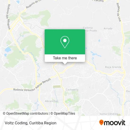
See Voltz Coding, Almirante Tamandaré, on the map
Public Transit to Voltz Coding in Almirante Tamandaré
Wondering how to get to Voltz Coding in Almirante Tamandaré? Moovit helps you find the best way to get to Voltz Coding with step-by-step directions from the nearest public transit station.
Moovit provides free maps and live directions to help you navigate through your city. View schedules, routes, timetables, and find out how long does it take to get to Voltz Coding in real time.
Looking for the nearest stop or station to Voltz Coding? Check out this list of stops closest to your destination: Rua Stanislau Borowski; R. Antônio Johnson; Av. Francisco Kruger.
Bus: A18 TAMANDARÉ / CABRAL, I90 CACHOEIRA / MARACANÃ, A17 SÃO JORGE / SÃO VENÂNCIO, A05 MAD. CURITIBA / TAMANDARÉ (VIA GRAZIELA), A12 JARDIM MONTE SANTO (VIA SÃO JORGE), A13 JARDIM MONTE SANTO, A14 JARDIM GRAMADOS, A01 CACHOEIRA / CURITIBA (MOREIRA GARCEZ).
Want to see if there’s another route that gets you there at an earlier time? Moovit helps you find alternative routes or times. Get directions from and directions to Voltz Coding easily from the Moovit App or Website.
We make riding to Voltz Coding easy, which is why over 1.5 million users, including users in Almirante Tamandaré, trust Moovit as the best app for public transit. You don’t need to download an individual bus app or train app, Moovit is your all-in-one transit app that helps you find the best bus time or train time available.
For information on prices of bus, costs and ride fares to Voltz Coding, please check the Moovit app.
Use the app to navigate to popular places including to the airport, hospital, stadium, grocery store, mall, coffee shop, school, college, and university.
Voltz Coding Address: Rua Nazílio Camargo, 107 Cachoeira Almirante Tamandaré-PR 83504-570 street in Almirante Tamandaré
- Talamini Construções,
- Rua Professora Mafalda Klapowsko 173,
- Mundialfire Equipamentos e Sistemas,
- Uapsf 1 São Venâncio,
- Reciclagem Garcia,
- Centro de Convivência Estrelar,
- Condominio Residencial Proenca I,
- Montana Condomínio Clube,
- Cei Mundo Verde,
- Rua Stanislau Borowski 832,
- Garagem do Acai,
- Wolvemech Mecânica Automotiva,
- Padaria Britos,
- Rua Maurício Rosemann 455,
- Windfall Language Institute,
- Condominio Verona,
- Construtora Mendes Soares,
- cemitério vaticano,
- Nova Supply - Suprimentos Empresariais.,
- Estofaria 2 Irmaos
Places Near Voltz Coding (Almirante Tamandaré)
- Parque Barigui, Mercês,
- Hospital de Clínicas (HC - UFPR), Centro,
- Hospital Madalena Sofia, Bairro Alto,
- Hospital Nossa Senhora Das Graças, Mercês,
- Jockey Plaza Shopping Center, Tarumã,
- Campo Largo, Campo,
- Arena Da Baixada - Curitiba,
- Hospital Angelina Caron, Campina Grande Do Sul,
- Hhhhh, Fazendinha,
- Hospital Universitário Evangélico de Curitiba, Bigorrilho,
- Shopping Estação, Rebouças,
- Jardim Botânico de Curitiba PR, Centro,
- Hospital Erasto Gaertner, Jardim Das Américas,
- Rua Martim Afonso 558, Mercês,
- Pontifícia Universidade Católica do Paraná (PUCPR), Prado Velho,
- Shopping Palladium, Portão,
- Hospital do Rocio, Campo,
- Park Shopping Barigüi, Mossunguê,
- Hospital Da Cruz Vermelha, Batel,
- Rua General Mário Tourinho, Campina Do Siqueira
How to get to popular places in Curitiba Region with public transit
Get around Almirante Tamandaré by public transit!
Traveling around Almirante Tamandaré has never been so easy. See step by step directions as you travel to any attraction, street or major public transit station. View bus and train schedules, arrival times, service alerts and detailed routes on a map, so you know exactly how to get to anywhere in Almirante Tamandaré.
When traveling to any destination around Almirante Tamandaré use Moovit's Live Directions with Get Off Notifications to know exactly where and how far to walk, how long to wait for your line, and how many stops are left. Moovit will alert you when it's time to get off — no need to constantly re-check whether yours is the next stop.
Wondering how to use public transit in Almirante Tamandaré or how to pay for public transit in Almirante Tamandaré? Moovit public transit app can help you navigate your way with public transit easily, and at minimum cost. It includes public transit fees, ticket prices, and costs. Looking for a map of Almirante Tamandaré public transit lines? Moovit public transit app shows all public transit maps in Almirante Tamandaré with all Bus and Cable Car routes and stops on an interactive map.
Curitiba Region has 2 transit type(s), including: Bus and Cable Car, operated by several transit agencies, including Sistema Integrado de Mobilidade (URBS), Sistema Integrado de Mobilidade (AMEP), URBS (Cartões bancários e Dinheiro), URBS (Cartões bancários / Cartão URBS), AMEP (Cartões bancários / Cartão MetroCard), AMEP (Cartões bancários / Cartão MetroCard / Dinheiro), Viação Colombo (Dinheiro), TRIAR (Cartão TRIAR / Dinheiro), Empresa Curitiba Cerro Azul (Dinheiro), Expresso Nossa Senhora da Penha (Dinheiro), Empresa Campo Alto Tijucas (Dinheiro), Auto Viação São José (Cartão VEM / Dinheiro), BRT S/A (Cartão VEM / Dinheiro), TransPiedade (Cartão Cidadão / Dinheiro) and Oceânica Sul (Cartão Transporte / Dinheiro)