How to get to WESTERN UNION by bus?
Click on the bus route to see step by step directions with maps, line arrival times and updated time schedules.
From Av Eugenio Garza Sada, Aguascalientes
44 minFrom El Llano, Aguascalientes
50 minFrom Colosio, Aguascalientes
49 minFrom Amway, Aguascalientes
38 minFrom Trojes de San Cristobal, Aguascalientes
55 minFrom Tec De Monterrey Campus Aguascalientes, Aguascalientes
48 minFrom Plaza Cuatro Hojas, Aguascalientes
50 minFrom El Cobano, Aguascalientes
42 minFrom Fraccionamiento Puesta del Sol, Aguascalientes
51 minFrom Tercer Anillo, Aguascalientes
36 min
Bus stops near WESTERN UNION in Aguascalientes
Bus lines to WESTERN UNION in Aguascalientes
What are the closest stations to WESTERN UNION?
The closest stations to WESTERN UNION are:
- Avenida Héroe De Nacozari, 2301 is 85 meters away, 2 min walk.
- Aguascalientes Sur, 405b is 630 meters away, 8 min walk.
- Avenida Aguascalientes Sur, 502 is 687 meters away, 9 min walk.
- Avenida Héroe De Nacozari, 1809(1810) is 817 meters away, 11 min walk.
Which bus lines stop near WESTERN UNION?
These bus lines stop near WESTERN UNION: RUTA 28, RUTA 37.
What’s the nearest bus station to WESTERN UNION in Aguascalientes?
The nearest bus station to WESTERN UNION in Aguascalientes is Avenida Héroe De Nacozari, 2301. It’s a 2 min walk away.
What time is the first bus to WESTERN UNION in Aguascalientes?
The RUTA 40 is the first bus that goes to WESTERN UNION in Aguascalientes. It stops nearby at 5:57 AM.
What time is the last bus to WESTERN UNION in Aguascalientes?
The RUTA 07 is the last bus that goes to WESTERN UNION in Aguascalientes. It stops nearby at 10:56 PM.
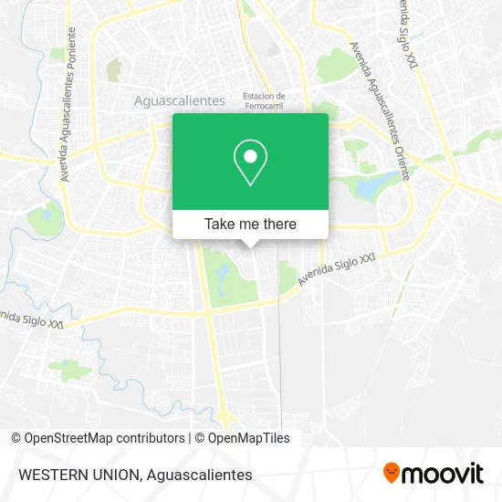
See WESTERN UNION, Aguascalientes, on the map
Public Transit to WESTERN UNION in Aguascalientes
Wondering how to get to WESTERN UNION in Aguascalientes? Moovit helps you find the best way to get to WESTERN UNION with step-by-step directions from the nearest public transit station.
Moovit provides free maps and live directions to help you navigate through your city. View schedules, routes, timetables, and find out how long does it take to get to WESTERN UNION in real time.
Looking for the nearest stop or station to WESTERN UNION? Check out this list of stops closest to your destination: Avenida Héroe De Nacozari; Aguascalientes Sur; Avenida Aguascalientes Sur; Avenida Héroe De Nacozari.
Bus: RUTA 28, RUTA 37, RUTA 42, RUTA 02, RUTA 40, RUTA 40, RUTA 07.
Want to see if there’s another route that gets you there at an earlier time? Moovit helps you find alternative routes or times. Get directions from and directions to WESTERN UNION easily from the Moovit App or Website.
We make riding to WESTERN UNION easy, which is why over 1.5 million users, including users in Aguascalientes, trust Moovit as the best app for public transit. You don’t need to download an individual bus app or train app, Moovit is your all-in-one transit app that helps you find the best bus time or train time available.
For information on prices of bus, costs and ride fares to WESTERN UNION, please check the Moovit app.
Use the app to navigate to popular places including to the airport, hospital, stadium, grocery store, mall, coffee shop, school, college, and university.
WESTERN UNION Address: Avenida Héroe de Nacozari Sur 2401, Fraccionamiento Jardines del Parque, 20276 Aguascalientes, Agua street in Aguascalientes
- MoneyGram,
- Inegi Agu,
- Chascas Los Tres Hermanos,
- Carnes Selectas El Encino - Inegi,
- Little Caesars Pizza,
- Little Caesars,
- Gorditas,
- Asadero Bar La Carnicería,
- Asadero Angus Beef Inegi,
- Chocos Y Tortas Santa Anita,
- Preparatoria Politécnica,
- La Chicharronería de Casa Ortega,
- Bacano Social Club,
- Leyendas Karaoke Bar,
- Condominio Rinconada del Parque,
- Comercial Vazquez Montalvo SA de CV,
- Fraccionamiento Jardines del Parque,
- Restaurante Las Delicias,
- Banamex Sec Inegi Sede,
- Jardín del Inegi
Places Near WESTERN UNION (Aguascalientes)
- Centro Comercial Altaria, Aguascalientes,
- Agropecuario, Aguascalientes,
- Blvd. Luis Donaldo Colosio, Aguascalientes,
- Hospital Imss No. 3, Aguascalientes,
- Aeropuerto de Aguascalientes S.A. de C.V., Aguascalientes,
- Universidad Autónoma de Aguascalientes, Aguascalientes,
- Ciudad industrial, Aguascalientes,
- Jesús María, Aguascalientes,
- Central De Autobuses, Aguascalientes,
- clinica 3 uaa, Aguascalientes,
- Villas de Nuestra Señora de la Asunción, Aguascalientes,
- Imss Clinica 1, Aguascalientes,
- Terminal De Combis, Aguascalientes,
- Villasuncion, Aguascalientes,
- ESPACIOS, Aguascalientes,
- Nuevo Hospital Hidalgo, Aguascalientes,
- La Isla San Marcos, Aguascalientes,
- Parque Las Tres Centurias, Aguascalientes,
- Centro, Aguascalientes,
- Isla San Marcos, Aguascalientes
How to get to popular places in Aguascalientes with public transit
Get around Aguascalientes by public transit!
Traveling around Aguascalientes has never been so easy. See step by step directions as you travel to any attraction, street or major public transit station. View bus and train schedules, arrival times, service alerts and detailed routes on a map, so you know exactly how to get to anywhere in Aguascalientes.
When traveling to any destination around Aguascalientes use Moovit's Live Directions with Get Off Notifications to know exactly where and how far to walk, how long to wait for your line, and how many stops are left. Moovit will alert you when it's time to get off — no need to constantly re-check whether yours is the next stop.
Wondering how to use public transit in Aguascalientes or how to pay for public transit in Aguascalientes? Moovit public transit app can help you navigate your way with public transit easily, and at minimum cost. It includes public transit fees, ticket prices, and costs. Looking for a map of Aguascalientes public transit lines? Moovit public transit app shows all public transit maps in Aguascalientes with all bus routes and stops on an interactive map.
Aguascalientes has 1 transit type(s), including: bus, operated by several transit agencies, including Coordinación General de Movilidad