How to get to WESTERN UNION by bus?
Click on the bus route to see step by step directions with maps, line arrival times and updated time schedules.
From José López Portillo, Aguascalientes
32 minFrom ATUSA, Aguascalientes
41 minFrom Avenida Josemaría Escrivá de Balaguer 101, Aguascalientes
66 minFrom Universidad Panamericana Bonaterra, Aguascalientes
66 minFrom Av.Valle de Los Romeros, Aguascalientes
36 minFrom El Picacho, Aguascalientes
33 minFrom Fraccionamiento Sol Naciente, Aguascalientes
62 minFrom Fundadores, Aguascalientes
55 minFrom Fracc. Fuentes del Lago, Aguascalientes
47 minFrom Jardines de las Palmas Bjx, Aguascalientes
56 min
Bus stops near WESTERN UNION in Aguascalientes
Bus lines to WESTERN UNION in Aguascalientes
- RUTA 19, Vistas De Oriente,VIEW
- RUTA 28, Jesús María,VIEW
- RUTA 30, Martínez Dóminguez,VIEW
- RUTA 40, Terminal Oriente - Terminal Oriente (S),VIEW
- RUTA 18, Uaa,VIEW
- RUTA 35, Uaa,VIEW
- RUTA 45, Valle De Los Cactus - Uaa,VIEW
- RUTA 40, Terminal Oriente - Terminal Oriente (N),VIEW
- RUTA 04, Jesús María - Mahatma Gandhi,VIEW
- RUTA 11, Mahatma Gandhi - Chichimeco,VIEW
- RUTA 33, Jesús María - Mahatma Gandhi,VIEW
- RUTA 38, Vicente Guerrero - Paso Blanco,VIEW
What are the closest stations to WESTERN UNION?
The closest stations to WESTERN UNION are:
- Avenida Aguascalientes Poniente, 139 is 133 meters away, 2 min walk.
- Uaa Segundo Anillo is 173 meters away, 3 min walk.
- Unidad Deportiva Universitaria Uaa is 405 meters away, 6 min walk.
- Avenida Universidad, 2023(739) is 909 meters away, 12 min walk.
Which bus lines stop near WESTERN UNION?
These bus lines stop near WESTERN UNION: RUTA 28, RUTA 30, RUTA 40.
What’s the nearest bus station to WESTERN UNION in Aguascalientes?
The nearest bus station to WESTERN UNION in Aguascalientes is Avenida Aguascalientes Poniente, 139. It’s a 2 min walk away.
What time is the first bus to WESTERN UNION in Aguascalientes?
The RUTA 40 is the first bus that goes to WESTERN UNION in Aguascalientes. It stops nearby at 6:08 AM.
What time is the last bus to WESTERN UNION in Aguascalientes?
The RUTA 45 is the last bus that goes to WESTERN UNION in Aguascalientes. It stops nearby at 10:10 PM.
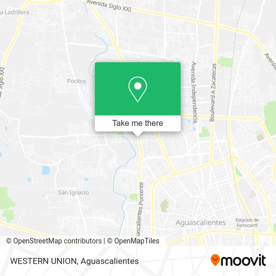
See WESTERN UNION, Aguascalientes, on the map
Public Transit to WESTERN UNION in Aguascalientes
Wondering how to get to WESTERN UNION in Aguascalientes? Moovit helps you find the best way to get to WESTERN UNION with step-by-step directions from the nearest public transit station.
Moovit provides free maps and live directions to help you navigate through your city. View schedules, routes, timetables, and find out how long does it take to get to WESTERN UNION in real time.
Looking for the nearest stop or station to WESTERN UNION? Check out this list of stops closest to your destination: Avenida Aguascalientes Poniente; Uaa Segundo Anillo; Unidad Deportiva Universitaria Uaa; Avenida Universidad.
Bus: RUTA 28, RUTA 30, RUTA 40, RUTA 19, RUTA 18, RUTA 35, RUTA 45, RUTA 04, RUTA 11, RUTA 33, RUTA 38.
Want to see if there’s another route that gets you there at an earlier time? Moovit helps you find alternative routes or times. Get directions from and directions to WESTERN UNION easily from the Moovit App or Website.
We make riding to WESTERN UNION easy, which is why over 1.5 million users, including users in Aguascalientes, trust Moovit as the best app for public transit. You don’t need to download an individual bus app or train app, Moovit is your all-in-one transit app that helps you find the best bus time or train time available.
For information on prices of bus, costs and ride fares to WESTERN UNION, please check the Moovit app.
Use the app to navigate to popular places including to the airport, hospital, stadium, grocery store, mall, coffee shop, school, college, and university.
WESTERN UNION Address: Primo Verdad, 20130 Aguascalientes, Aguascalientes street in Aguascalientes
- Centro Educativo Termapolis,
- Los Perales,
- Little Caesars Pizza,
- Seguros Banorte Generali,
- Muebles Esepcionales Exel,
- Exell Home Boutique,
- Fester,
- Bach Artes y Humanidades,
- Prepa Marsella Campus I,
- Federal Emiliano Zapata,
- Templo San Pio X,
- Decoves Persianas y Cortinas,
- Fisiotodo Aguascalientes,
- Kinder,
- Col. Primo Verdad,
- Pádel 3015,
- Preparatoria Marsella,
- Distribuidora Rey Gar,
- Iglesia de San Pio X,
- Restaurante los Cantaros
Places Near WESTERN UNION (Aguascalientes)
- Villas de Nuestra Señora de la Asunción, Aguascalientes,
- La Isla San Marcos, Aguascalientes,
- Isla San Marcos, Aguascalientes,
- Agropecuario, Aguascalientes,
- Blvd. Luis Donaldo Colosio, Aguascalientes,
- Universidad Autónoma de Aguascalientes, Aguascalientes,
- Jesús María, Aguascalientes,
- Aeropuerto de Aguascalientes S.A. de C.V., Aguascalientes,
- Villasuncion, Aguascalientes,
- Hospital Imss No. 3, Aguascalientes,
- ESPACIOS, Aguascalientes,
- Nuevo Hospital Hidalgo, Aguascalientes,
- Imss Clinica 1, Aguascalientes,
- Terminal De Combis, Aguascalientes,
- Parque Las Tres Centurias, Aguascalientes,
- Centro, Aguascalientes,
- clinica 3 uaa, Aguascalientes,
- Ciudad industrial, Aguascalientes,
- Centro Comercial Altaria, Aguascalientes,
- Central De Autobuses, Aguascalientes
How to get to popular places in Aguascalientes with public transit
Get around Aguascalientes by public transit!
Traveling around Aguascalientes has never been so easy. See step by step directions as you travel to any attraction, street or major public transit station. View bus and train schedules, arrival times, service alerts and detailed routes on a map, so you know exactly how to get to anywhere in Aguascalientes.
When traveling to any destination around Aguascalientes use Moovit's Live Directions with Get Off Notifications to know exactly where and how far to walk, how long to wait for your line, and how many stops are left. Moovit will alert you when it's time to get off — no need to constantly re-check whether yours is the next stop.
Wondering how to use public transit in Aguascalientes or how to pay for public transit in Aguascalientes? Moovit public transit app can help you navigate your way with public transit easily, and at minimum cost. It includes public transit fees, ticket prices, and costs. Looking for a map of Aguascalientes public transit lines? Moovit public transit app shows all public transit maps in Aguascalientes with all bus routes and stops on an interactive map.
Aguascalientes has 1 transit type(s), including: bus, operated by several transit agencies, including Coordinación General de Movilidad