How to get to WESTERN UNION by bus?
Click on the bus route to see step by step directions with maps, line arrival times and updated time schedules.
From CERCA AL OVALO INFANTAS, Los Olivos
40 minFrom Jr. Andahuaylas, Lima
45 minFrom Corpac, San Isidro
62 minFrom Tomas Marsano, Surquillo
46 minFrom Mala al Sur de Lima, Miraflores
44 minFrom Scarlet Night Club, Los Olivos
45 minFrom AV CESAR VALLEJO, Lince
46 minFrom hospital cayetano heredia, San Martin
40 minFrom Estación Caja De Agua, San Juan D
48 minFrom Av. Canadá, La Victori
45 min
Bus stops near WESTERN UNION in Ventanilla
Bus lines to WESTERN UNION in Ventanilla
- 1030, Canta Callao (San Martin De Porres) - San Diego (San Martin De Porres),VIEW
- 1163, Santa Margarita (Ventanilla) - Jockey Plaza (Surco),VIEW
- 1203, Portón (San Juan De Lurigancho) - Plaza Norte (San Martin De Porres) - Portón (San Juan De Lurigancho),VIEW
- 1223, Sarita Colonia (Callao) - Ceres (Ate),VIEW
- 1275, Upc (Santiago De Surco) - Oquendo (San Martín De Porres),VIEW
- 1276, Puente Benavides (Surco),VIEW
- 1286, San Diego (S.M. Porres) - Mariategui (S.J. Lurigancho),VIEW
- 1291, Ventanilla - Chorrillos,VIEW
- 1293, José Gálvez (Pachacamac) - Mi Perú (Ventanilla),VIEW
- 1300, San Juan De Lurigancho - Ventanilla,VIEW
- 1316, Pachacútec/Mi Perú (Ventanilla) - Mariátegui (San Juan de Lurigancho),VIEW
- 1435, Minka (Callao) - Torre Blanca (Carabayllo),VIEW
- 1442, Pachacútec (Ventanilla) - La Marina (San Miguel),VIEW
- 1482, Chorrillos - S.M.P.,VIEW
- 1491, Puente Benavides (Surco) - Pacasmayo (Callao),VIEW
- CR16, San Miguel - Ventanilla,VIEW
- CR34, San Miguel - Comas,VIEW
- CR35, Ventanilla - San Miguel,VIEW
- CR42, Ovalo La Perla (La Perla) - Payet (Independencia),VIEW
- CR43, Ventanilla - Carabayllo,VIEW
What are the closest stations to WESTERN UNION?
The closest stations to WESTERN UNION are:
- San José is 134 meters away, 3 min walk.
- Venezuela is 388 meters away, 6 min walk.
- Venezuela / Faucett is 471 meters away, 7 min walk.
- Colonial is 608 meters away, 9 min walk.
- Faucett is 631 meters away, 9 min walk.
Which bus lines stop near WESTERN UNION?
These bus lines stop near WESTERN UNION: 1203, 1275, 1276, 1293, 1300, CR43.
What’s the nearest bus station to WESTERN UNION in Ventanilla?
The nearest bus station to WESTERN UNION in Ventanilla is San José. It’s a 3 min walk away.
What time is the first bus to WESTERN UNION in Ventanilla?
The 1319 is the first bus that goes to WESTERN UNION in Ventanilla. It stops nearby at 3:00 AM.
What time is the last bus to WESTERN UNION in Ventanilla?
The 1319 is the last bus that goes to WESTERN UNION in Ventanilla. It stops nearby at 4:46 AM.
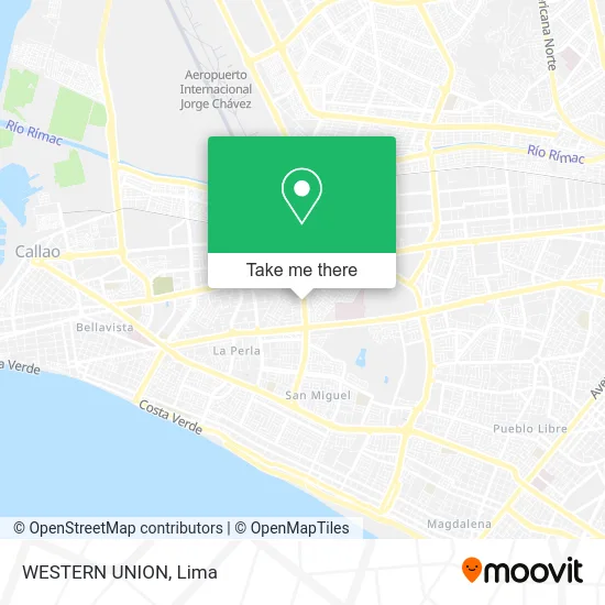
See WESTERN UNION, Ventanilla, on the map
Public Transit to WESTERN UNION in Ventanilla
Wondering how to get to WESTERN UNION in Ventanilla? Moovit helps you find the best way to get to WESTERN UNION with step-by-step directions from the nearest public transit station.
Moovit provides free maps and live directions to help you navigate through your city. View schedules, routes, timetables, and find out how long does it take to get to WESTERN UNION in real time.
Looking for the nearest stop or station to WESTERN UNION? Check out this list of stops closest to your destination: San José; Venezuela; Venezuela / Faucett; Colonial; Faucett.
Bus: 1203, 1275, 1276, 1293, 1300, CR43, 1030, 1163, 1223, 1138, 1173, 1429, IM31, 1219 SX, 1007, 1218, 1234, 1319, 1448, 1445, CR09, IM08, OM39.
Want to see if there’s another route that gets you there at an earlier time? Moovit helps you find alternative routes or times. Get directions from and directions to WESTERN UNION easily from the Moovit App or Website.
We make riding to WESTERN UNION easy, which is why over 1.5 million users, including users in Ventanilla, trust Moovit as the best app for public transit. You don’t need to download an individual bus app or train app, Moovit is your all-in-one transit app that helps you find the best bus time or train time available.
For information on prices of bus, costs and ride fares to WESTERN UNION, please check the Moovit app.
Use the app to navigate to popular places including to the airport, hospital, stadium, grocery store, mall, coffee shop, school, college, and university.
WESTERN UNION Address: Avenida Elmer Faucett 1859 El Águila, 07011 Bellavista street in Ventanilla
- Air Facility Wholesale,
- José Galvez Bellavista,
- Jm Design,
- Faucett Suite,
- LOS EUCALIPTOS 489 URB VIRU BELLAVISTA,
- Av Elmer Faucett Alt. San José,
- El Hurón Azul Bellavista,
- Cuadra 3 de Faucett,
- Omega Power SAC,
- Avenida los Eucaliptos,
- Lavanderia Flash,
- Parque Los Juegos,
- Parque Zona 2 Madre Selva,
- Jiron LAS GAVIOTAS BELLAVISTA,
- Imperio Tanpu Q Hotels,
- Constructoras-Claussen Constructors S.A.C,
- Avenida Elmer Faucett 2879,
- Notaria Campos,
- Clínica Bellavista,
- Paviferia San Fernando
Places Near WESTERN UNION (Ventanilla)
- Jockey Plaza, Santiago D,
- Mall Del Sur,
- Circuito Mágico Del Agua, Lima,
- Real Plaza Puruchuco, Ate,
- Hospital Edgardo Rebagliati Martins, Jesus Mari,
- Pontificia Universidad Católica del Perú - PUCP, San Miguel,
- av arequipa, Lima,
- Barranco, Barranco,
- Parque de las Leyendas, San Miguel,
- Miraflores, Miraflores,
- Plaza San Miguel, San Miguel,
- Aeropuerto Internacional Jorge Chávez, Ventanilla,
- Larcomar, Miraflores,
- Av. La Marina, San Miguel,
- Gamarra,
- Paradero Av.Brasil,
- Av. Salaverry, Jesus Mari,
- Av. Abancay, Lima,
- Centro Comercial Plaza Norte, Independen,
- Parque Kennedy, Miraflores
How to get to popular places in Lima with public transit
Get around Ventanilla by public transit!
Traveling around Ventanilla has never been so easy. See step by step directions as you travel to any attraction, street or major public transit station. View bus and train schedules, arrival times, service alerts and detailed routes on a map, so you know exactly how to get to anywhere in Ventanilla.
When traveling to any destination around Ventanilla use Moovit's Live Directions with Get Off Notifications to know exactly where and how far to walk, how long to wait for your line, and how many stops are left. Moovit will alert you when it's time to get off — no need to constantly re-check whether yours is the next stop.
Wondering how to use public transit in Ventanilla or how to pay for public transit in Ventanilla? Moovit public transit app can help you navigate your way with public transit easily, and at minimum cost. It includes public transit fees, ticket prices, and costs. Looking for a map of Ventanilla public transit lines? Moovit public transit app shows all public transit maps in Ventanilla with all Bus, Metro and Ferry routes and stops on an interactive map.
Lima has 3 transit type(s), including: Bus, Metro and Ferry, operated by several transit agencies, including Metro de Lima Línea 2 , Metro de Lima, Corredor Rojo, Metropolitano, Metropolitano - Alimentadores, Corredor Morado, Corredor Azul, Rutas Tradicionales, Transportes y Servicios La Esperanza S.A., Las Flores S.A., Virgen de la Asunción S.A., Consorcio HAM, Transportes y Service Canadá S.A., ETUL4SA and ETUCHISA