How to get to WESTERN UNION by bus?
Click on the bus route to see step by step directions with maps, line arrival times and updated time schedules.
From Mercado No. 2 Jorge Chavez - Surco, Santiago D
46 minFrom Parque de las Leyendas - Municipalidad Metropolitana de Lima, San Miguel
50 minFrom Parque de las Leyendas, San Miguel
51 minFrom San Miguel, San Miguel
50 minFrom Avenida Venezuela, Lima
26 minFrom Av Universitaria y Av Angelica Gamarra, San Martin
42 minFrom Av Oscar R Benavides(Ex Colonial), Lima
27 minFrom Real Plaza Salaverry, Jesus Mari
34 minFrom Avenida Carlos Izaguirre, Los Olivos
53 minFrom Av Santiago de Surco, Santiago D
42 min
How to get to WESTERN UNION by metro?
Click on the metro route to see step by step directions with maps, line arrival times and updated time schedules.
Bus stops near WESTERN UNION in El Agustin
Metro station near WESTERN UNION in El Agustin
- El Ángel, 34 min walk,VIEW
Bus lines to WESTERN UNION in El Agustin
- 1049, S.J.L. - San Luis - S.J.L.,VIEW
- 1053, Campoy (San Juan De Lurigancho) - San Genaro (Chorrillos),VIEW
- 1057, Bayóvar (San Juan De Lurigancho) - Hospital Del Empleado (Lince),VIEW
- 1062, V.E.S. - S.J.L.,VIEW
- 1067, Gamarra (La Victoria) - Los Perales (Santa Anita),VIEW
- 1075, Cajamrquilla (Lurigancho) - Gamarra (La Victoria) ,VIEW
- 1078, Ate - La Victoria - Ate,VIEW
- 1096, Oasis (V.E.S.) - Jicamarca (S.J.L.),VIEW
- 1189, Izaguirre (San Martin De Porres) - Bravo Chico (El Agustino) ,VIEW
- 1193, La Victoria - Ate,VIEW
- 1203, Portón (San Juan De Lurigancho) - Plaza Norte (San Martin De Porres) - Portón (San Juan De Lurigancho),VIEW
- 1204, S.J.L. - La Victoria - S.J.L.,VIEW
- 1205, El Agustino - San Miguel,VIEW
- 1220, Gamarra (El Agustino) - Proceres (San Juan de Lurigancho) ,VIEW
- 1223, Sarita Colonia (Callao) - Ceres (Ate),VIEW
- 1285, Callao - Ate ,VIEW
- 1065, Valdiviezo (Ate) - Ceres (Ate),VIEW
- 1195, Huachipa (Lurigancho) - Chuquitanta (San Martin De Porres),VIEW
- 1219, San Miguel - Ate,VIEW
- 1226, Ceres Medio (Ate) - Av. Perú (San Martin De Porres),VIEW
What are the closest stations to WESTERN UNION?
The closest stations to WESTERN UNION are:
- Mercado Riva Agüero is 299 meters away, 4 min walk.
- Ocros / Riva Agüero is 557 meters away, 8 min walk.
- El Ángel is 2656 meters away, 34 min walk.
Which bus lines stop near WESTERN UNION?
These bus lines stop near WESTERN UNION: 1053, 1078, 1189, 1193, 1195, 1203, 1223.
Which metro line stops near WESTERN UNION?
LINEA 1 (Separadora Industrial (Villa El Salvador) - Bayóvar (San Juan De Lurigancho))
What’s the nearest bus station to WESTERN UNION in El Agustin?
The nearest bus station to WESTERN UNION in El Agustin is Mercado Riva Agüero. It’s a 4 min walk away.
What time is the first metro to WESTERN UNION in El Agustin?
The LINEA 1 is the first metro that goes to WESTERN UNION in El Agustin. It stops nearby at 5:15 AM.
What time is the last metro to WESTERN UNION in El Agustin?
The LINEA 1 is the last metro that goes to WESTERN UNION in El Agustin. It stops nearby at 10:32 PM.
What time is the first bus to WESTERN UNION in El Agustin?
The 1203 is the first bus that goes to WESTERN UNION in El Agustin. It stops nearby at 4:36 AM.
What time is the last bus to WESTERN UNION in El Agustin?
The 1203 is the last bus that goes to WESTERN UNION in El Agustin. It stops nearby at 12:28 AM.
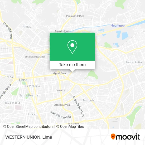
See WESTERN UNION, El Agustin, on the map
Public Transit to WESTERN UNION in El Agustin
Wondering how to get to WESTERN UNION in El Agustin? Moovit helps you find the best way to get to WESTERN UNION with step-by-step directions from the nearest public transit station.
Moovit provides free maps and live directions to help you navigate through your city. View schedules, routes, timetables, and find out how long does it take to get to WESTERN UNION in real time.
Looking for the nearest stop or station to WESTERN UNION? Check out this list of stops closest to your destination: Mercado Riva Agüero; Ocros / Riva Agüero; El Ángel.
Bus: 1053, 1078, 1189, 1193, 1195, 1203, 1223, 1049, 1057, 1062, 1067, 1065, 1219, 1226, 1269.Metro: LINEA 1.
Want to see if there’s another route that gets you there at an earlier time? Moovit helps you find alternative routes or times. Get directions from and directions to WESTERN UNION easily from the Moovit App or Website.
We make riding to WESTERN UNION easy, which is why over 1.5 million users, including users in El Agustin, trust Moovit as the best app for public transit. You don’t need to download an individual bus app or train app, Moovit is your all-in-one transit app that helps you find the best bus time or train time available.
For information on prices of bus and metro, costs and ride fares to WESTERN UNION, please check the Moovit app.
Use the app to navigate to popular places including to the airport, hospital, stadium, grocery store, mall, coffee shop, school, college, and university.
WESTERN UNION Address: Calle La Granada 209 El Agustíno Setima Zona, 15004 El Agustino street in El Agustin
- Aroha Panaderia y Pasteleria,
- Clínica Vida Plena Oficial,
- Avenida Riva Aguero 415,
- Calle la Granada 206,
- Agro Veterinaria Segura,
- Paradero el Pino,
- Restaurante Argentino Perotti,
- Inppares,
- Centro Medico Medimagen,
- Berrospi Calzada Juan Hugo,
- Ingenieros-Vizcarra Espinoza Giovanna Grimanesa,
- Institución Educativa No. 1170,
- pasaje san francisco de asis el agustino,
- C.E.I Martir Olaya,
- JR ANCASH 2210 EL AGUSTINO,
- Agustino,
- Banco de la Nación,
- Leiva Castaneda Jose Eduardo,
- Complejo Deportivo "El Cenicero",
- Colegio Santa Isabel - Oficial
Places Near WESTERN UNION (El Agustin)
- Larcomar, Miraflores,
- Paradero Av.Brasil,
- Parque Kennedy, Miraflores,
- Plaza San Miguel, San Miguel,
- Hospital Edgardo Rebagliati Martins, Jesus Mari,
- Av. Abancay, Lima,
- Jockey Plaza, Santiago D,
- av arequipa, Lima,
- Real Plaza Puruchuco, Ate,
- Gamarra,
- Centro Comercial Plaza Norte, Independen,
- Miraflores, Miraflores,
- Mall Del Sur,
- Av. La Marina, San Miguel,
- Circuito Mágico Del Agua, Lima,
- Parque de las Leyendas, San Miguel,
- Av. Salaverry, Jesus Mari,
- Barranco, Barranco,
- Pontificia Universidad Católica del Perú - PUCP, San Miguel,
- Aeropuerto Internacional Jorge Chávez, Ventanilla
How to get to popular places in Lima with public transit
Get around El Agustin by public transit!
Traveling around El Agustin has never been so easy. See step by step directions as you travel to any attraction, street or major public transit station. View bus and train schedules, arrival times, service alerts and detailed routes on a map, so you know exactly how to get to anywhere in El Agustin.
When traveling to any destination around El Agustin use Moovit's Live Directions with Get Off Notifications to know exactly where and how far to walk, how long to wait for your line, and how many stops are left. Moovit will alert you when it's time to get off — no need to constantly re-check whether yours is the next stop.
Wondering how to use public transit in El Agustin or how to pay for public transit in El Agustin? Moovit public transit app can help you navigate your way with public transit easily, and at minimum cost. It includes public transit fees, ticket prices, and costs. Looking for a map of El Agustin public transit lines? Moovit public transit app shows all public transit maps in El Agustin with all Bus, Metro and Ferry routes and stops on an interactive map.
Lima has 3 transit type(s), including: Bus, Metro and Ferry, operated by several transit agencies, including Metro de Lima Línea 2 , Metro de Lima, Corredor Rojo, Metropolitano, Metropolitano - Alimentadores, Corredor Morado, Corredor Azul, Rutas Tradicionales, Transportes y Servicios La Esperanza S.A., Las Flores S.A., Virgen de la Asunción S.A., Consorcio HAM, Transportes y Service Canadá S.A., ETUL4SA and ETUCHISA