Directions to WESTERN UNION (Washington) with public transportation
The following transit lines have routes that pass near WESTERN UNION
 Bus: 64, E4, F6, R2, D30.
- Metro: METRORAIL GREEN LINE, METRORAIL RED LINE, GREEN, YELLOW, RED.
How to get to WESTERN UNION by bus?
Click on the bus route to see step by step directions with maps, line arrival times and updated time schedules.
From Patriot's Plaza, Washington
57 minFrom Buffalo Wild Wings, Prince George's County
80 minFrom Ronald Reagan Building Food Court, Washington
59 minFrom Neiman Marcus, Washington
41 minFrom Comfort Inn Downtown DC/Convention Center, Washington
43 minFrom Arlington Rooftop Bar & Grill, Arlington County
94 minFrom Hilton Garden Inn Arlington/Courthouse Plaza, Arlington County
94 minFrom Landover, Maryland, Prince George's County
75 minFrom Greenbelt Yard, Prince George's County
60 minFrom Kensington MARC Station, Montgomery County
66 min
How to get to WESTERN UNION by metro?
Click on the metro route to see step by step directions with maps, line arrival times and updated time schedules.
From Patriot's Plaza, Washington
30 minFrom Ronald Reagan Building Food Court, Washington
31 minFrom Neiman Marcus, Washington
36 minFrom Comfort Inn Downtown DC/Convention Center, Washington
28 minFrom Arlington Rooftop Bar & Grill, Arlington County
43 minFrom Hilton Garden Inn Arlington/Courthouse Plaza, Arlington County
44 minFrom Landover, Maryland, Prince George's County
53 minFrom Greenbelt Yard, Prince George's County
20 min
Bus stops near WESTERN UNION in Washington
Metro stations near WESTERN UNION in Washington
Bus lines to WESTERN UNION in Washington
- D30, South To L'Enfant Plaza,VIEW
- P32, East To Greenbelt,VIEW
- P35, West To Fort Totten,VIEW
- C81, West To Sibley Hospital,VIEW
- P15, Riggs Rd-Adelphi,VIEW
- P16, Riggs Rd-White Oak,VIEW
- M60, New Hampshire Av,VIEW
- C71, 18 St,VIEW
- C77, South To Fort Totten,VIEW
- M6X, South To Fort Totten,VIEW
- D44, North To Fort Totten,VIEW
What are the closest stations to WESTERN UNION?
The closest stations to WESTERN UNION are:
- Fort Totten+Alighting Only is 145 yards away, 2 min walk.
- Fort Totten+Bay K is 240 yards away, 3 min walk.
- Fort Totten+Bay H is 242 yards away, 4 min walk.
- Fort Totten+Bay A is 282 yards away, 4 min walk.
- Ft Totten Station & Bus Bay B & C is 297 yards away, 4 min walk.
- Georgia Ave - Petworth is 622 yards away, 8 min walk.
- Fort Totten is 2909 yards away, 35 min walk.
Which bus lines stop near WESTERN UNION?
These bus lines stop near WESTERN UNION: 64, E4, F6, R2.
Which metro lines stop near WESTERN UNION?
These metro lines stop near WESTERN UNION: METRORAIL GREEN LINE, METRORAIL RED LINE.
What’s the nearest metro station to WESTERN UNION in Washington?
The nearest metro station to WESTERN UNION in Washington is Georgia Ave - Petworth. It’s a 8 min walk away.
What’s the nearest bus station to WESTERN UNION in Washington?
The nearest bus station to WESTERN UNION in Washington is Fort Totten+Alighting Only. It’s a 2 min walk away.
What time is the first metro to WESTERN UNION in Washington?
The METRORAIL GREEN LINE is the first metro that goes to WESTERN UNION in Washington. It stops nearby at 5:09 AM.
What time is the last metro to WESTERN UNION in Washington?
The METRORAIL GREEN LINE is the last metro that goes to WESTERN UNION in Washington. It stops nearby at 12:33 AM.
What time is the first bus to WESTERN UNION in Washington?
The 80 is the first bus that goes to WESTERN UNION in Washington. It stops nearby at 3:00 AM.
What time is the last bus to WESTERN UNION in Washington?
The 80 is the last bus that goes to WESTERN UNION in Washington. It stops nearby at 3:41 AM.
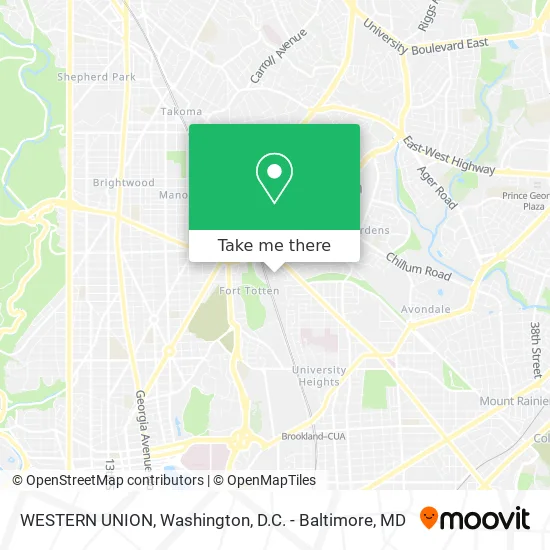
See WESTERN UNION, Washington, on the map
Public Transit to WESTERN UNION in Washington
Wondering how to get to WESTERN UNION in Washington? Moovit helps you find the best way to get to WESTERN UNION with step-by-step directions from the nearest public transit station.
Moovit provides free maps and live directions to help you navigate through your city. View schedules, routes, timetables, and find out how long does it take to get to WESTERN UNION in real time.
Looking for the nearest stop or station to WESTERN UNION? Check out this list of stops closest to your destination: Fort Totten+Alighting Only; Fort Totten+Bay K; Fort Totten+Bay H; Fort Totten+Bay A; Ft Totten Station & Bus Bay B & C; Georgia Ave - Petworth; Fort Totten.
Bus: 64, E4, F6, R2, D30, P32, P35, C81, P15, P16, M60, C71, C77, M6X.Metro: METRORAIL GREEN LINE, METRORAIL RED LINE, GREEN, YELLOW, RED.
Want to see if there’s another route that gets you there at an earlier time? Moovit helps you find alternative routes or times. Get directions from and directions to WESTERN UNION easily from the Moovit App or Website.
We make riding to WESTERN UNION easy, which is why over 1.5 million users, including users in Washington, trust Moovit as the best app for public transit. You don’t need to download an individual bus app or train app, Moovit is your all-in-one transit app that helps you find the best bus time or train time available.
For information on prices of metro, bus and train, costs and ride fares to WESTERN UNION, please check the Moovit app.
Use the app to navigate to popular places including to the airport, hospital, stadium, grocery store, mall, coffee shop, school, college, and university.
WESTERN UNION Address: 5201 3rd St NE Washington, DC 20011 street in Washington
- Credit Union 1,
- Citibank,
- 5210 3rd Street Northeast,
- Supremeterpene,
- R2 To Calverton,
- Ft Totten Station & Alighting Only,
- Fort Totten Metro Parking Lot,
- 64 Bus Stop Fort Totten,
- Colpark Loc 864,
- SJCS,
- Love and Care Child Development Center,
- Ward 5 Mutual Aid Hub,
- Onelife Fitness,
- Onelife Fitness - Fort Totten,
- Hibiscus Medical,
- Fort Totten Metro Parking Lot,
- Amazon Locker-Comet,
- Covid-19 Testing Site: Udc-CC Bertie Backus Campus,
- Bertie Backus,
- 5171 South Dakota Ave NE
Places Near WESTERN UNION (Washington)
- Camden Yards, Baltimore,
- The Anthem, Washington,
- Sibley Memorial Hospital, Washington,
- Warner Theatre, Washington,
- National Zoo, Washington,
- Amazon Hq2, Arlington County,
- Westfield Montgomery Mall, Montgomery County,
- National Theatre, Washington,
- Pennsylvania Ave NW (3rd st and pennsylvania), Washington,
- Marriott Marquis Washington, DC, Washington,
- Georgetown, Washington,
- M&T Bank Stadium, Baltimore,
- Washington DC VA Medical Center, Washington,
- Basilica of the National Shrine, Washington,
- Museum Of The Bible, Washington,
- Capital One Arena, Washington,
- Washington National Cathedral, Washington,
- National Museum of African American History and Culture, Washington,
- Rock Creek Tennis Center, Washington,
- PG Mall, Prince George's County
How to get to popular places in Washington, D.C. - Baltimore, MD with public transit
Get around Washington by public transit!
Traveling around Washington has never been so easy. See step by step directions as you travel to any attraction, street or major public transit station. View bus and train schedules, arrival times, service alerts and detailed routes on a map, so you know exactly how to get to anywhere in Washington.
When traveling to any destination around Washington use Moovit's Live Directions with Get Off Notifications to know exactly where and how far to walk, how long to wait for your line, and how many stops are left. Moovit will alert you when it's time to get off — no need to constantly re-check whether yours is the next stop.
Wondering how to use public transit in Washington or how to pay for public transit in Washington? Moovit public transit app can help you navigate your way with public transit easily, and at minimum cost. It includes public transit fees, ticket prices, and costs. Looking for a map of Washington public transit lines? Moovit public transit app shows all public transit maps in Washington with all Bus, Train, Metro, Light Rail and Ferry routes and stops on an interactive map.
Washington, D.C. - Baltimore, MD has 5 transit type(s), including: Bus, Train, Metro, Light Rail and Ferry, operated by several transit agencies, including WMATA, Montgomery County Ride On, Fairfax Connector, TheBus, PRTC, DASH - Alexandria, Arlington Transit (ART), RTA of Central Maryland, MDOT MTA, MDOT MTA Light RailLink, MDOT MTA Commuter Bus, MDOT MTA Local Bus, FXBGO!, Virginia Railway Express (VRE) and MARC