Bus stop near WESTERN UNION in Tazewell County
- Springville-Valero Station (Hurt Rd.), 2 min walk,VIEW
Bus lines to WESTERN UNION in Tazewell County
- Valero,
- Fas Mart,
- Subway,
- Springville Lumber Co.,
- Glamour Nails,
- Springville,
- Tactical Retreat Unplugged,
- Wallace Cemetery,
- Harmon Cemetery,
- Springville Elementary School,
- Davis Mechanical,
- Springville Church,
- Mcmullen Cemetery,
- Envirocheck of Virginia, Inc.,
- Caribbean Tan,
- VFW Club,
- United Exhaust,
- Tracey's Shinning Star,
- Bluefield Manufacturing,
- Enviro Check of Viirgina
Places Near WESTERN UNION (Tazewell County)
- Amazon Hq2, Arlington County,
- Westfield Montgomery Mall, Montgomery County,
- Warner Theatre, Washington,
- PG Mall, Prince George's County,
- Basilica of the National Shrine, Washington,
- National Museum of African American History and Culture, Washington,
- National Mall, Washington,
- Washington National Cathedral, Washington,
- Pennsylvania Ave NW (3rd st and pennsylvania), Washington,
- M&T Bank Stadium, Baltimore,
- Georgetown, Washington,
- Washington DC VA Medical Center, Washington,
- National Zoo, Washington,
- Rock Creek Tennis Center, Washington,
- The Anthem, Washington,
- Capital One Arena, Washington,
- Sibley Memorial Hospital, Washington,
- Museum Of The Bible, Washington,
- Marriott Marquis Washington, DC, Washington,
- Camden Yards, Baltimore
How to get to popular places in Washington, D.C. - Baltimore, MD with public transit
What are the closest stations to WESTERN UNION?
The closest stations to WESTERN UNION are:
- Springville-Valero Station (Hurt Rd.) is 58 yards away, 2 min walk.
What’s the nearest bus station to WESTERN UNION in Tazewell County?
The nearest bus station to WESTERN UNION in Tazewell County is Springville-Valero Station (Hurt Rd.). It’s a 2 min walk away.
What time is the first bus to WESTERN UNION in Tazewell County?
The SWVCC EAGLE EXPRESS TAZEWELL COUNTY is the first bus that goes to WESTERN UNION in Tazewell County. It stops nearby at 6:30 AM.
What time is the last bus to WESTERN UNION in Tazewell County?
The SWVCC EAGLE EXPRESS TAZEWELL COUNTY is the last bus that goes to WESTERN UNION in Tazewell County. It stops nearby at 5:45 PM.
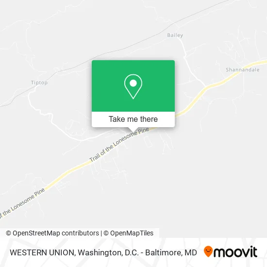
See WESTERN UNION, Tazewell County, on the map
Public Transit to WESTERN UNION in Tazewell County
Wondering how to get to WESTERN UNION in Tazewell County? Moovit helps you find the best way to get to WESTERN UNION with step-by-step directions from the nearest public transit station.
Moovit provides free maps and live directions to help you navigate through your city. View schedules, routes, timetables, and find out how long does it take to get to WESTERN UNION in real time.
Looking for the nearest stop or station to WESTERN UNION? Check out this list of stops closest to your destination: Springville-Valero Station (Hurt Rd.).
Want to see if there’s another route that gets you there at an earlier time? Moovit helps you find alternative routes or times. Get directions from and directions to WESTERN UNION easily from the Moovit App or Website.
We make riding to WESTERN UNION easy, which is why over 1.5 million users, including users in Tazewell County, trust Moovit as the best app for public transit. You don’t need to download an individual bus app or train app, Moovit is your all-in-one transit app that helps you find the best bus time or train time available.
Use the app to navigate to popular places including to the airport, hospital, stadium, grocery store, mall, coffee shop, school, college, and university.
WESTERN UNION Address: 34051 The Governor George C Peery Hwy North Tazewell, VA 24630 street in Tazewell County
Get around Tazewell County by public transit!
Traveling around Tazewell County has never been so easy. See step by step directions as you travel to any attraction, street or major public transit station. View bus and train schedules, arrival times, service alerts and detailed routes on a map, so you know exactly how to get to anywhere in Tazewell County.
When traveling to any destination around Tazewell County use Moovit's Live Directions with Get Off Notifications to know exactly where and how far to walk, how long to wait for your line, and how many stops are left. Moovit will alert you when it's time to get off — no need to constantly re-check whether yours is the next stop.
Wondering how to use public transit in Tazewell County or how to pay for public transit in Tazewell County? Moovit public transit app can help you navigate your way with public transit easily, and at minimum cost. It includes public transit fees, ticket prices, and costs. Looking for a map of Tazewell County public transit lines? Moovit public transit app shows all public transit maps in Tazewell County with all Bus, Train, Metro, Light Rail and Ferry routes and stops on an interactive map.
Washington, D.C. - Baltimore, MD has 5 transit type(s), including: Bus, Train, Metro, Light Rail and Ferry, operated by several transit agencies, including WMATA, Montgomery County Ride On, Fairfax Connector, TheBus, PRTC, DASH - Alexandria, Arlington Transit (ART), RTA of Central Maryland, MDOT MTA, MDOT MTA Light RailLink, MDOT MTA Commuter Bus, MDOT MTA Local Bus, FXBGO!, Virginia Railway Express (VRE) and MARC