Directions to WESTERN UNION (Arlington County) with public transportation
The following transit lines have routes that pass near WESTERN UNION
 Bus: 43, A1X, A40, 598, 282.
- Train: MANASSAS LINE, FREDERICKSBURG LINE.
- Metro: BLUE, YELLOW.
How to get to WESTERN UNION by bus?
Click on the bus route to see step by step directions with maps, line arrival times and updated time schedules.
From Washington Convention Center (Walter E. Washington Convention Center), Washington
56 minFrom Rock Creek Park Tennis Center (William Hg Fitzgerald), Washington
78 minFrom Apple Carnegie Library, Washington
57 minFrom Tenleytown, Washington
52 minFrom Hilton Alexandria Old Town, Alexandria
38 minFrom Omni Shoreham Hotel, Washington
64 minFrom Washington Yu Ying Public Charter School, Washington
100 minFrom U.S. Census Bureau, Prince George's County
98 minFrom Purple Patch Food and Drink, Washington
71 minFrom Sibley Memorial Hospital, Washington
85 min
How to get to WESTERN UNION by train?
Click on the train route to see step by step directions with maps, line arrival times and updated time schedules.
How to get to WESTERN UNION by metro?
Click on the metro route to see step by step directions with maps, line arrival times and updated time schedules.
From Washington Convention Center (Walter E. Washington Convention Center), Washington
25 minFrom Apple Carnegie Library, Washington
24 minFrom Tenleytown, Washington
34 minFrom Hilton Alexandria Old Town, Alexandria
16 minFrom Omni Shoreham Hotel, Washington
31 minFrom Washington Yu Ying Public Charter School, Washington
48 minFrom U.S. Census Bureau, Prince George's County
39 minFrom Purple Patch Food and Drink, Washington
32 min
Bus stops near WESTERN UNION in Arlington County
Metro station near WESTERN UNION in Arlington County
- Crystal City, 19 min walk,VIEW
Train station near WESTERN UNION in Arlington County
- Crystal City, 21 min walk,VIEW
Bus lines to WESTERN UNION in Arlington County
- A1X, South To Braddock Rd,VIEW
- A40, East To Crystal City,VIEW
- 43, Crystal City,VIEW
- 598, 598 Pentagon - Crystal City,VIEW
- 282, Crystal City Via Rosslyn & Pentagon,VIEW
- 482, Crystal City Via Rosslyn And Pentagon,VIEW
- 682, East Gate Via Stone Ridge II,VIEW
- 882, Loudoun Gateway,VIEW
- 972-C, Pentagon / Dale City,VIEW
- A11, North To Pentagon,VIEW
What are the closest stations to WESTERN UNION?
The closest stations to WESTERN UNION are:
- Crystal Dr+18 St S is 37 yards away, 1 min walk.
- Crystal Dr Nb @ 18th St S Fs-Transitway Station E is 44 yards away, 1 min walk.
- 18th St @ Crystal City Metro is 317 yards away, 4 min walk.
- 18th St & Route 1 is 340 yards away, 5 min walk.
- 18th St Bus Bays is 362 yards away, 5 min walk.
- S Eads St+18 St S is 475 yards away, 6 min walk.
- Crystal City is 1561 yards away, 19 min walk.
Which bus lines stop near WESTERN UNION?
These bus lines stop near WESTERN UNION: 43, A1X.
Which train line stops near WESTERN UNION?
MANASSAS LINE (Broad Run)
Which metro lines stop near WESTERN UNION?
These metro lines stop near WESTERN UNION: BLUE, YELLOW.
What’s the nearest metro station to WESTERN UNION in Arlington County?
The nearest metro station to WESTERN UNION in Arlington County is Crystal City. It’s a 19 min walk away.
What’s the nearest train station to WESTERN UNION in Arlington County?
The nearest train station to WESTERN UNION in Arlington County is Crystal City. It’s a 21 min walk away.
What’s the nearest bus station to WESTERN UNION in Arlington County?
The nearest bus stations to WESTERN UNION in Arlington County are Crystal Dr+18 St S and Crystal Dr Nb @ 18th St S Fs-Transitway Station E. The closest one is a 1 min walk away.
What time is the first metro to WESTERN UNION in Arlington County?
The YELLOW is the first metro that goes to WESTERN UNION in Arlington County. It stops nearby at 5:11 AM.
What time is the last metro to WESTERN UNION in Arlington County?
The BLUE is the last metro that goes to WESTERN UNION in Arlington County. It stops nearby at 12:26 AM.
What time is the first train to WESTERN UNION in Arlington County?
The MANASSAS LINE is the first train that goes to WESTERN UNION in Arlington County. It stops nearby at 6:04 AM.
What time is the last train to WESTERN UNION in Arlington County?
The MANASSAS LINE is the last train that goes to WESTERN UNION in Arlington County. It stops nearby at 7:15 PM.
What time is the first bus to WESTERN UNION in Arlington County?
The A11 is the first bus that goes to WESTERN UNION in Arlington County. It stops nearby at 4:57 AM.
What time is the last bus to WESTERN UNION in Arlington County?
The A40 is the last bus that goes to WESTERN UNION in Arlington County. It stops nearby at 2:10 AM.
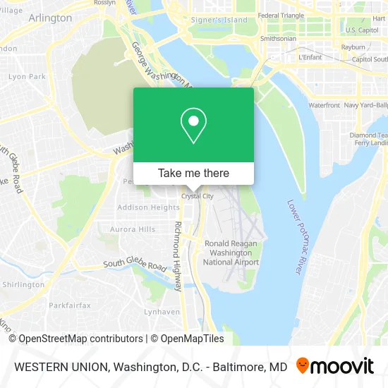
See WESTERN UNION, Arlington County, on the map
Public Transit to WESTERN UNION in Arlington County
Wondering how to get to WESTERN UNION in Arlington County? Moovit helps you find the best way to get to WESTERN UNION with step-by-step directions from the nearest public transit station.
Moovit provides free maps and live directions to help you navigate through your city. View schedules, routes, timetables, and find out how long does it take to get to WESTERN UNION in real time.
Looking for the nearest stop or station to WESTERN UNION? Check out this list of stops closest to your destination: Crystal Dr+18 St S; Crystal Dr Nb @ 18th St S Fs-Transitway Station E; 18th St @ Crystal City Metro; 18th St & Route 1; 18th St Bus Bays; S Eads St+18 St S; Crystal City.
Bus: 43, A1X, A40, 598, 282, 482, 682, 882.Train: MANASSAS LINE, FREDERICKSBURG LINE.Metro: BLUE, YELLOW.
Want to see if there’s another route that gets you there at an earlier time? Moovit helps you find alternative routes or times. Get directions from and directions to WESTERN UNION easily from the Moovit App or Website.
We make riding to WESTERN UNION easy, which is why over 1.5 million users, including users in Arlington County, trust Moovit as the best app for public transit. You don’t need to download an individual bus app or train app, Moovit is your all-in-one transit app that helps you find the best bus time or train time available.
For information on prices of metro, bus and train, costs and ride fares to WESTERN UNION, please check the Moovit app.
Use the app to navigate to popular places including to the airport, hospital, stadium, grocery store, mall, coffee shop, school, college, and university.
WESTERN UNION Address: 1675 Crystal Square Arc Arlington, VA 22202 street in Arlington County
- Mt Vernon Trail Access,
- Alamo Drafthouse Crystal City,
- Fat Fish,
- Phowheels,
- Crystal City Water Park,
- Dolci Gelati,
- Shapiro & Duncan,
- Colada Shop,
- Crystal City Shops at 1750,
- Total Fright,
- Solidcore,
- EV Charging Station,
- Was16 Cafe,
- Morton's The Steakhouse,
- Amazon Hq2,
- Queen Mother's,
- Cracked Eggery,
- Water Park,
- Tiki Thai,
- DC Dosa
Places Near WESTERN UNION (Arlington County)
- PG Mall, Prince George's County,
- National Museum of African American History and Culture, Washington,
- Washington DC VA Medical Center, Washington,
- Basilica of the National Shrine, Washington,
- Capital One Arena, Washington,
- Camden Yards, Baltimore,
- M&T Bank Stadium, Baltimore,
- Marriott Marquis Washington, DC, Washington,
- Warner Theatre, Washington,
- Washington National Cathedral, Washington,
- Pennsylvania Ave NW (3rd st and pennsylvania), Washington,
- Georgetown, Washington,
- National Zoo, Washington,
- Sibley Memorial Hospital, Washington,
- Rock Creek Tennis Center, Washington,
- Amazon Hq2, Arlington County,
- Museum Of The Bible, Washington,
- The Anthem, Washington,
- National Theatre, Washington,
- Westfield Montgomery Mall, Montgomery County
How to get to popular places in Washington, D.C. - Baltimore, MD with public transit
Get around Arlington County by public transit!
Traveling around Arlington County has never been so easy. See step by step directions as you travel to any attraction, street or major public transit station. View bus and train schedules, arrival times, service alerts and detailed routes on a map, so you know exactly how to get to anywhere in Arlington County.
When traveling to any destination around Arlington County use Moovit's Live Directions with Get Off Notifications to know exactly where and how far to walk, how long to wait for your line, and how many stops are left. Moovit will alert you when it's time to get off — no need to constantly re-check whether yours is the next stop.
Wondering how to use public transit in Arlington County or how to pay for public transit in Arlington County? Moovit public transit app can help you navigate your way with public transit easily, and at minimum cost. It includes public transit fees, ticket prices, and costs. Looking for a map of Arlington County public transit lines? Moovit public transit app shows all public transit maps in Arlington County with all Bus, Train, Metro, Light Rail and Ferry routes and stops on an interactive map.
Washington, D.C. - Baltimore, MD has 5 transit type(s), including: Bus, Train, Metro, Light Rail and Ferry, operated by several transit agencies, including WMATA, Montgomery County Ride On, Fairfax Connector, TheBus, PRTC, DASH - Alexandria, Arlington Transit (ART), RTA of Central Maryland, MDOT MTA, MDOT MTA Light RailLink, MDOT MTA Commuter Bus, MDOT MTA Local Bus, FXBGO!, Virginia Railway Express (VRE) and MARC