Directions to WING STOP (Fairfax County) with public transportation
The following transit lines have routes that pass near WING STOP
 Bus: 310, 334, 394, 396.
- Train: MANASSAS LINE, FREDERICKSBURG LINE.
- Metro: BLUE.
How to get to WING STOP by bus?
Click on the bus route to see step by step directions with maps, line arrival times and updated time schedules.
From Inova Fairfax Hospital North Tower Building, Fairfax County
63 minFrom Lorton, VA, Fairfax County
45 minFrom Department of State SA 34, Fairfax County
65 minFrom Falls Church Marriott Fairview Park, Fairfax County
74 minFrom Inova Fairfax Hospital, Fairfax County
64 minFrom King's Dominion, Fairfax County
74 minFrom Northern Virginia Community College - Annandale Campus, Fairfax County
70 minFrom Burke, VA, Fairfax County
46 minFrom Nova- Alexandria Campus, Alexandria
79 minFrom Inova Mount Vernon Hospital, Fairfax County
60 min
Bus stops near WING STOP in Fairfax County
- Backlick Rd @ Spring Garden Dr, 2 min walk,VIEW
- Backlick Rd @ Villa Park Rd, 4 min walk,VIEW
- Backlick North Park And Ride, 6 min walk,VIEW
- Springfield Cbc Garage And Tc Bay E, 11 min walk,VIEW
- Springfield Cbc Garage And Tc Bay D, 13 min walk,VIEW
- Metropolitan Center Dr @ Metropoloitan Center Dr, 20 min walk,VIEW
- Spring Mall Dr @ Loisdale Rd, 21 min walk,VIEW
- Loisdale Ct @ 6564, 25 min walk,VIEW
Train stations near WING STOP in Fairfax County
Metro station near WING STOP in Fairfax County
- Franconia-Springfield Metro, 32 min walk,VIEW
Bus lines to WING STOP in Fairfax County
- 310, 310 Rolling Vly Park & Ride,VIEW
- 394, 394 Pentagon,VIEW
- 396, 396 Springfield,VIEW
- 494, 494 Tysons Metro,VIEW
- 393, 393 Saratoga,VIEW
- 334, 334 Dla-Newington,VIEW
- 352, 352 Tsa Springfield Town Center,VIEW
- 321, 321 Franconia - Springfield,VIEW
- 322, 322 Franconia- Springfield Via Kingstowne,VIEW
- 350, 350 Springfield Town Center - Hilton,VIEW
What are the closest stations to WING STOP?
The closest stations to WING STOP are:
- Backlick Rd @ Spring Garden Dr is 107 yards away, 2 min walk.
- Backlick Rd @ Villa Park Rd is 284 yards away, 4 min walk.
- Backlick North Park And Ride is 453 yards away, 6 min walk.
- Springfield Cbc Garage And Tc Bay E is 840 yards away, 11 min walk.
- Springfield Cbc Garage And Tc Bay D is 1041 yards away, 13 min walk.
- Metropolitan Center Dr @ Metropoloitan Center Dr is 1682 yards away, 20 min walk.
- Spring Mall Dr @ Loisdale Rd is 1757 yards away, 21 min walk.
- Backlick Road Station is 1821 yards away, 22 min walk.
- Loisdale Ct @ 6564 is 2110 yards away, 25 min walk.
- Franconia-Springfield Metro is 2741 yards away, 32 min walk.
- Franconia-Springfield Vre Station is 2923 yards away, 36 min walk.
Which bus lines stop near WING STOP?
These bus lines stop near WING STOP: 310, 334.
What’s the nearest train station to WING STOP in Fairfax County?
The nearest train station to WING STOP in Fairfax County is Backlick Road Station. It’s a 22 min walk away.
What’s the nearest bus station to WING STOP in Fairfax County?
The nearest bus station to WING STOP in Fairfax County is Backlick Rd @ Spring Garden Dr. It’s a 2 min walk away.
What time is the first metro to WING STOP in Fairfax County?
The BLUE is the first metro that goes to WING STOP in Fairfax County. It stops nearby at 5:00 AM.
What time is the last metro to WING STOP in Fairfax County?
The BLUE is the last metro that goes to WING STOP in Fairfax County. It stops nearby at 12:44 AM.
What time is the first train to WING STOP in Fairfax County?
The MANASSAS LINE is the first train that goes to WING STOP in Fairfax County. It stops nearby at 5:42 AM.
What time is the last train to WING STOP in Fairfax County?
The MANASSAS LINE is the last train that goes to WING STOP in Fairfax County. It stops nearby at 7:34 PM.
What time is the first bus to WING STOP in Fairfax County?
The 322 is the first bus that goes to WING STOP in Fairfax County. It stops nearby at 4:14 AM.
What time is the last bus to WING STOP in Fairfax County?
The 321 is the last bus that goes to WING STOP in Fairfax County. It stops nearby at 12:41 AM.
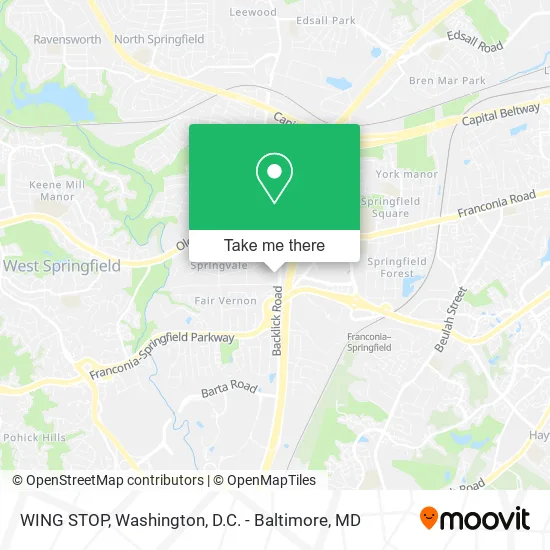
See WING STOP, Fairfax County, on the map
Public Transit to WING STOP in Fairfax County
Wondering how to get to WING STOP in Fairfax County? Moovit helps you find the best way to get to WING STOP with step-by-step directions from the nearest public transit station.
Moovit provides free maps and live directions to help you navigate through your city. View schedules, routes, timetables, and find out how long does it take to get to WING STOP in real time.
Looking for the nearest stop or station to WING STOP? Check out this list of stops closest to your destination: Backlick Rd @ Spring Garden Dr; Backlick Rd @ Villa Park Rd; Backlick North Park And Ride; Springfield Cbc Garage And Tc Bay E; Springfield Cbc Garage And Tc Bay D; Metropolitan Center Dr @ Metropoloitan Center Dr; Spring Mall Dr @ Loisdale Rd; Backlick Road Station; Loisdale Ct @ 6564; Franconia-Springfield Metro; Franconia-Springfield Vre Station.
Bus: 310, 334, 394, 396.Train: MANASSAS LINE, FREDERICKSBURG LINE.Metro: BLUE.
Want to see if there’s another route that gets you there at an earlier time? Moovit helps you find alternative routes or times. Get directions from and directions to WING STOP easily from the Moovit App or Website.
We make riding to WING STOP easy, which is why over 1.5 million users, including users in Fairfax County, trust Moovit as the best app for public transit. You don’t need to download an individual bus app or train app, Moovit is your all-in-one transit app that helps you find the best bus time or train time available.
For information on prices of bus and metro, costs and ride fares to WING STOP, please check the Moovit app.
Use the app to navigate to popular places including to the airport, hospital, stadium, grocery store, mall, coffee shop, school, college, and university.
WING STOP Address: 7012 Spring Garden Dr Springfield, VA 22150 street in Fairfax County
- Makchang Dodook K-BBQ,
- Brookfield Plaza,
- Post Office-Springfield,
- Getcoins Bitcoin ATM,
- Credit Union 1,
- Thirteen Twenty Club II,
- Presidential Carpet Cleaning,
- Harwood Floor Cleaning,
- Mac's Plumbing,
- Ashburn Cyber Security,
- WESTERN UNION,
- Carpet Cleaning Company,
- Akmal,S Catering Kitchen,
- R S R Remodeling,
- AG Lawn Care,
- Purple Diamond Detailing,
- Rene Painting,
- B&A Contracting,
- Doras Residential Cleaning Services,
- Two Step Transport
Places Near WING STOP (Fairfax County)
- National Zoo, Washington,
- Sibley Memorial Hospital, Washington,
- Rock Creek Tennis Center, Washington,
- National Museum of African American History and Culture, Washington,
- Amazon Hq2, Arlington County,
- Camden Yards, Baltimore,
- Capital One Arena, Washington,
- The Anthem, Washington,
- Washington DC VA Medical Center, Washington,
- Washington National Cathedral, Washington,
- Museum Of The Bible, Washington,
- National Mall, Washington,
- PG Mall, Prince George's County,
- Marriott Marquis Washington, DC, Washington,
- Pennsylvania Ave NW (3rd st and pennsylvania), Washington,
- Georgetown, Washington,
- Warner Theatre, Washington,
- Basilica of the National Shrine, Washington,
- M&T Bank Stadium, Baltimore,
- Westfield Montgomery Mall, Montgomery County
How to get to popular places in Washington, D.C. - Baltimore, MD with public transit
Get around Fairfax County by public transit!
Traveling around Fairfax County has never been so easy. See step by step directions as you travel to any attraction, street or major public transit station. View bus and train schedules, arrival times, service alerts and detailed routes on a map, so you know exactly how to get to anywhere in Fairfax County.
When traveling to any destination around Fairfax County use Moovit's Live Directions with Get Off Notifications to know exactly where and how far to walk, how long to wait for your line, and how many stops are left. Moovit will alert you when it's time to get off — no need to constantly re-check whether yours is the next stop.
Wondering how to use public transit in Fairfax County or how to pay for public transit in Fairfax County? Moovit public transit app can help you navigate your way with public transit easily, and at minimum cost. It includes public transit fees, ticket prices, and costs. Looking for a map of Fairfax County public transit lines? Moovit public transit app shows all public transit maps in Fairfax County with all Bus, Train, Metro, Light Rail and Ferry routes and stops on an interactive map.
Washington, D.C. - Baltimore, MD has 5 transit type(s), including: Bus, Train, Metro, Light Rail and Ferry, operated by several transit agencies, including WMATA, Montgomery County Ride On, Fairfax Connector, TheBus, PRTC, DASH - Alexandria, Arlington Transit (ART), RTA of Central Maryland, MDOT MTA, MDOT MTA Light RailLink, MDOT MTA Commuter Bus, MDOT MTA Local Bus, FXBGO!, Virginia Railway Express (VRE) and MARC