How to get to WSC by bus?
Click on the bus route to see step by step directions with maps, line arrival times and updated time schedules.
From Inova Fairfax Hospital North Tower Building, Fairfax County
67 minFrom Arabx Com Inc, Fairfax County
63 minFrom The Watermark Hotel, Fairfax County
63 minFrom Office of the Director of National Intelligence (DNI), Fairfax County
69 minFrom Fairfax County Government Center, Fairfax County
56 minFrom Fair Oaks Mall, Fairfax County
57 minFrom Cia Headquarters, Fairfax County
82 minFrom McLean, Virginia, Fairfax County
82 minFrom Kaiser Permanente - Falls Church Medical Center, Falls Church
77 min
How to get to WSC by metro?
Click on the metro route to see step by step directions with maps, line arrival times and updated time schedules.
Bus stop near WSC in Fairfax County
- Chain Bridge Rd @ Oak Valley Dr, 7 min walk,VIEW
Metro station near WSC in Fairfax County
- Vienna Metro Station, 21 min walk,VIEW
Bus lines to WSC in Fairfax County
- 461, 461 Oakton- Flint Hill - Vienna,VIEW
What are the closest stations to WSC?
The closest stations to WSC are:
- Chain Bridge Rd @ Oak Valley Dr is 489 yards away, 7 min walk.
- Vienna Metro Station is 1797 yards away, 21 min walk.
Which bus lines stop near WSC?
These bus lines stop near WSC: 461, 463.
Which metro line stops near WSC?
ORANGE (Vienna)
What’s the nearest metro station to WSC in Fairfax County?
The nearest metro station to WSC in Fairfax County is Vienna Metro Station. It’s a 21 min walk away.
What’s the nearest bus station to WSC in Fairfax County?
The nearest bus station to WSC in Fairfax County is Chain Bridge Rd @ Oak Valley Dr. It’s a 7 min walk away.
What time is the first metro to WSC in Fairfax County?
The ORANGE is the first metro that goes to WSC in Fairfax County. It stops nearby at 5:00 AM.
What time is the last metro to WSC in Fairfax County?
The ORANGE is the last metro that goes to WSC in Fairfax County. It stops nearby at 12:32 AM.
What time is the first bus to WSC in Fairfax County?
The 461 is the first bus that goes to WSC in Fairfax County. It stops nearby at 6:15 AM.
What time is the last bus to WSC in Fairfax County?
The 461 is the last bus that goes to WSC in Fairfax County. It stops nearby at 7:39 PM.
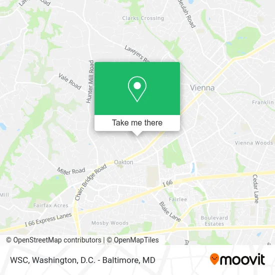
See WSC, Fairfax County, on the map
Public Transit to WSC in Fairfax County
Wondering how to get to WSC in Fairfax County? Moovit helps you find the best way to get to WSC with step-by-step directions from the nearest public transit station.
Moovit provides free maps and live directions to help you navigate through your city. View schedules, routes, timetables, and find out how long does it take to get to WSC in real time.
Looking for the nearest stop or station to WSC? Check out this list of stops closest to your destination: Chain Bridge Rd @ Oak Valley Dr; Vienna Metro Station.
Bus: 461, 463.Metro: ORANGE.
Want to see if there’s another route that gets you there at an earlier time? Moovit helps you find alternative routes or times. Get directions from and directions to WSC easily from the Moovit App or Website.
We make riding to WSC easy, which is why over 1.5 million users, including users in Fairfax County, trust Moovit as the best app for public transit. You don’t need to download an individual bus app or train app, Moovit is your all-in-one transit app that helps you find the best bus time or train time available.
For information on prices of bus and metro, costs and ride fares to WSC, please check the Moovit app.
Use the app to navigate to popular places including to the airport, hospital, stadium, grocery store, mall, coffee shop, school, college, and university.
WSC Address: 2675 Oak Valley Dr Vienna, VA 22181 street in Fairfax County
- Bracing Effect,
- Tams Consultants,
- Virginia Electrical Contractors,
- Artemis Consulting,
- Vienna Tattoo Studio,
- Family Preservation and Strengthening Services - Family Pass,
- Hicks Plumbing Services,
- Glebe Electronics, Inc.,
- Express Title Company,
- Suntech,
- Stars and Stripes Construction,
- Lwin, Soe,
- Rainbowjellys,
- Gualberto Covar,
- Donna Cloud Hair Studio,
- Doric,
- Morek Group,
- Adt Security Services,
- Interactivate,
- Lee Bazzarone - Vienna Oaks Chiropractic Center
Places Near WSC (Fairfax County)
- Pennsylvania Ave NW (3rd st and pennsylvania), Washington,
- National Mall, Washington,
- Georgetown, Washington,
- PG Mall, Prince George's County,
- Museum Of The Bible, Washington,
- Westfield Montgomery Mall, Montgomery County,
- Washington National Cathedral, Washington,
- Rock Creek Tennis Center, Washington,
- Capital One Arena, Washington,
- Marriott Marquis Washington, DC, Washington,
- Washington DC VA Medical Center, Washington,
- Warner Theatre, Washington,
- Camden Yards, Baltimore,
- Basilica of the National Shrine, Washington,
- Amazon Hq2, Arlington County,
- Sibley Memorial Hospital, Washington,
- National Museum of African American History and Culture, Washington,
- The Anthem, Washington,
- National Zoo, Washington,
- M&T Bank Stadium, Baltimore
How to get to popular places in Washington, D.C. - Baltimore, MD with public transit
Get around Fairfax County by public transit!
Traveling around Fairfax County has never been so easy. See step by step directions as you travel to any attraction, street or major public transit station. View bus and train schedules, arrival times, service alerts and detailed routes on a map, so you know exactly how to get to anywhere in Fairfax County.
When traveling to any destination around Fairfax County use Moovit's Live Directions with Get Off Notifications to know exactly where and how far to walk, how long to wait for your line, and how many stops are left. Moovit will alert you when it's time to get off — no need to constantly re-check whether yours is the next stop.
Wondering how to use public transit in Fairfax County or how to pay for public transit in Fairfax County? Moovit public transit app can help you navigate your way with public transit easily, and at minimum cost. It includes public transit fees, ticket prices, and costs. Looking for a map of Fairfax County public transit lines? Moovit public transit app shows all public transit maps in Fairfax County with all Bus, Train, Metro, Light Rail and Ferry routes and stops on an interactive map.
Washington, D.C. - Baltimore, MD has 5 transit type(s), including: Bus, Train, Metro, Light Rail and Ferry, operated by several transit agencies, including WMATA, Montgomery County Ride On, Fairfax Connector, TheBus, PRTC, DASH - Alexandria, Arlington Transit (ART), RTA of Central Maryland, MDOT MTA, MDOT MTA Light RailLink, MDOT MTA Commuter Bus, MDOT MTA Local Bus, FXBGO!, Virginia Railway Express (VRE) and MARC