How to get to W HTFD Cornerstone by bus?
Click on the bus route to see step by step directions with maps, line arrival times and updated time schedules.
Bus stops near W HTFD Cornerstone in West Hartford
Bus lines to W HTFD Cornerstone in West Hartford
What are the closest stations to W HTFD Cornerstone?
The closest stations to W HTFD Cornerstone are:
- Ridgewood Rd @ Sedgwick Rd is 843 yards away, 11 min walk.
- Farmington Ave @ Opp Sunset Farm Rd is 883 yards away, 11 min walk.
Which bus line stops near W HTFD Cornerstone?
66 (66t - Farmington Av-Uconn Health Ctr-Tunxis Comm College)
What’s the nearest bus station to W HTFD Cornerstone in West Hartford?
The nearest bus stations to W HTFD Cornerstone in West Hartford are Ridgewood Rd @ Sedgwick Rd and Farmington Ave @ Opp Sunset Farm Rd. The closest one is a 11 min walk away.
What time is the first bus to W HTFD Cornerstone in West Hartford?
The 66 is the first bus that goes to W HTFD Cornerstone in West Hartford. It stops nearby at 5:40 AM.
What time is the last bus to W HTFD Cornerstone in West Hartford?
The 66 is the last bus that goes to W HTFD Cornerstone in West Hartford. It stops nearby at 8:07 PM.
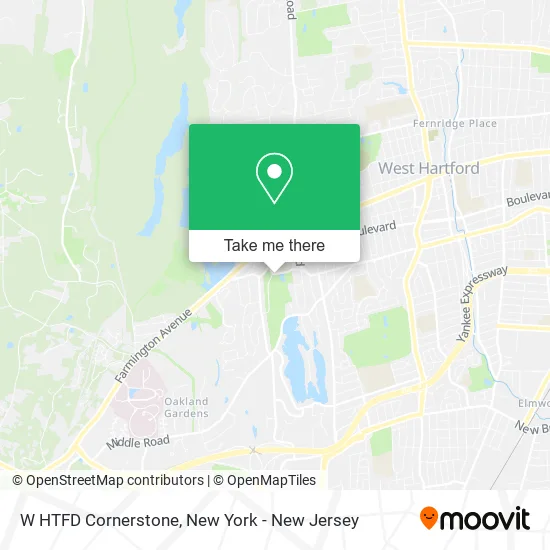
See W HTFD Cornerstone, West Hartford, on the map
Public Transit to W HTFD Cornerstone in West Hartford
Wondering how to get to W HTFD Cornerstone in West Hartford? Moovit helps you find the best way to get to W HTFD Cornerstone with step-by-step directions from the nearest public transit station.
Moovit provides free maps and live directions to help you navigate through your city. View schedules, routes, timetables, and find out how long does it take to get to W HTFD Cornerstone in real time.
Looking for the nearest stop or station to W HTFD Cornerstone? Check out this list of stops closest to your destination: Ridgewood Rd @ Sedgwick Rd; Farmington Ave @ Opp Sunset Farm Rd.
Bus: 66, 33.
Want to see if there’s another route that gets you there at an earlier time? Moovit helps you find alternative routes or times. Get directions from and directions to W HTFD Cornerstone easily from the Moovit App or Website.
We make riding to W HTFD Cornerstone easy, which is why over 1.5 million users, including users in West Hartford, trust Moovit as the best app for public transit. You don’t need to download an individual bus app or train app, Moovit is your all-in-one transit app that helps you find the best bus time or train time available.
For information on prices of bus and train, costs and ride fares to W HTFD Cornerstone, please check the Moovit app.
Use the app to navigate to popular places including to the airport, hospital, stadium, grocery store, mall, coffee shop, school, college, and university.
W HTFD Cornerstone Address: 55 Buena Vista Rd West Hartford, CT 06107 street in West Hartford
- Veterans Memorial Ice Rink,
- Cork N Bottle Fine Wines and Spirits,
- Calvary Fellowship,
- Zuka Catering,
- US Homes Realty,
- M B Tax & Accounting L,
- Eagle Rock Apartments at West Hartford,
- Kitchen Plate,
- Christ Community Presbyterian Church,
- Presbytery of Southern New England,
- The Neighbors' School,
- Wallington Dale MD,
- Marshall + Ostop Team,
- Sunset Properties,
- Milrose Realty,
- Exchange Club of West Hartford,
- West Hartford Reservoir,
- West Hartford Life Insurance Brokers,
- Signature Custom Auto & Accessories,
- The Jackson Laboratory for Genomic Medicine
Places Near W HTFD Cornerstone (West Hartford)
- Wall Street, Manhattan,
- Chinatown, Manhattan,
- 111 Centre New York City Supreme Court, Manhattan,
- Katz's Deli, Manhattan,
- Queens Center Mall, Queens,
- 66 John Street, Manhattan,
- Mountainside Hospital, Glen Ridge,
- San Gennaro Feast, Manhattan,
- 26 Federal Plaza, Manhattan,
- 3 Stone St, Manhattan,
- 1 Police Plaza, Manhattan,
- Rockefeller Center, Manhattan,
- Hudson Yards, Manhattan,
- Bellevue Hospital, Manhattan,
- 376 Hudson Street, Manhattan,
- Pier 83, Manhattan,
- SoHo, Manhattan,
- 911 Memorial, Manhattan,
- qqqq, Manhattan,
- Times Square, Manhattan
How to get to popular places in New York - New Jersey with public transit
Get around West Hartford by public transit!
Traveling around West Hartford has never been so easy. See step by step directions as you travel to any attraction, street or major public transit station. View bus and train schedules, arrival times, service alerts and detailed routes on a map, so you know exactly how to get to anywhere in West Hartford.
When traveling to any destination around West Hartford use Moovit's Live Directions with Get Off Notifications to know exactly where and how far to walk, how long to wait for your line, and how many stops are left. Moovit will alert you when it's time to get off — no need to constantly re-check whether yours is the next stop.
Wondering how to use public transit in West Hartford or how to pay for public transit in West Hartford? Moovit public transit app can help you navigate your way with public transit easily, and at minimum cost. It includes public transit fees, ticket prices, and costs. Looking for a map of West Hartford public transit lines? Moovit public transit app shows all public transit maps in West Hartford with all Bus, Train, Subway, Light Rail, Ferry and Cable Car routes and stops on an interactive map.
New York - New Jersey has 6 transit type(s), including: Bus, Train, Subway, Light Rail, Ferry and Cable Car, operated by several transit agencies, including MTA Subway, Metro-North Railroad, LIRR, PATH, MTA New York City Transit - Express routes, MTA Bus, NJ Transit, NYC Ferry, NICE bus, Bee-Line Bus, NJ Transit Rail, Norwalk Transit District, Hartford Line, River Valley Transit and HART