Directions to W.R Grace (Baltimore) with public transportation
The following transit lines have routes that pass near W.R Grace
 Bus: 67, CITYLINK SILVER.
How to get to W.R Grace by bus?
Click on the bus route to see step by step directions with maps, line arrival times and updated time schedules.
From Hilton Baltimore, Baltimore
53 minFrom Walmart, Baltimore County
116 minFrom Pier Six Pavilion, Baltimore
58 minFrom Maryland, Baltimore
56 minFrom Maryland Science Center, Baltimore
42 minFrom Social Security Administration, Baltimore
56 minFrom Hippodrome Theatre, Baltimore
48 minFrom Joseph Meyerhoff Symphony Hall, Baltimore
57 minFrom Downtown Baltimore, Baltimore
48 minFrom NSA Friendship Annex (FANX), Anne Arundel County
103 min
Bus stop near W.R Grace in Baltimore
- Hawkins Point Rd & Chemical Rd Eb, 17 min walk,VIEW
Bus lines to W.R Grace in Baltimore
- 67, Downtown,VIEW
What are the closest stations to W.R Grace?
The closest stations to W.R Grace are:
- Hawkins Point Rd & Chemical Rd Eb is 1413 yards away, 17 min walk.
Which bus lines stop near W.R Grace?
These bus lines stop near W.R Grace: 67, CITYLINK SILVER.
What time is the first bus to W.R Grace in Baltimore?
The 67 is the first bus that goes to W.R Grace in Baltimore. It stops nearby at 5:23 AM.
What time is the last bus to W.R Grace in Baltimore?
The 67 is the last bus that goes to W.R Grace in Baltimore. It stops nearby at 12:44 AM.
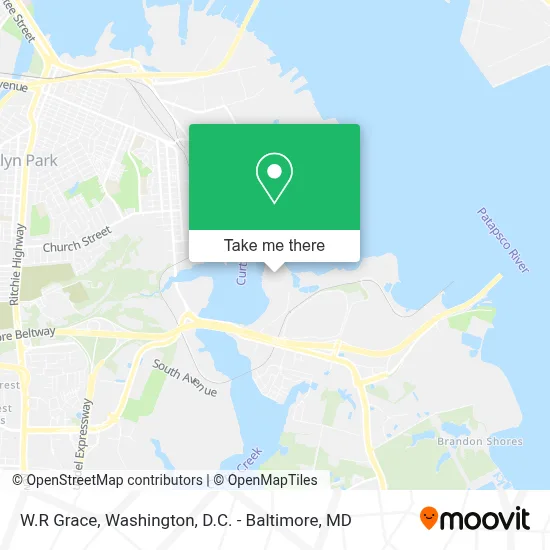
See W.R Grace, Baltimore, on the map
Public Transit to W.R Grace in Baltimore
Wondering how to get to W.R Grace in Baltimore? Moovit helps you find the best way to get to W.R Grace with step-by-step directions from the nearest public transit station.
Moovit provides free maps and live directions to help you navigate through your city. View schedules, routes, timetables, and find out how long does it take to get to W.R Grace in real time.
Looking for the nearest stop or station to W.R Grace? Check out this list of stops closest to your destination: Hawkins Point Rd & Chemical Rd Eb.
Bus: 67, CITYLINK SILVER.
Want to see if there’s another route that gets you there at an earlier time? Moovit helps you find alternative routes or times. Get directions from and directions to W.R Grace easily from the Moovit App or Website.
We make riding to W.R Grace easy, which is why over 1.7 million users, including users in Baltimore, trust Moovit as the best app for public transit. You don’t need to download an individual bus app or train app, Moovit is your all-in-one transit app that helps you find the best bus time or train time available.
For information on prices of bus, costs and ride fares to W.R Grace, please check the Moovit app.
Use the app to navigate to popular places including to the airport, hospital, stadium, grocery store, mall, coffee shop, school, college, and university.
W.R Grace Address: 5500 Chemical Rd street in Baltimore
- I-695 @ Exit 1 (Quarantine Rd),
- Coast Guard Yard Uph,
- U.S. Coast Guard - Station Curtis Bay,
- Curtis Bay,
- Berry Hall @ CG Yard,
- Best Buy,
- Fort Armistead Fort Smallwood Rd,
- Hawkins Point, Maryland,
- Home Chef,
- Curtis Bay,
- 1sg Brandt Us Army Reserve Center,
- 3919 Glidden Rd,
- Millennium,
- Baltimore Water Treatment,
- Benjamin Franklin High School,
- Fort Armistead,
- Pasadena,
- Brooklyn,
- Brooklyn Park, Maryland,
- Brooklyn, Maryland
Places Near W.R Grace (Baltimore)
- Georgetown, Washington,
- National Zoo, Washington,
- Museum Of The Bible, Washington,
- Amazon Hq2, Arlington County,
- Westfield Montgomery Mall, Montgomery County,
- M&T Bank Stadium, Baltimore,
- Warner Theatre, Washington,
- Rock Creek Tennis Center, Washington,
- Washington DC VA Medical Center, Washington,
- National Museum of African American History and Culture, Washington,
- Sibley Memorial Hospital, Washington,
- Camden Yards, Baltimore,
- Capital One Arena, Washington,
- The Anthem, Washington,
- Basilica of the National Shrine, Washington,
- Marriott Marquis Washington, DC, Washington,
- Washington National Cathedral, Washington,
- National Theatre, Washington,
- PG Mall, Prince George's County,
- Pennsylvania Ave NW (3rd st and pennsylvania), Washington
How to get to popular places in Washington, D.C. - Baltimore, MD with public transit
Get around Baltimore by public transit!
Traveling around Baltimore has never been so easy. See step by step directions as you travel to any attraction, street or major public transit station. View bus and train schedules, arrival times, service alerts and detailed routes on a map, so you know exactly how to get to anywhere in Baltimore.
When traveling to any destination around Baltimore use Moovit's Live Directions with Get Off Notifications to know exactly where and how far to walk, how long to wait for your line, and how many stops are left. Moovit will alert you when it's time to get off — no need to constantly re-check whether yours is the next stop.
Wondering how to use public transit in Baltimore or how to pay for public transit in Baltimore? Moovit public transit app can help you navigate your way with public transit easily, and at minimum cost. It includes public transit fees, ticket prices, and costs. Looking for a map of Baltimore public transit lines? Moovit public transit app shows all public transit maps in Baltimore with all Bus, Train, Metro, Light Rail and Ferry routes and stops on an interactive map.
Washington, D.C. - Baltimore, MD has 5 transit type(s), including: Bus, Train, Metro, Light Rail and Ferry, operated by several transit agencies, including WMATA, Montgomery County Ride On, Fairfax Connector, TheBus, PRTC, DASH - Alexandria, Arlington Transit (ART), RTA of Central Maryland, MDOT MTA, MDOT MTA Light RailLink, MDOT MTA Commuter Bus, MDOT MTA Local Bus, FXBGO!, Virginia Railway Express (VRE) and MARC