How to get to Walch Mathematics by bus?
Click on the bus route to see step by step directions with maps, line arrival times and updated time schedules.
Bus stops near Walch Mathematics in South Portland
Bus lines to Walch Mathematics in South Portland
What are the closest stations to Walch Mathematics?
The closest stations to Walch Mathematics are:
- Foden Rd + Western Ave is 0 yards away, 1 min walk.
- Western Ave + Foden Rd is 208 yards away, 4 min walk.
- 100 Foden Rd is 267 yards away, 4 min walk.
Which bus lines stop near Walch Mathematics?
These bus lines stop near Walch Mathematics: 24B, 5, 60.
What’s the nearest bus station to Walch Mathematics in South Portland?
The nearest bus station to Walch Mathematics in South Portland is Foden Rd + Western Ave. It’s a 1 min walk away.
What time is the first bus to Walch Mathematics in South Portland?
The 5 is the first bus that goes to Walch Mathematics in South Portland. It stops nearby at 5:37 AM.
What time is the last bus to Walch Mathematics in South Portland?
The 24A is the last bus that goes to Walch Mathematics in South Portland. It stops nearby at 10:33 PM.
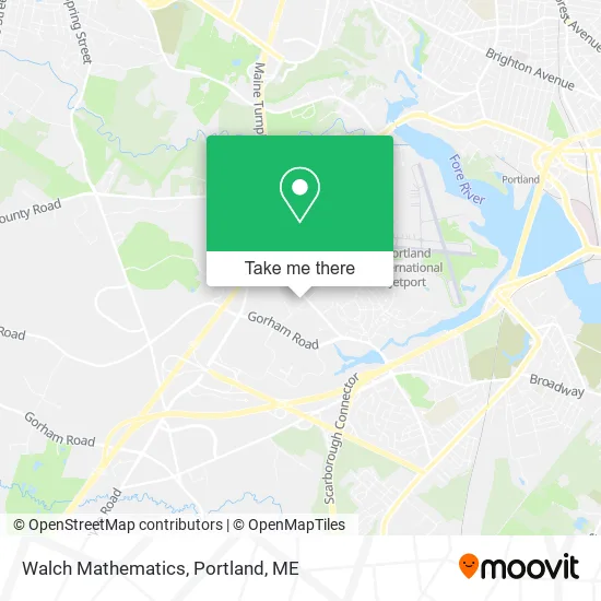
See Walch Mathematics, South Portland, on the map
Public Transit to Walch Mathematics in South Portland
Wondering how to get to Walch Mathematics in South Portland? Moovit helps you find the best way to get to Walch Mathematics with step-by-step directions from the nearest public transit station.
Moovit provides free maps and live directions to help you navigate through your city. View schedules, routes, timetables, and find out how long does it take to get to Walch Mathematics in real time.
Looking for the nearest stop or station to Walch Mathematics? Check out this list of stops closest to your destination: Foden Rd + Western Ave; Western Ave + Foden Rd; 100 Foden Rd.
Bus: 24B, 5, 60, 24A, 24A.
Want to see if there’s another route that gets you there at an earlier time? Moovit helps you find alternative routes or times. Get directions from and directions to Walch Mathematics easily from the Moovit App or Website.
We make riding to Walch Mathematics easy, which is why over 1.5 million users, including users in South Portland, trust Moovit as the best app for public transit. You don’t need to download an individual bus app or train app, Moovit is your all-in-one transit app that helps you find the best bus time or train time available.
For information on prices of bus, costs and ride fares to Walch Mathematics, please check the Moovit app.
Use the app to navigate to popular places including to the airport, hospital, stadium, grocery store, mall, coffee shop, school, college, and university.
Walch Mathematics Address: 35 Foden Rd South Portland, ME 04106 street in South Portland
- The Vein Healthcare Center,
- On Semiconductor,
- Mog Saco Bay Physical Therapy,
- Tiny Totland,
- Kelly Worster, DC,
- Pure Tattoo,
- Kelly Patterson,
- Simons Gwen - Simons & Associates Law,
- Sandler Training,
- Maine Medical Partners,
- Dr. Corey & Dr. Then Periodontics,
- Maine Med Cleaning Services,
- Peregrine,
- Dyhrberg Thomas A,
- Intermed Urgent Care,
- Bassett Home Furnishings,
- Benjamin Liess, MD, Facs,
- Kristy Murray Pulsifer,
- Wex,
- James W Giguere - Humana Agent
Places Near Walch Mathematics (South Portland)
- Fort Williams Park, Cape Elizabeth,
- L. L. Bean Outlet,
- Mercy Hospital - Fore River Campus,
- Portland International Jetport (PWM) (Portland International Jetport),
- The Old Port,
- Walmart,
- Southern Maine Community College, South Portland,
- ZzZzZzZzZzZ, Westbrook,
- Jewell Island,
- Portland Transportation Center,
- On a bus to Kennebunkport,
- Exit 45 Park And Ride, South Portland,
- Clarion Hotel Portland,
- House Island,
- Cape Elizabeth, ME, Cape Elizabeth,
- Fort Gorges,
- Casco Bay Ferry Terminal,
- Walmart Scarborough Supercenter,
- Cross Insurance Arena,
- Maine Medical Center
How to get to popular places in Portland, ME with public transit
Get around South Portland by public transit!
Traveling around South Portland has never been so easy. See step by step directions as you travel to any attraction, street or major public transit station. View bus and train schedules, arrival times, service alerts and detailed routes on a map, so you know exactly how to get to anywhere in South Portland.
When traveling to any destination around South Portland use Moovit's Live Directions with Get Off Notifications to know exactly where and how far to walk, how long to wait for your line, and how many stops are left. Moovit will alert you when it's time to get off — no need to constantly re-check whether yours is the next stop.
Wondering how to use public transit in South Portland or how to pay for public transit in South Portland? Moovit public transit app can help you navigate your way with public transit easily, and at minimum cost. It includes public transit fees, ticket prices, and costs. Looking for a map of South Portland public transit lines? Moovit public transit app shows all public transit maps in South Portland with all Bus, Train and Ferry routes and stops on an interactive map.
Portland, ME has 3 transit type(s), including: Bus, Train and Ferry, operated by several transit agencies, including Greater Portland Metro, City of South Portland, Biddeford Saco Old Orchard Beach Transit, Casco Bay Lines, Amtrak, Greyhound-us and FlixBus-us