How to get to Walgreens by bus?
Click on the bus route to see step by step directions with maps, line arrival times and updated time schedules.
From US-1 / SE Port St Lucie Blvd, Port St. Lucie
122 minFrom Clover Park, Port St. Lucie
96 minFrom Stuart, Florida, Stuart
129 minFrom US-1, Fort Pierce
48 minFrom CVS Pharmacy - (Lyngate Dr), Port St. Lucie
80 minFrom Suncoast Community High School, Riviera Beach
562 minFrom Tradition Park, Port St. Lucie
110 minFrom Suncoast High School, Riviera Beach
560 min
Bus stops near Walgreens in Fort Pierce
Bus lines to Walgreens in Fort Pierce
What are the closest stations to Walgreens?
The closest stations to Walgreens are:
- Orange Ave & N 26th St is 282 yards away, 4 min walk.
- Delaware Ave & S 25th St is 294 yards away, 4 min walk.
- Avenue D & 24th St is 962 yards away, 12 min walk.
Which bus lines stop near Walgreens?
These bus lines stop near Walgreens: 1, 3, 8.
What’s the nearest bus station to Walgreens in Fort Pierce?
The nearest bus stations to Walgreens in Fort Pierce are Orange Ave & N 26th St and Delaware Ave & S 25th St. The closest one is a 4 min walk away.
What time is the first bus to Walgreens in Fort Pierce?
The 2 is the first bus that goes to Walgreens in Fort Pierce. It stops nearby at 6:03 AM.
What time is the last bus to Walgreens in Fort Pierce?
The 3 is the last bus that goes to Walgreens in Fort Pierce. It stops nearby at 7:48 PM.
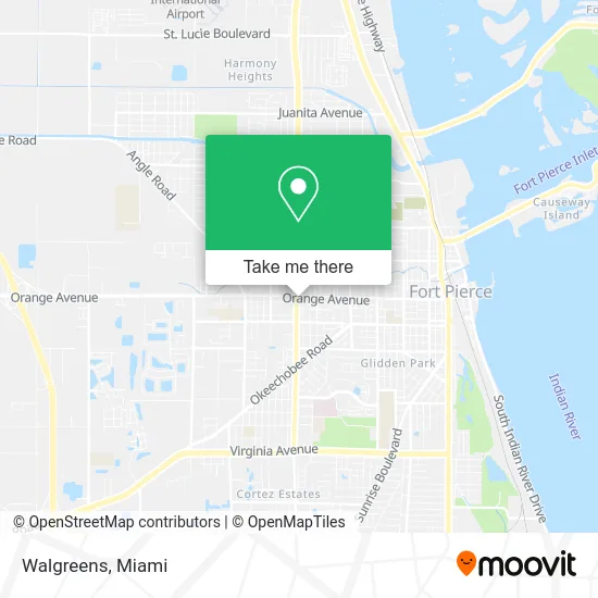
See Walgreens, Fort Pierce, on the map
Public Transit to Walgreens in Fort Pierce
Wondering how to get to Walgreens in Fort Pierce? Moovit helps you find the best way to get to Walgreens with step-by-step directions from the nearest public transit station.
Moovit provides free maps and live directions to help you navigate through your city. View schedules, routes, timetables, and find out how long does it take to get to Walgreens in real time.
Looking for the nearest stop or station to Walgreens? Check out this list of stops closest to your destination: Orange Ave & N 26th St; Delaware Ave & S 25th St; Avenue D & 24th St.
Bus: 1, 3, 8, 2.
Want to see if there’s another route that gets you there at an earlier time? Moovit helps you find alternative routes or times. Get directions from and directions to Walgreens easily from the Moovit App or Website.
We make riding to Walgreens easy, which is why over 1.5 million users, including users in Fort Pierce, trust Moovit as the best app for public transit. You don’t need to download an individual bus app or train app, Moovit is your all-in-one transit app that helps you find the best bus time or train time available.
For information on prices of bus, costs and ride fares to Walgreens, please check the Moovit app.
Use the app to navigate to popular places including to the airport, hospital, stadium, grocery store, mall, coffee shop, school, college, and university.
Walgreens Address: 2423 Orange Ave Fort Pierce, FL 34950 street in Fort Pierce
- Jyd BBQ,
- 1st Auto Sales,
- Perry Music,
- Dreamland Park,
- Native Roofing Solutions,
- Tienda Guatemalteca El Quetzal,
- Chef Dad's BBQ,
- Rihanna Jamaican,
- Adventist Church,
- El Sabor de Mi Tierra,
- WESTERN UNION,
- Health Mart Pharmacy,
- Family Dollar,
- Stanley Carwash,
- White Diamonds,
- Dreamland Park,
- Hot Spot Car Wash,
- Sands Affordable Mobile Detailing,
- Multicultural Resource Center for Children & Families (MRC),
- Rainbow Academy Fort Pierce
Places Near Walgreens (Fort Pierce)
- Miami Design District, Miami,
- Richard E. Gerstein Justice Building, Miami,
- Miami Freedom Park, Miami,
- Miami-Dade County Courthouse, Miami,
- Wynwood, Miami,
- Aventura Mall, Miami Beach,
- Sawgrass mall ( FL ), Miami Beach,
- Brickell City Centre, Miami,
- Sawgrass Mall, Miami,
- Hard Rock Stadium, Miami Gardens,
- Bayside Marketplace, Miami,
- Dolphin Mall, Miami,
- Miami VA Hospital, Miami,
- Dolphin Mall Bus, Miami,
- Keiser University Flagship Campus, West Palm Beach,
- Zoo Miami, Miami,
- Marlins Park, Miami,
- Port of Miami Cruise Terminal, Miami,
- Aventura Mall, Miami,
- Little Havana, Miami
How to get to popular places in Miami with public transit
Get around Fort Pierce by public transit!
Traveling around Fort Pierce has never been so easy. See step by step directions as you travel to any attraction, street or major public transit station. View bus and train schedules, arrival times, service alerts and detailed routes on a map, so you know exactly how to get to anywhere in Fort Pierce.
When traveling to any destination around Fort Pierce use Moovit's Live Directions with Get Off Notifications to know exactly where and how far to walk, how long to wait for your line, and how many stops are left. Moovit will alert you when it's time to get off — no need to constantly re-check whether yours is the next stop.
Wondering how to use public transit in Fort Pierce or how to pay for public transit in Fort Pierce? Moovit public transit app can help you navigate your way with public transit easily, and at minimum cost. It includes public transit fees, ticket prices, and costs. Looking for a map of Fort Pierce public transit lines? Moovit public transit app shows all public transit maps in Fort Pierce with all Bus, Train, Light Rail and Ferry routes and stops on an interactive map.
Miami has 4 transit type(s), including: Bus, Train, Light Rail and Ferry, operated by several transit agencies, including Broward County Transit, Miami-Dade Transit, Metrorail, Palm Tran, Tri-Rail, Brightline, MARTY, City of Homestead Trolley, Key West Transit, Treasure Coast Connector, GoLine IRT, Amtrak, Greyhound-us, FlixBus-us and Aventura Express Shuttle Bus