Directions to Walgreens (Richmond) with public transportation
The following transit lines have routes that pass near Walgreens
 Bus: 2B.
How to get to Walgreens by bus?
Click on the bus route to see step by step directions with maps, line arrival times and updated time schedules.
From Lorton, VA - Amtrak Auto Train Station (LOR), Fairfax County
254 minFrom Rose Gaming Resort, Prince William County
264 minFrom Potomac Mills Mall, Prince William County
239 minFrom Lorton, VA, Fairfax County
248 minFrom Amazon Fulfillment Center-Ric3, Richmond
103 minFrom Woodbridge, VA, Prince William County
184 minFrom UVA Hospital Medical Center, Charlottesville
328 min
Bus stop near Walgreens in Richmond
- Cjw Medical Center Main Entrance, 3 min walk,VIEW
Bus lines to Walgreens in Richmond
- 2B, Jahnke/Forest Hill/North Ave,VIEW
What are the closest stations to Walgreens?
The closest stations to Walgreens are:
- Cjw Medical Center Main Entrance is 203 yards away, 3 min walk.
Which bus line stops near Walgreens?
2B (Forest Hill/Jahnke/Midlothian)
What’s the nearest bus station to Walgreens in Richmond?
The nearest bus station to Walgreens in Richmond is Cjw Medical Center Main Entrance. It’s a 3 min walk away.
What time is the first bus to Walgreens in Richmond?
The 2B is the first bus that goes to Walgreens in Richmond. It stops nearby at 5:41 AM.
What time is the last bus to Walgreens in Richmond?
The 2B is the last bus that goes to Walgreens in Richmond. It stops nearby at 12:23 AM.
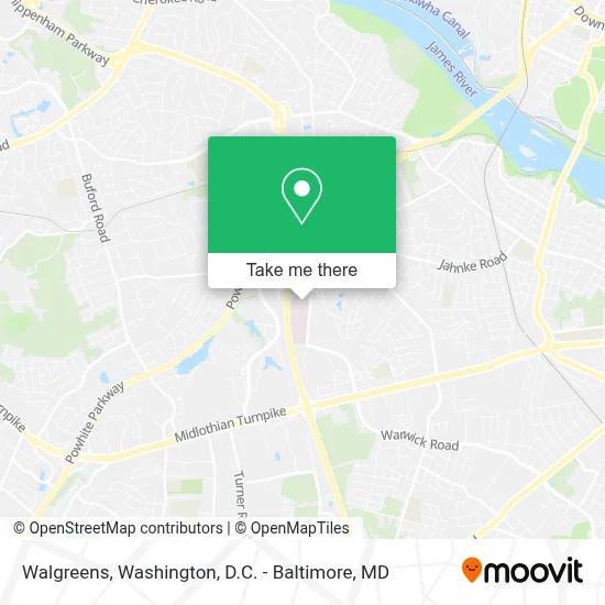
See Walgreens, Richmond, on the map
Public Transit to Walgreens in Richmond
Wondering how to get to Walgreens in Richmond? Moovit helps you find the best way to get to Walgreens with step-by-step directions from the nearest public transit station.
Moovit provides free maps and live directions to help you navigate through your city. View schedules, routes, timetables, and find out how long does it take to get to Walgreens in real time.
Looking for the nearest stop or station to Walgreens? Check out this list of stops closest to your destination: Cjw Medical Center Main Entrance.
Bus: 2B.
Want to see if there’s another route that gets you there at an earlier time? Moovit helps you find alternative routes or times. Get directions from and directions to Walgreens easily from the Moovit App or Website.
We make riding to Walgreens easy, which is why over 1.5 million users, including users in Richmond, trust Moovit as the best app for public transit. You don’t need to download an individual bus app or train app, Moovit is your all-in-one transit app that helps you find the best bus time or train time available.
For information on prices of bus and train, costs and ride fares to Walgreens, please check the Moovit app.
Use the app to navigate to popular places including to the airport, hospital, stadium, grocery store, mall, coffee shop, school, college, and university.
Walgreens Address: 7101 Jahnke Rd Richmond, VA 23225 street in Richmond
- Sasa Espino, MD - Hca Healthcare,
- Dipin Gupta, MD, Facs,
- Beers Construction,
- Urology Specialists of Richmond,
- Chippenham Hospital,
- Commonwealth Podiatry Associates,
- Chippenham Hospital Heliport,
- Forest Hill Station Richmond Post Office,
- John Crockett Home Remodeling,
- Entrance VA-150 S,
- Entrance VA-150 N,
- Boulder Parke,
- Timmons Group,
- CJW Medical Center-Johnston-Willis Campus,
- Entrance VA-150 N,
- Westover Gardens,
- Towers Retirement Community,
- Westover Gardens,
- Westover Heights,
- Glen Echo Place
Places Near Walgreens (Richmond)
- Warner Theatre, Washington,
- Camden Yards, Baltimore,
- Westfield Montgomery Mall, Montgomery County,
- PG Mall, Prince George's County,
- National Museum of African American History and Culture, Washington,
- National Zoo, Washington,
- Amazon Hq2, Arlington County,
- Capital One Arena, Washington,
- National Theatre, Washington,
- Museum Of The Bible, Washington,
- Basilica of the National Shrine, Washington,
- The Anthem, Washington,
- M&T Bank Stadium, Baltimore,
- Georgetown, Washington,
- Pennsylvania Ave NW (3rd st and pennsylvania), Washington,
- Marriott Marquis Washington, DC, Washington,
- Washington National Cathedral, Washington,
- Rock Creek Tennis Center, Washington,
- Sibley Memorial Hospital, Washington,
- Washington DC VA Medical Center, Washington
How to get to popular places in Washington, D.C. - Baltimore, MD with public transit
Get around Richmond by public transit!
Traveling around Richmond has never been so easy. See step by step directions as you travel to any attraction, street or major public transit station. View bus and train schedules, arrival times, service alerts and detailed routes on a map, so you know exactly how to get to anywhere in Richmond.
When traveling to any destination around Richmond use Moovit's Live Directions with Get Off Notifications to know exactly where and how far to walk, how long to wait for your line, and how many stops are left. Moovit will alert you when it's time to get off — no need to constantly re-check whether yours is the next stop.
Wondering how to use public transit in Richmond or how to pay for public transit in Richmond? Moovit public transit app can help you navigate your way with public transit easily, and at minimum cost. It includes public transit fees, ticket prices, and costs. Looking for a map of Richmond public transit lines? Moovit public transit app shows all public transit maps in Richmond with all Bus, Train, Metro, Light Rail and Ferry routes and stops on an interactive map.
Washington, D.C. - Baltimore, MD has 5 transit type(s), including: Bus, Train, Metro, Light Rail and Ferry, operated by several transit agencies, including WMATA, Montgomery County Ride On, Fairfax Connector, TheBus, PRTC, DASH - Alexandria, Arlington Transit (ART), RTA of Central Maryland, MDOT MTA, MDOT MTA Light RailLink, MDOT MTA Commuter Bus, MDOT MTA Local Bus, FXBGO!, Virginia Railway Express (VRE) and MARC