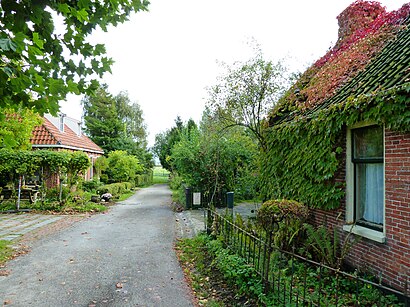
Directions to Warfhuizen (De Marne) with public transportation
The following transit lines have routes that pass near Warfhuizen
 Bus: 163, 65, 565, 637.
How to get to Warfhuizen by bus?
Click on the bus route to see step by step directions with maps, line arrival times and updated time schedules.
Bus stop near Warfhuizen in De Marne
- Warfhuizen, Brug, 3 min walk,
Bus lines to Warfhuizen in De Marne
- 565, Kloosterburen,
- 637, Zoutkamp,
What are the closest stations to Warfhuizen?
The closest stations to Warfhuizen are:
- Warfhuizen, Brug is 212 meters away, 3 min walk.
Which bus lines stop near Warfhuizen?
These bus lines stop near Warfhuizen: 163, 65.
What’s the nearest bus station to Warfhuizen in De Marne?
The nearest bus station to Warfhuizen in De Marne is Warfhuizen, Brug. It’s a 3 min walk away.
See Warfhuizen, De Marne, on the map
Public Transit to Warfhuizen in De Marne
Wondering how to get to Warfhuizen in De Marne? Moovit helps you find the best way to get to Warfhuizen with step-by-step directions from the nearest public transit station.
Moovit provides free maps and live directions to help you navigate through your city. View schedules, routes, timetables, and find out how long does it take to get to Warfhuizen in real time.
Looking for the nearest stop or station to Warfhuizen? Check out this list of stops closest to your destination: Warfhuizen.
Bus: 163, 65, 565, 637.
Want to see if there’s another route that gets you there at an earlier time? Moovit helps you find alternative routes or times. Get directions from and directions to Warfhuizen easily from the Moovit App or Website.
We make riding to Warfhuizen easy, which is why over 1.5 million users, including users in De Marne, trust Moovit as the best app for public transit. You don’t need to download an individual bus app or train app, Moovit is your all-in-one transit app that helps you find the best bus time or train time available.
For information on prices of bus and train, costs and ride fares to Warfhuizen, please check the Moovit app.
Use the app to navigate to popular places including to the airport, hospital, stadium, grocery store, mall, coffee shop, school, college, and university.
Warfhuizen Address: Vaart Oostzijde street in De Marne
- Noorderlicht,
- Fotoschietsalon Tilstra-Keizer,
- Postma Motoren,
- Luchtwachttoren 701,
- Wehe-Den Hoorn,
- Ehbo Kon Ned Ver.,
- Nam-Locatie Leens,
- Praktijk Kind in Beeld,
- EQUANS,
- Tijdloos,
- Wieringa Klusbedrijf Stoffer,
- Camperplaats Wehe-Den-Hoorn,
- Jacelien Desig,
- Gemaal Schaphalsterzijl,
- Kerk Mensingeweer,
- Uitvaart-C.Q. Begrafenisvereniging Eenrum,
- Allersmaborg,
- Ereconsulaat Groningen Van België,
- Ede Staal Pad,
- Kids2b Gemeente de Marne
Places Near Warfhuizen (De Marne)
- OLVG West, Amsterdam,
- Diergaarde Blijdorp, Rotterdam,
- Kralingse Bos, Rotterdam,
- OLVG Oost, Amsterdam,
- Fenixloodsen, Rotterdam,
- Brabanthallen, 'S-Hertogenbosch,
- Kaufland Nordhorn, Bentheimer Straße 118 48529 Nordhorn,
- St. Antonius Ziekenhuis, Nieuwegein,
- Ziggo Dome, Amsterdam,
- Erasmus MC, Rotterdam,
- Johan Cruijff Arena, Amsterdam,
- Euromast, Rotterdam,
- Maasstad Ziekenhuis, Rotterdam,
- Franciscus Gasthuis, Rotterdam,
- Het Concertgebouw, Amsterdam,
- IKEA, Amsterdam,
- Feyenoord Stadion (De Kuip), Rotterdam,
- Mall of the Netherlands, Leidschendam-Voorburg,
- Dappermarkt, Amsterdam,
- Jan Bik Amsterdam, Amsterdam
How to get to popular places in Netherlands with public transit
Get around De Marne by public transit!
Traveling around De Marne has never been so easy. See step by step directions as you travel to any attraction, street or major public transit station. View bus and train schedules, arrival times, service alerts and detailed routes on a map, so you know exactly how to get to anywhere in De Marne.
When traveling to any destination around De Marne use Moovit's Live Directions with Get Off Notifications to know exactly where and how far to walk, how long to wait for your line, and how many stops are left. Moovit will alert you when it's time to get off — no need to constantly re-check whether yours is the next stop.
Wondering how to use public transit in De Marne or how to pay for public transit in De Marne? Moovit public transit app can help you navigate your way with public transit easily, and at minimum cost. It includes public transit fees, ticket prices, and costs. Looking for a map of De Marne public transit lines? Moovit public transit app shows all public transit maps in De Marne with all Bus, Train, Metro, Light Rail and Ferry routes and stops on an interactive map.
Netherlands has 5 transit type(s), including: Bus, Train, Metro, Light Rail and Ferry, operated by several transit agencies, including NS, GVB, U-OV, HTM, RET, De Lijn, Connexxion, Arriva, Breng, EBS, Bravo (Hermes), Hermes, Qbuzz, Bravo (Arriva) and allGo