How to get to Warkop 366 by bus?
Click on the bus route to see step by step directions with maps, line arrival times and updated time schedules.
From Rumah Sakit Islam Malahayati, Kota Medan
48 minFrom Sumut Pasar Sambas, Kota Medan
30 minFrom Kantin SMA Negeri 1 Medan, Kota Medan
44 minFrom Wisma Taman Sari Indah, Kota Medan
44 minFrom Gunung Sibayak, Kota Medan
41 minFrom Hotel Santika Dyandra, Kota Medan
27 minFrom PT Alva Mountindo Atau Indodairy, Kota Medan
59 minFrom Sabrina Al Fikri Kantor Perwakilan Travel Umroh & Hajj, Kota Medan
49 minFrom Ai Aphin Kwetiau Goreng Meranti, Kota Medan
26 minFrom Fa.Sempana, Kota Medan
29 min
Bus stops near Warkop 366 in Kota Medan
Bus lines to Warkop 366 in Kota Medan
What are the closest stations to Warkop 366?
The closest stations to Warkop 366 are:
- Jalan Vanili Raya, 95 is 20 meters away, 1 min walk.
- Jalan Sagu 1, 20 is 226 meters away, 4 min walk.
- Meranti 1 is 1646 meters away, 22 min walk.
- Jalan Merica Raya, 97 is 2034 meters away, 26 min walk.
Which bus lines stop near Warkop 366?
These bus lines stop near Warkop 366: 10, 104, 108, 53.
What’s the nearest bus station to Warkop 366 in Kota Medan?
The nearest bus station to Warkop 366 in Kota Medan is Jalan Vanili Raya, 95. It’s a 1 min walk away.
What time is the first bus to Warkop 366 in Kota Medan?
The 104 is the first bus that goes to Warkop 366 in Kota Medan. It stops nearby at 5:03 AM.
What time is the last bus to Warkop 366 in Kota Medan?
The 104 is the last bus that goes to Warkop 366 in Kota Medan. It stops nearby at 10:07 PM.
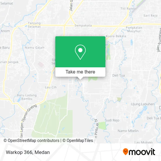
See Warkop 366, Kota Medan, on the map
Public Transit to Warkop 366 in Kota Medan
Wondering how to get to Warkop 366 in Kota Medan? Moovit helps you find the best way to get to Warkop 366 with step-by-step directions from the nearest public transit station.
Moovit provides free maps and live directions to help you navigate through your city. View schedules, routes, timetables, and find out how long does it take to get to Warkop 366 in real time.
Looking for the nearest stop or station to Warkop 366? Check out this list of stops closest to your destination: Jalan Vanili Raya; Jalan Sagu 1; Meranti 1; Jalan Merica Raya.
Bus: 10, 104, 108, 53, 69, 121, 43.
Want to see if there’s another route that gets you there at an earlier time? Moovit helps you find alternative routes or times. Get directions from and directions to Warkop 366 easily from the Moovit App or Website.
We make riding to Warkop 366 easy, which is why over 1.5 million users, including users in Kota Medan, trust Moovit as the best app for public transit. You don’t need to download an individual bus app or train app, Moovit is your all-in-one transit app that helps you find the best bus time or train time available.
For information on prices of bus, costs and ride fares to Warkop 366, please check the Moovit app.
Use the app to navigate to popular places including to the airport, hospital, stadium, grocery store, mall, coffee shop, school, college, and university.
Warkop 366 Address: Jalan Vanili Raya Medan 20138 street in Kota Medan
- Serik Ponsel,
- Gkps Simalingkar,
- Jess Ponsel,
- Ck Laundry,
- Vanili Laundry,
- Pangkas Alex 2,
- Pangkas Pratama 2,
- Glory Salon,
- TK Eleane School,
- Esli,
- Sempoa Aipi,
- Dapur Mama Kito,
- Jamur Crispy Trhees Ta,
- Ida Ponsel,
- Ms Gym & Fitness Center,
- Baim Water,
- UD Bre Karo,
- Dapur Tinna,
- Warung Makan Mbak Cici,
- Annasya Perfume Store
Places Near Warkop 366 (Kota Medan)
- Usu, Kota Medan,
- Binjai, Kota Medan,
- Centre Point, Kota Medan,
- Port Belawan, Kota Medan,
- Prof. Dr. Darwin Dalimunthe, Sp.Pd, Kota Medan,
- Gunung Sibayak, Kota Medan,
- Loket Kbt Medan, Kota Medan,
- Manhattan Times Square, Kota Medan,
- Rs Murni Teguh, Kota Medan,
- Toko Mas Seribu Medan Mall Lt. 1, Kota Medan,
- Mikie Holiday Office, Kota Medan,
- Bus To Berastagi, Kota Medan,
- Silangit, Kota Medan,
- Sun Plaza, Kota Medan,
- Berastagi, Tanah Karo, Kota Medan,
- Tanjung Morawa, Kota Medan,
- Pengangkutan Megawati, Kota Medan,
- Pelabuhan Belawan Medan, Kota Medan,
- Loket Gopans Jaya, Kota Medan,
- Terminal Damri Ke Kualanamu, Kota Medan
How to get to popular places in Medan with public transit
Get around Kota Medan by public transit!
Traveling around Kota Medan has never been so easy. See step by step directions as you travel to any attraction, street or major public transit station. View bus and train schedules, arrival times, service alerts and detailed routes on a map, so you know exactly how to get to anywhere in Kota Medan.
When traveling to any destination around Kota Medan use Moovit's Live Directions with Get Off Notifications to know exactly where and how far to walk, how long to wait for your line, and how many stops are left. Moovit will alert you when it's time to get off — no need to constantly re-check whether yours is the next stop.
Wondering how to use public transit in Kota Medan or how to pay for public transit in Kota Medan? Moovit public transit app can help you navigate your way with public transit easily, and at minimum cost. It includes public transit fees, ticket prices, and costs. Looking for a map of Kota Medan public transit lines? Moovit public transit app shows all public transit maps in Kota Medan with all bus routes and stops on an interactive map.
Medan has 1 transit type(s), including: bus, operated by several transit agencies, including TemanBus Medan, KPUM, Rahayu Medan Ceria, Medan Bus Transport, Koperasi Hikma, Morina, Wampu Mini Medan, Mekar Jaya Saudara, Mitra Swadaya Mandiri, Marjandi Suka, Gajah Mada Sakti, Nasional Transport, Medan Raya Express and Koperasi Desa Maju